- Bible Maps - (you are currently on this page) overlaps with #2 but has maps not found in the alphabetical listing
- Bible Maps - alphabetical listing of maps - by books of the Bible and subjects
- Bible Maps - Bible maps posted on preceptaustin.org
- Bible Images
ADDITIONS
- Chronological Map
- Multiple Timelines Old/New Testament, Paul, etc
- Timeline of the Apostle Paul
- Chronology of Acts and the Epistles
- Charts and Maps, By: Clarence Larkin
- The Revelation of Jesus Christ, By: H.A. Ironside
- Bible Prophecy, God's Order of Events, By: Donald Perkins (English)
- Bible Prophecy, God's Order of Events, By: Donald Perkins (Spanish)
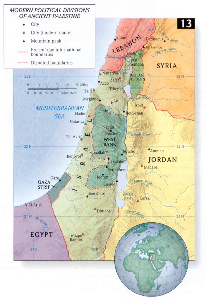
- New Testament Time Line and Maps
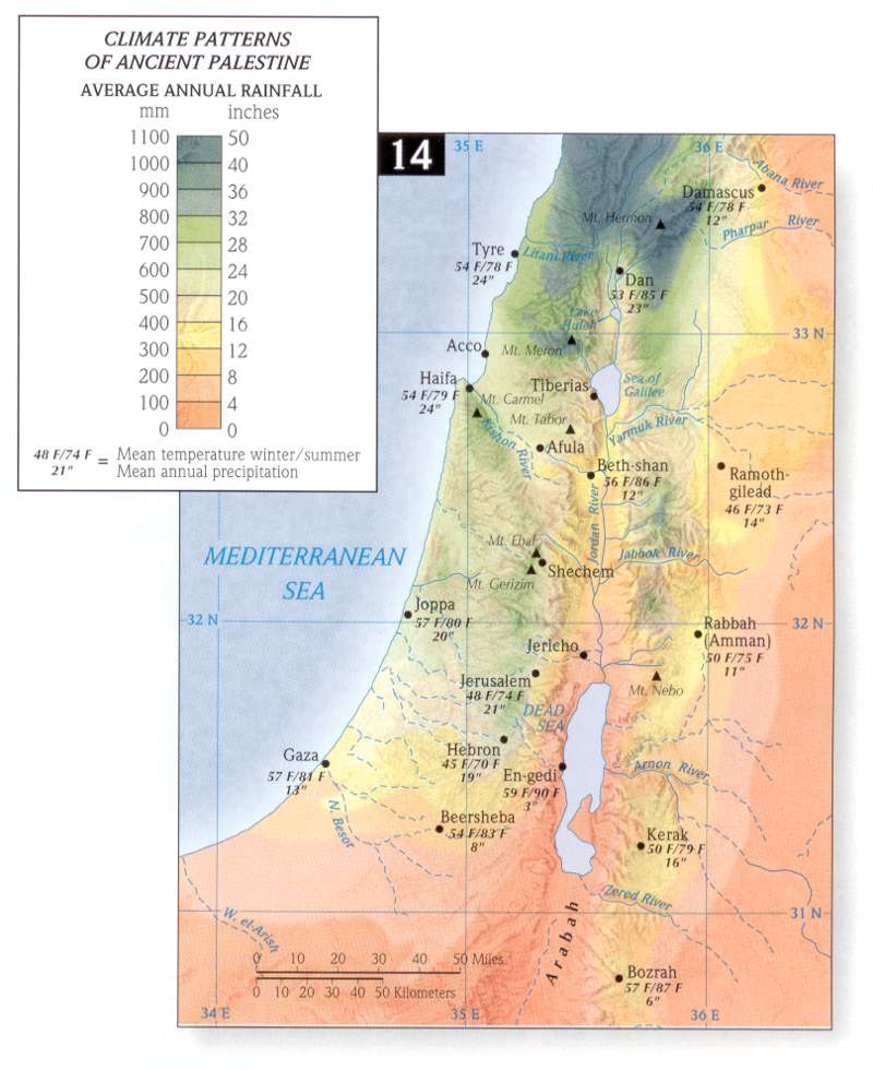
- Instruments in the Bible
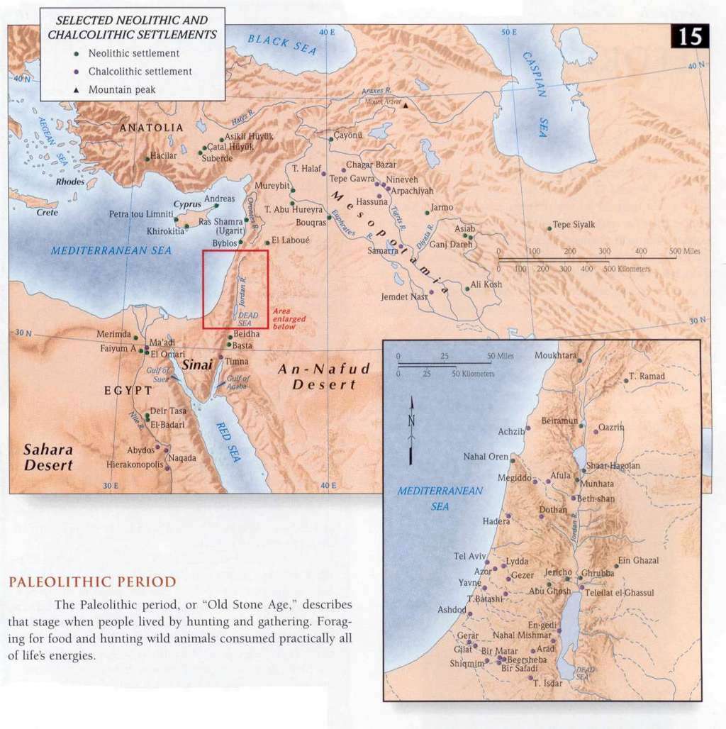
- Graphic Bible - Simple Map Diagrams
- Charts and Outlines - OT, NT, misc
- Bible maps - over 100 - excellent maps
- Holman Atlas Bible Maps - see list at bottom of this page
- Free Bible Maps - Hi Resolution
- Complete list of Holman Bible Atlas Maps - the best maps available on the internet in my opinion.
- Book by Book Bible Maps - allows printing (open map, right click, print) - Old and New Testament - Highly recommended
- Complete list: Maps from Studylight.org - most of these are Holman Bible Atlas maps
- Maps sorted by book of the Bible - most are Holman Bible Atlas maps
- Old Testament Maps - most are Holman Bible Atlas maps
- New Testament Maps - most are Holman Bible Atlas maps
- Complete list: ESV Maps
- Zondervan Atlas of The Bible By Carl G Rasmussen - NO RESTRICTIONS - 676 pages. Excellent maps, charts, pictures with commentary. A very nice resource.
- Genesis (286 images)
- Exodus (196 images)
- Leviticus (39 images)
- Numbers (67 images)
- Deuteronomy (56 images)
- Joshua (48 images)
- Judges (76 images)
- Ruth (27 images)
- 1 Samuel (103 images)
- 2 Samuel (81 images)
- 1 Kings (99 images)
- 2 Kings (102 images)
- 1 Chronicles (57 images)
- 2 Chronicles (87 images)
- Ezra (27 images)
- Nehemiah (35 images)
- Esther (28 images)
- Job (48 images)
- Psalms (69 images)
- Proverbs (12 images)
- Ecclesiastes (7 images)
- Song of Songs (24 images)
- Isaiah (71 images)
- Jeremiah (64 images)
- Lamentations (8 images)
- Ezekiel (43 images)
- Daniel (85 images)
- Hosea (11 images)
- Joel (13 images)
- Amos (16 images)
- Obadiah (6 images)
- Jonah (17 images)
- Micah (19 images)
- Nahum (7 images)
- Habakkuk (11 images)
- Zephaniah (10 images)
- Haggai (11 images)
- Zechariah (71 images)
- Malachi (21 images)
- Matthew (187 images)
- Mark (120 images)
- Luke (176 images)
- John (128 images)
- Acts (102 images)
- Romans (66 images)
- 1 Corinthians (48 images)
- 2 Corinthians (45 images)
- Galatians (13 images)
- Ephesians (41 images)
- Philippians (21 images)
- Colossians (30 images)
- 1 Thessalonians (57 images)
- 2 Thessalonians (36 images)
- 1 Timothy (32 images)
- 2 Timothy (18 images)
- Titus (9 images)
- Philemon (5 images)
- Hebrews (69 images)
- James (18 images)
- 1 Peter (20 images)
- 2 Peter (51 images)
- 1 John (6 images)
- 2 John (6 images)
- 3 John (4 images)
- Jude (16 images)
- Revelation (106 images)
- Genesis - Nimrod's Empire
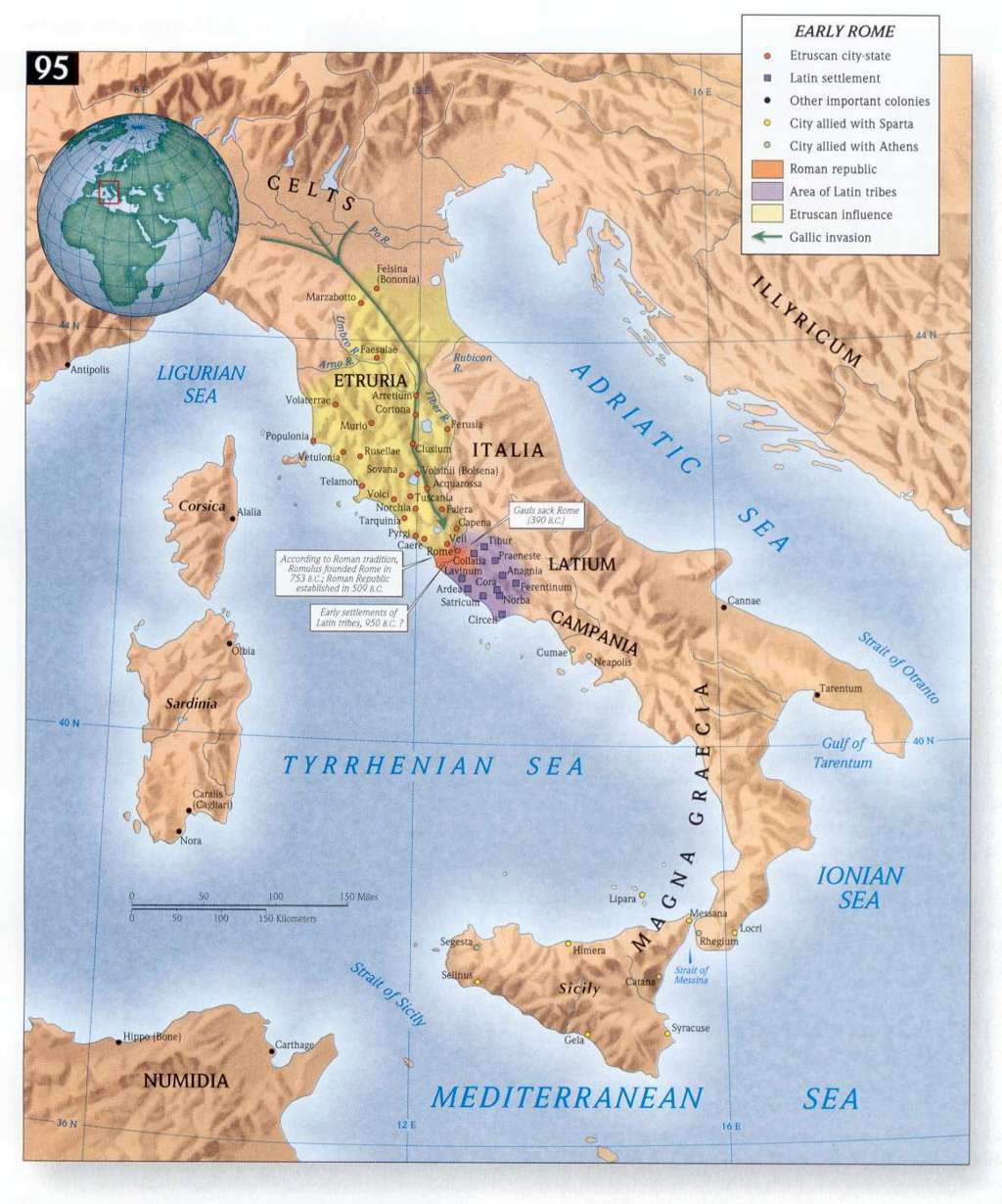
- Genesis - Palestine
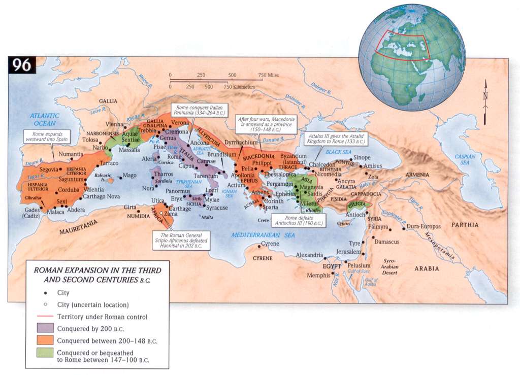
- Genesis - Early Canaan
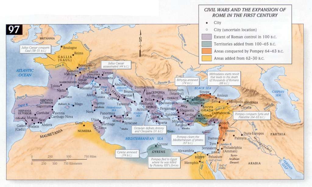
- Genesis - Aram-Naharaim- Homeland of Terah
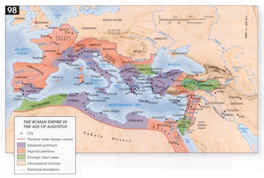
- Genesis - Early Mesopotamian Kingdoms
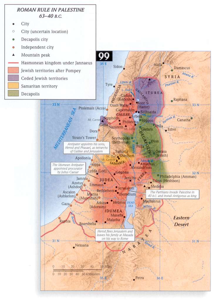
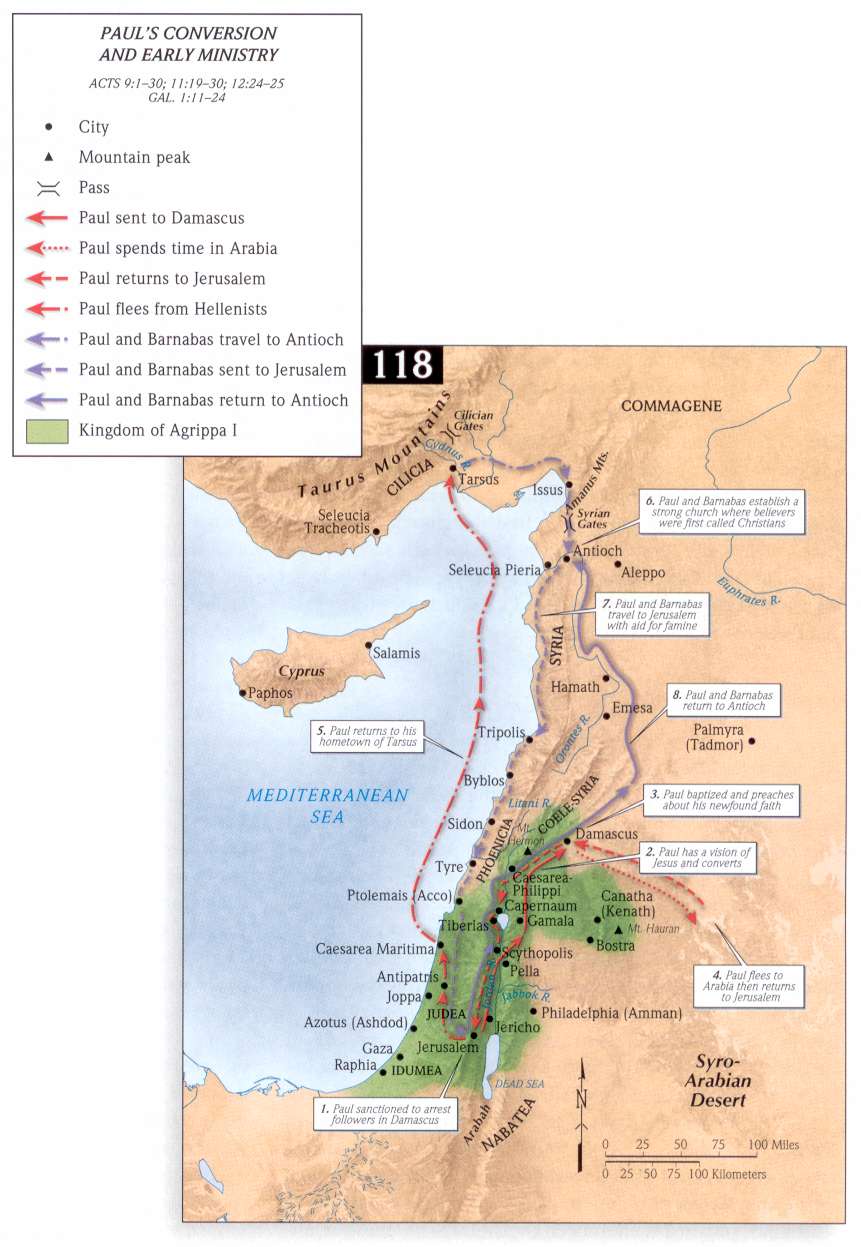
- Genesis 12:1 (Acts 7:2) Ge 11:31 - Abraham's Journey to Canaan
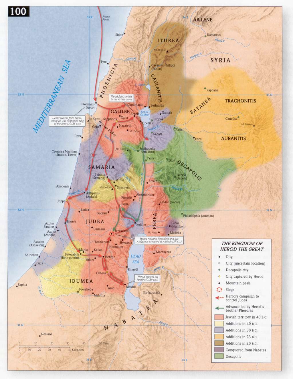
- Genesis 12:6, 7 (Acts 7:4) - Abraham Enters Canaan
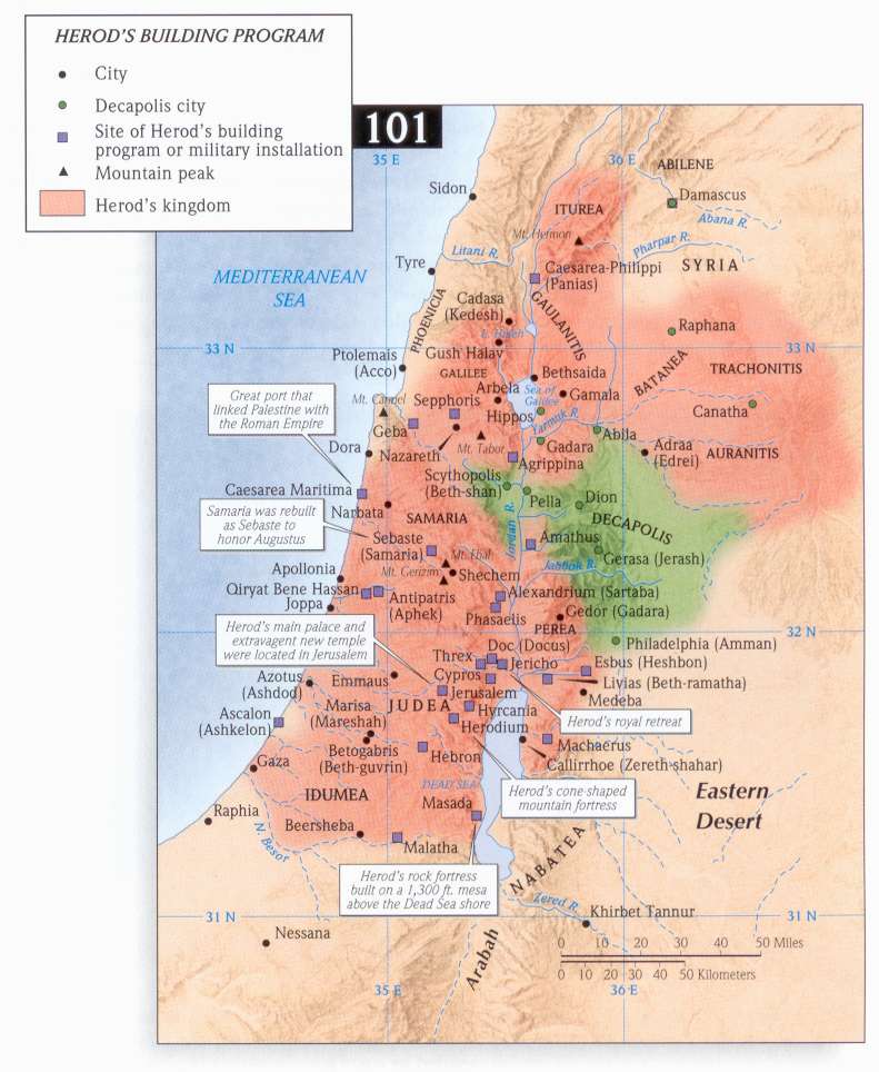
- Genesis 12:8 - Abraham and Lot Between Bethel and Ai
- Genesis 12:9, 10 - Abraham in the Negev
- Genesis - Old Testament Map of the Negev - Home of Abraham
- Genesis 12:10, 11, 12, 13, 14, 15, 16 - Abraham Migrates to Egypt
- Genesis 14:1,2 - Chedorlaomer's Alliance
- Genesis 14:3, 8, 9, 10 - Route of Chedorlaomer's Invasion
- Genesis 14:14, 15, 16 - Abram's Rescue of Lot
- Genesis 14:18, He 7:1,2,3,4- Abraham Meets Melchizedek
- Genesis 16:4-14 - Hagar, Setting of (images only)
- Genesis 18:1, 2 - Setting of Sodom and Gomorrah
- Genesis - Sodom and Gomorrah - Map of Possible Locations
- Genesis 20:1,2 -Abraham in Philistia - Gerar: Capital of Philistine colony on the coast
- Genesis 21:14, 15,16, 17, 18, 19 - Hagar and Ishmael Flee (Images only)
- Genesis 25:24, 25, 26, 27, 28, 29-34 -Jacob & Esau
- Genesis 27:43 - Jacob's Flight from Esau
- Genesis 28:12 - Jacob's Ladder, the Site of
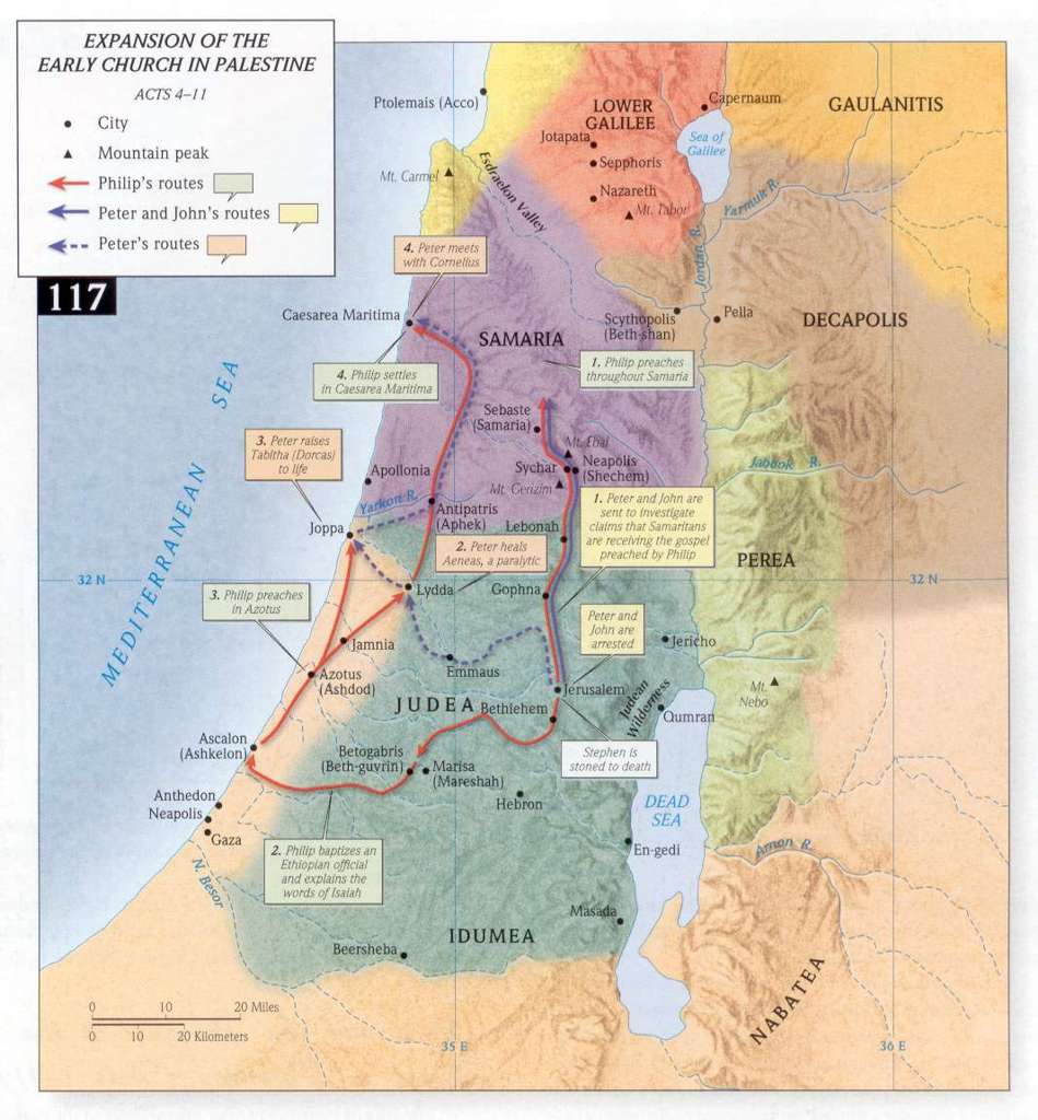
- Genesis 32 - Jacob and Esau Reunite
- Genesis 33:18 - Jacob Stays in Shechem
- Genesis - Jacob and Sons in Canaan
- Genesis - The Land of the Patriarchs
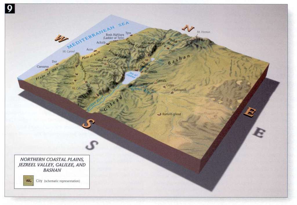
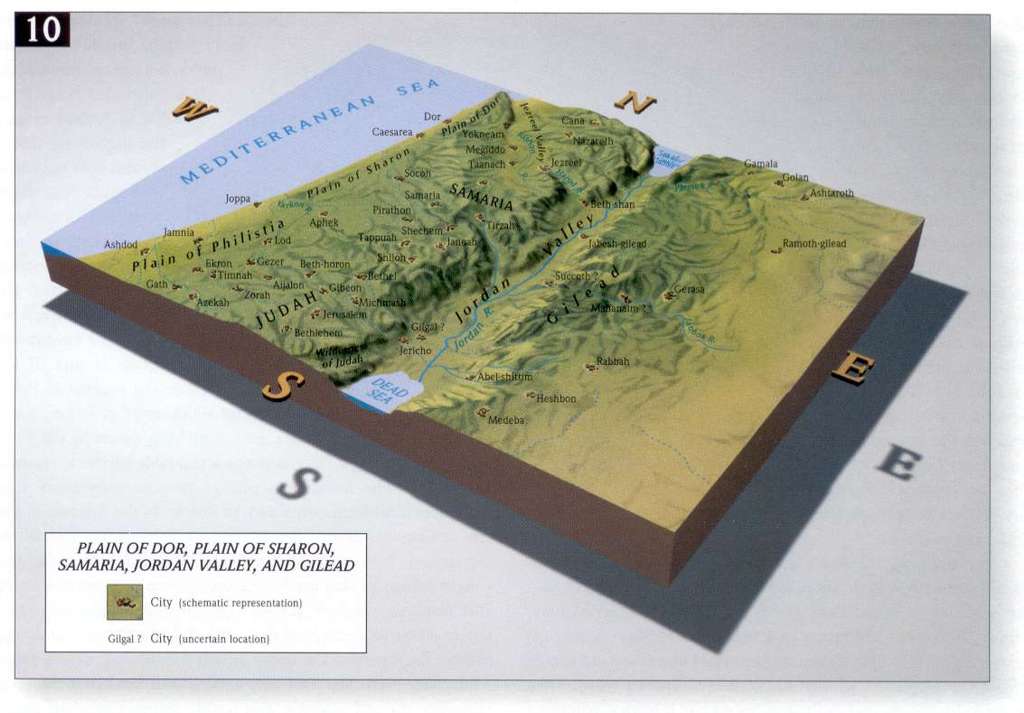
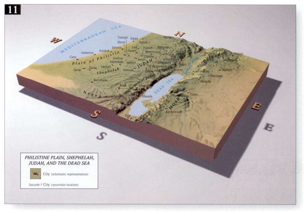
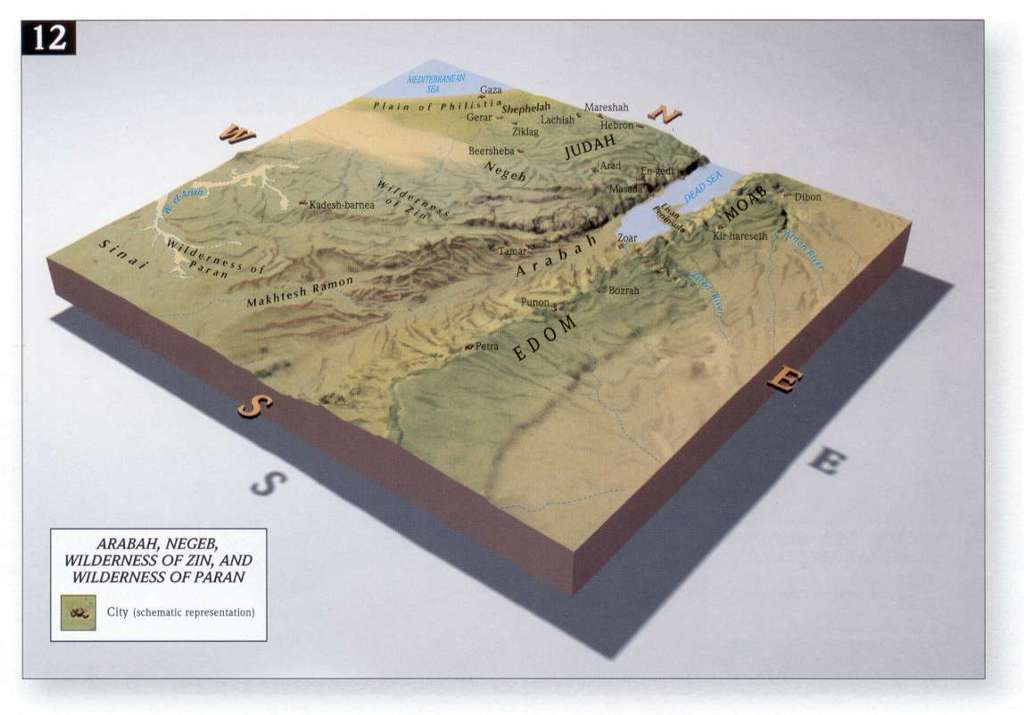
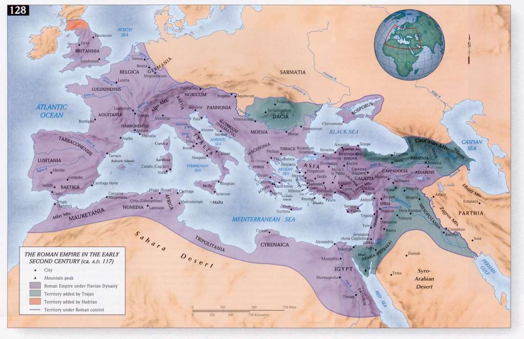
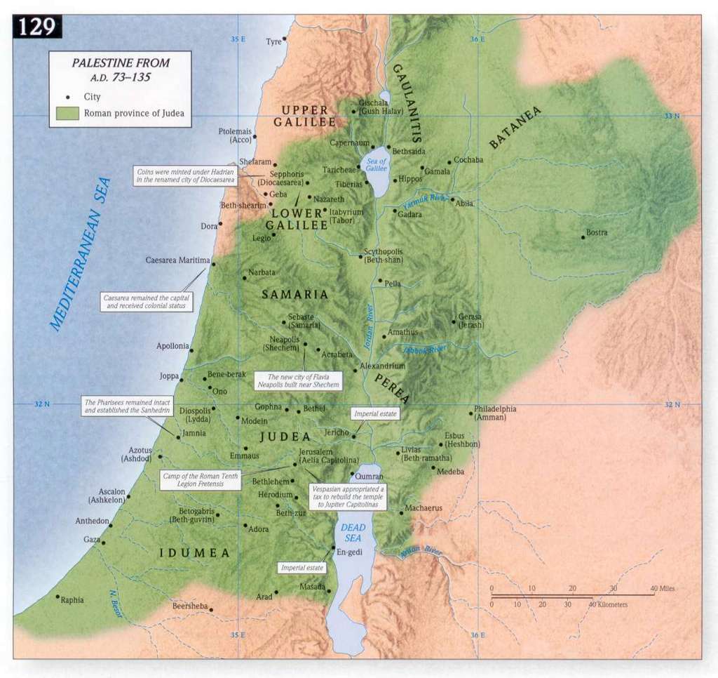
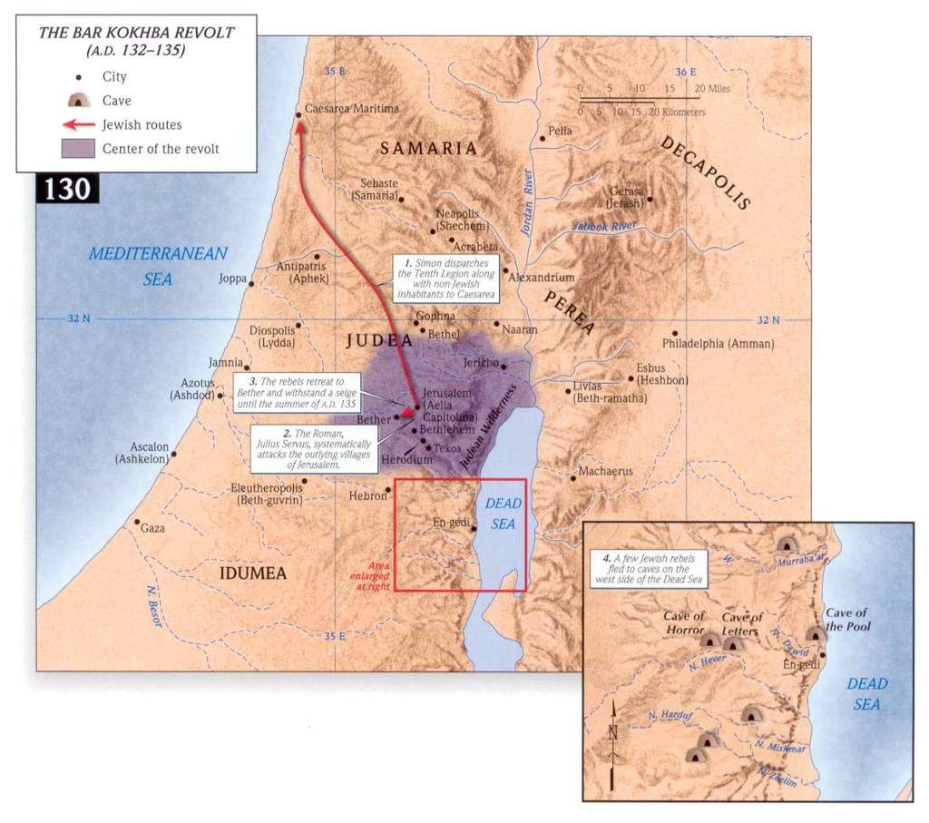
The following maps are some of the highest quality maps available. They are from the Holman Bible Atlas (digital book; Hardcover/Paperback version) copyrighted © 1998 B&H Publishing Group, used by permission, all rights reserved.
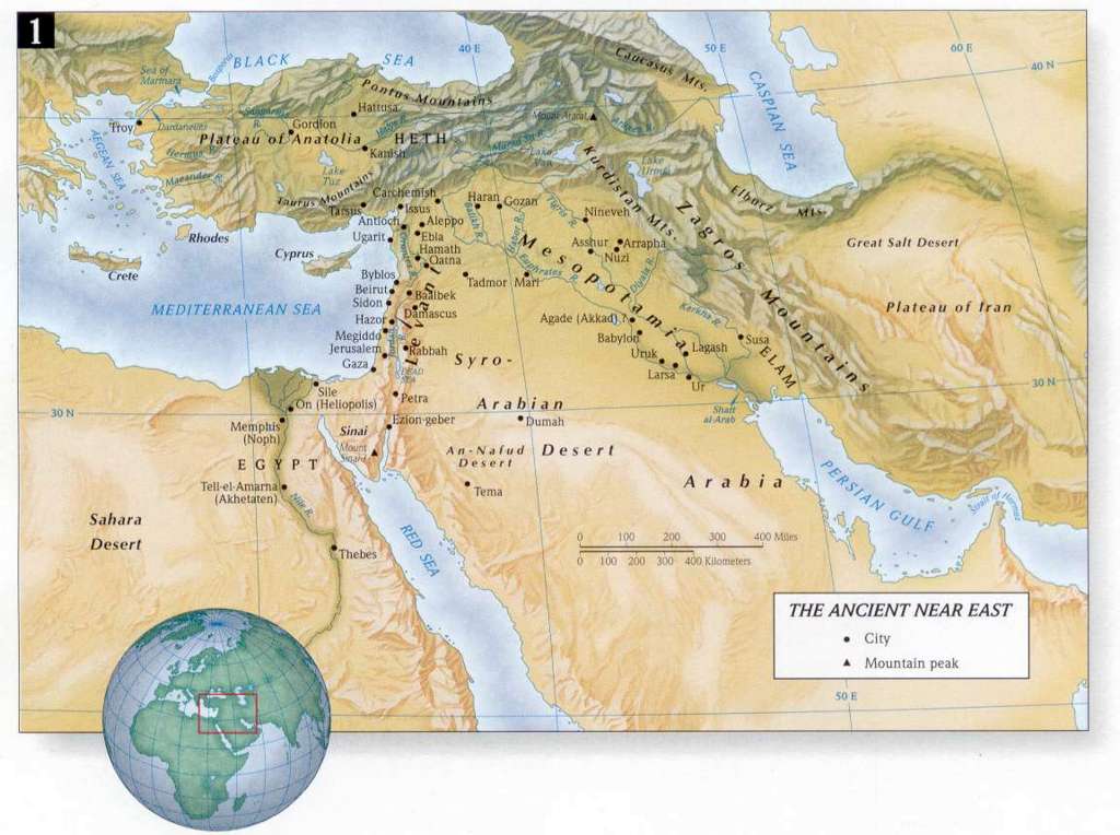
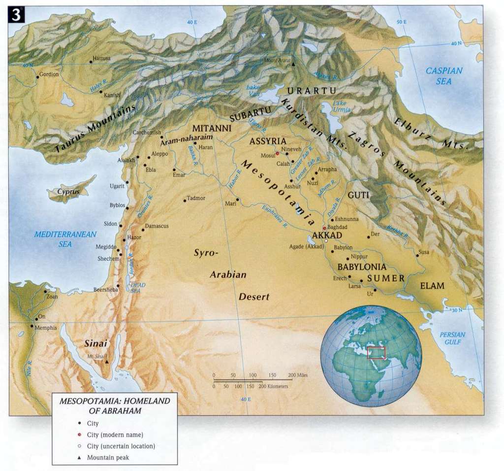
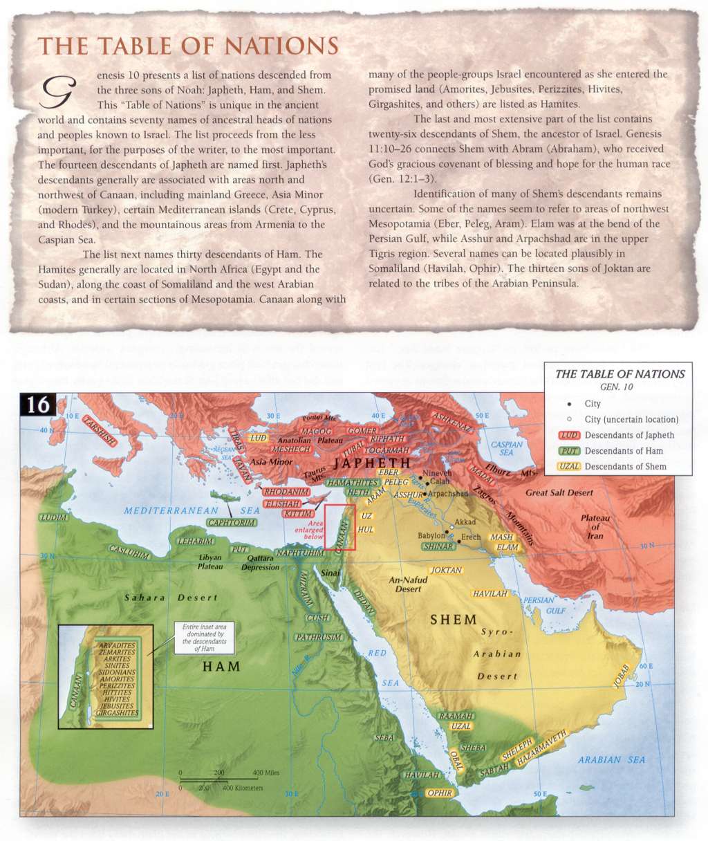
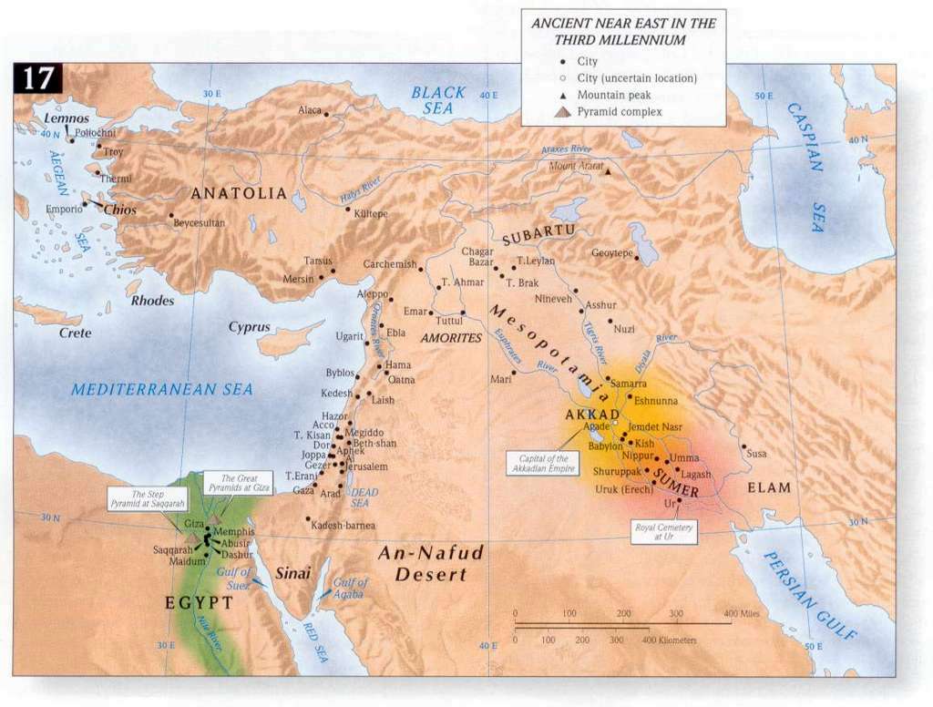
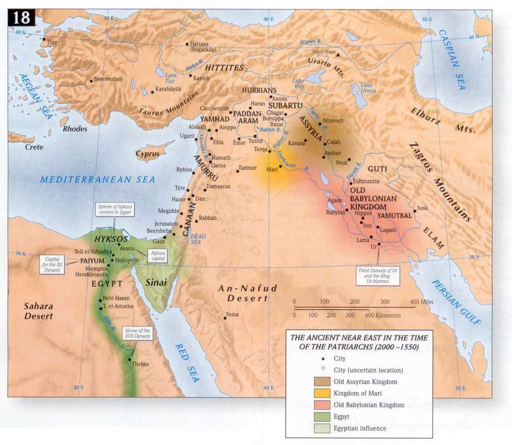
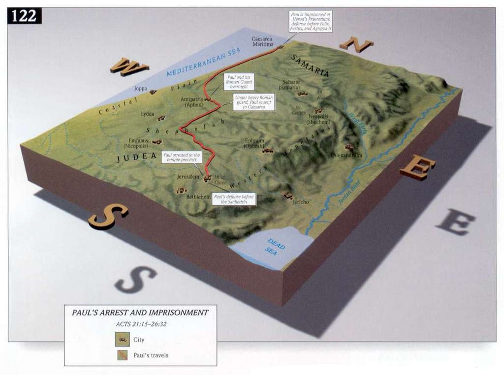
- Ancient Near East in the Time of the Patriarchs
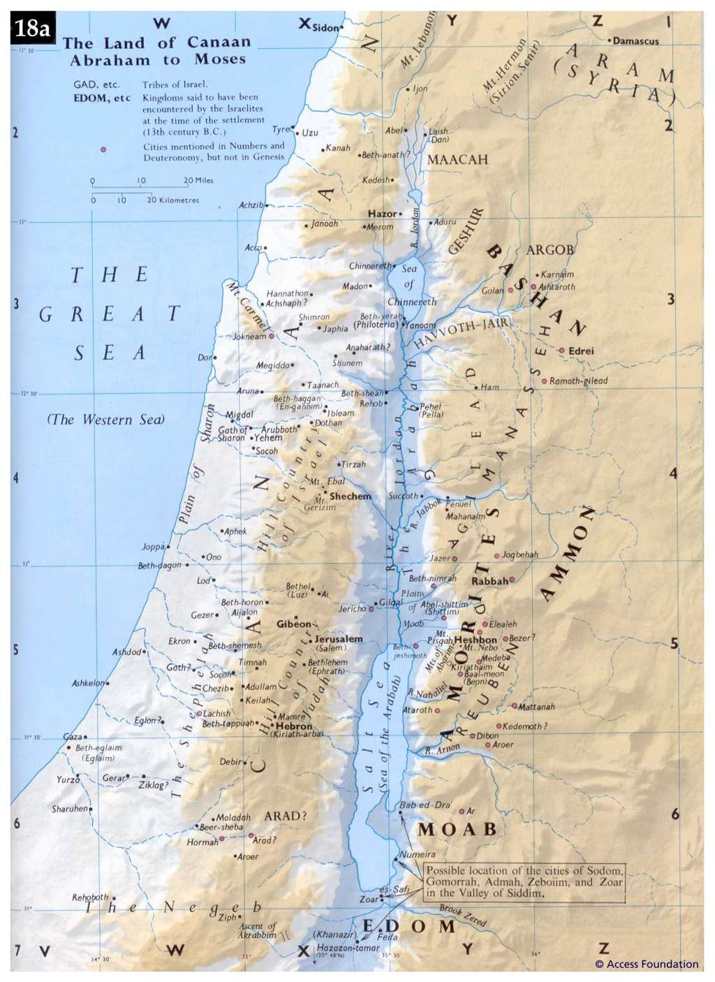
- The Land of Canaan from Abraham to Moses
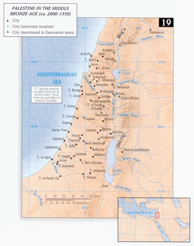
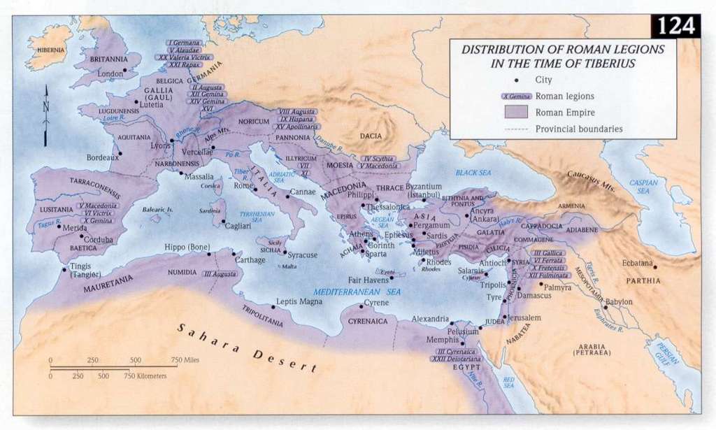
- Palestine in the Middle Bronze Age
- The Migration of Abraham
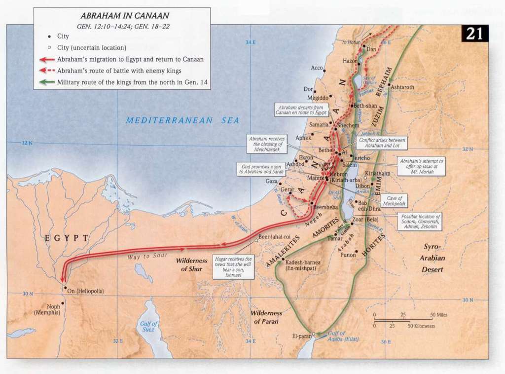
- Abraham in Canaan
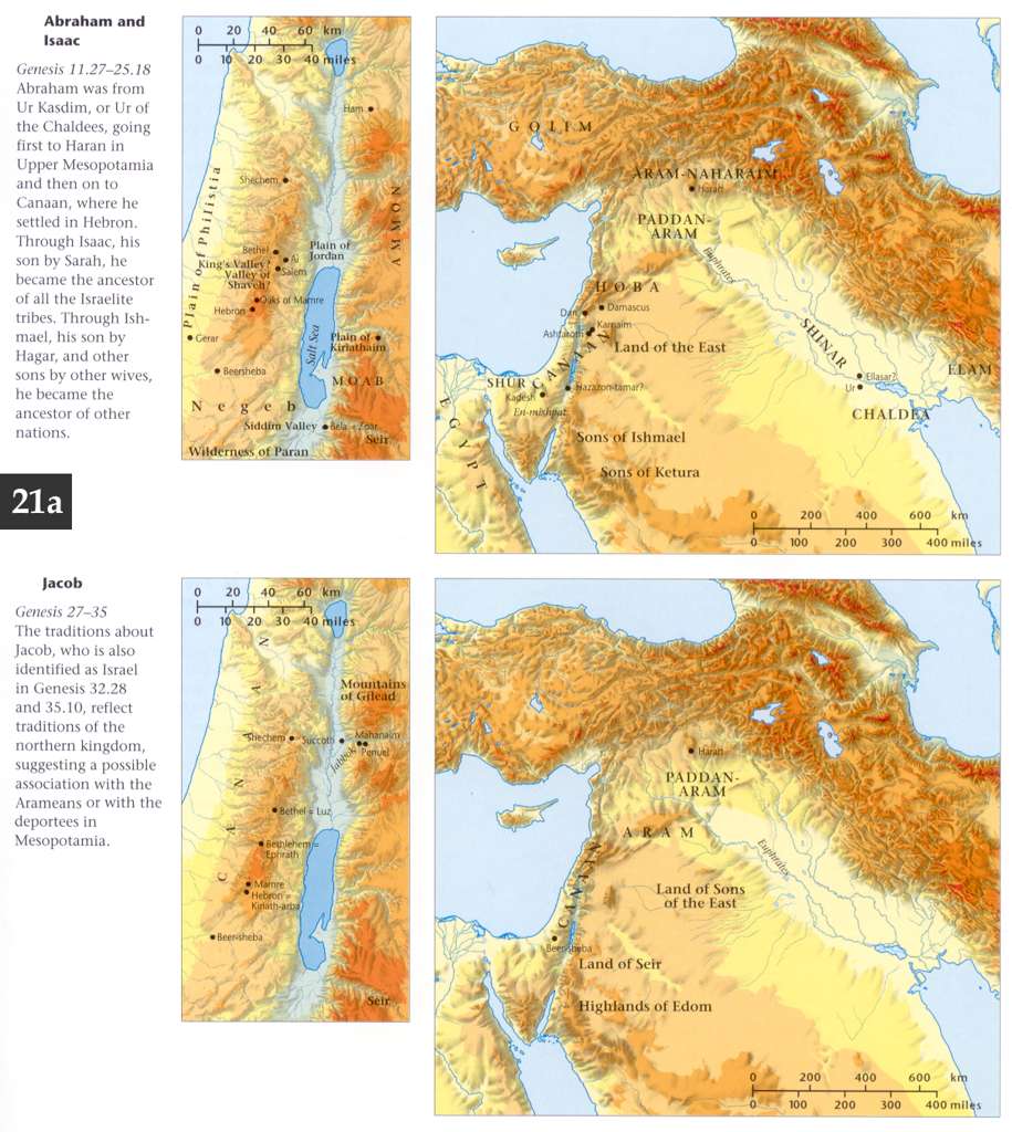
- Abraham, Isaac, and Jacob
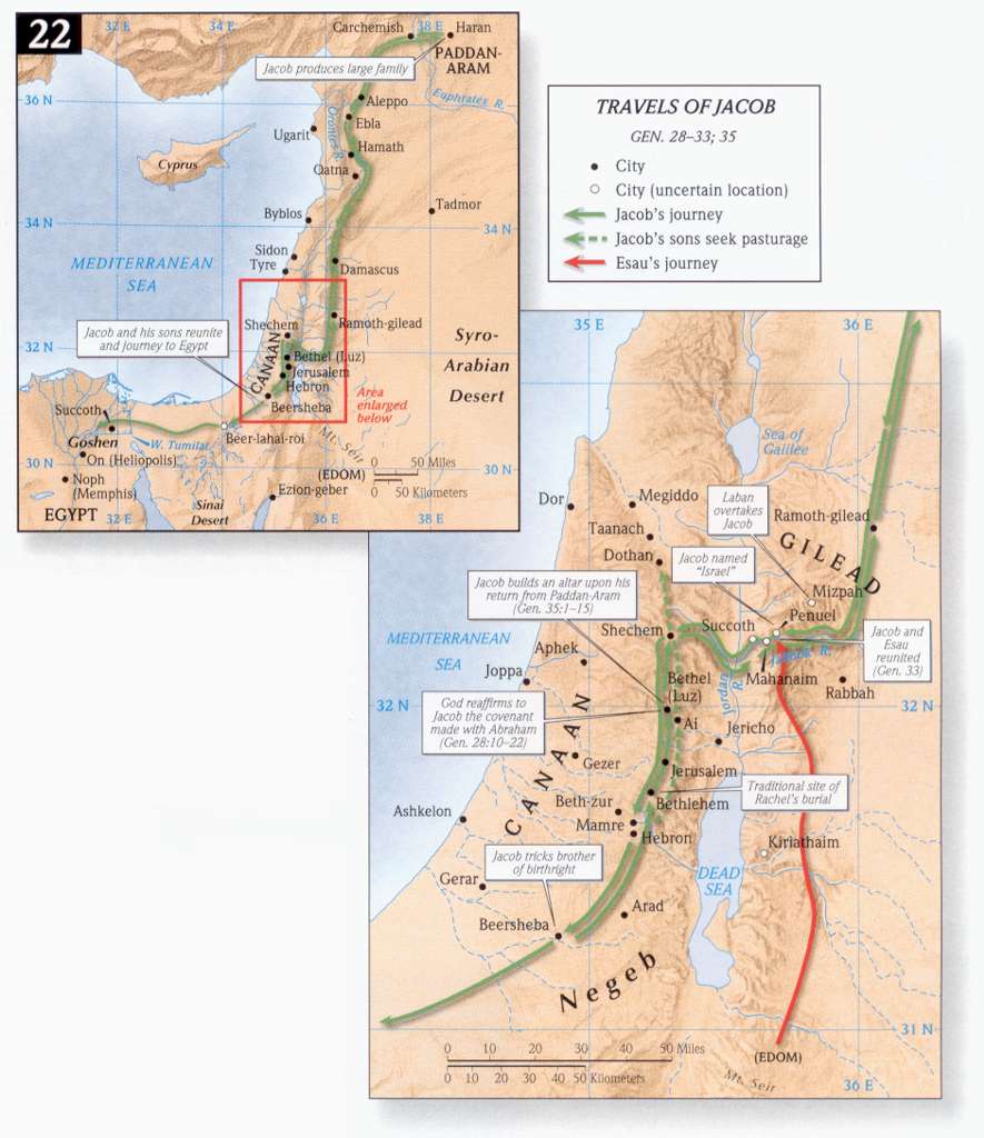
- Travels of Jacob
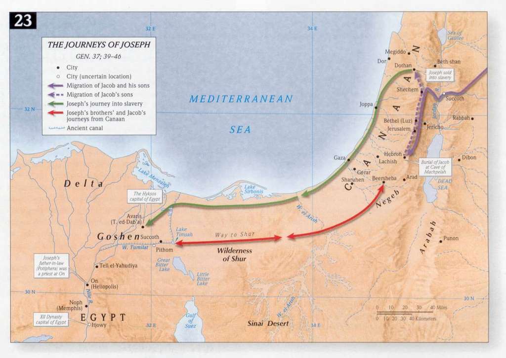
- The Journeys of Joseph
- Exodus 15:22, 23, 27, 16:1Jo - Israelites Out of Egypt Under Moses
- Exodus 17:1, 8 - Israel - Possible Routes Through Sinai
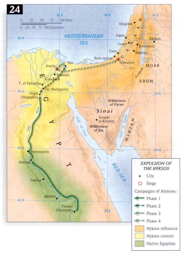
- Expulsion of the Hyksos
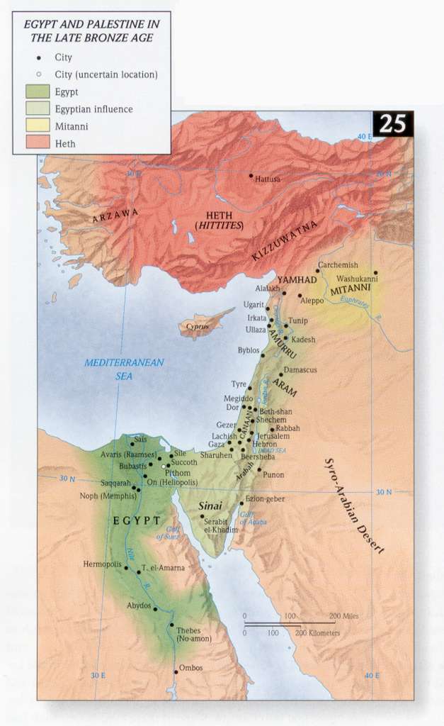
- Egypt and Palestine in the Late Bronze Age
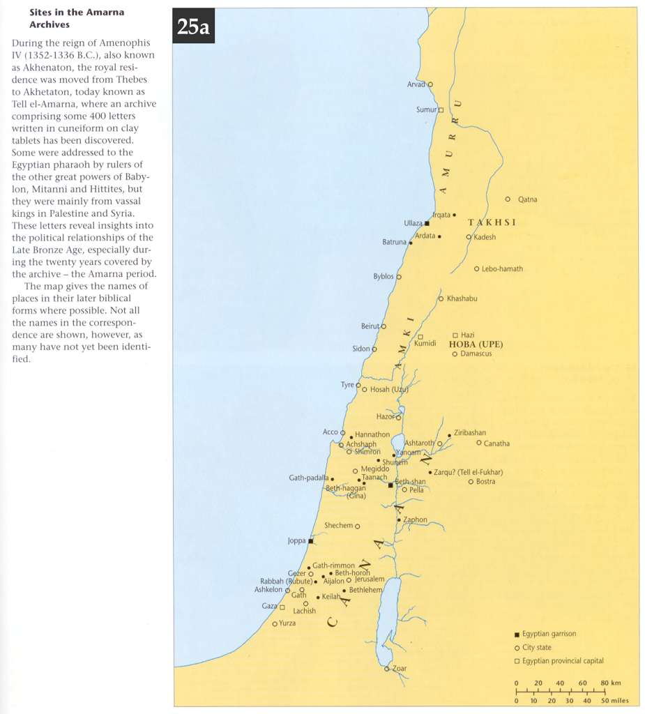
- Sites in the Amarna Archive (Akhetaton; Tell el-Amarna)
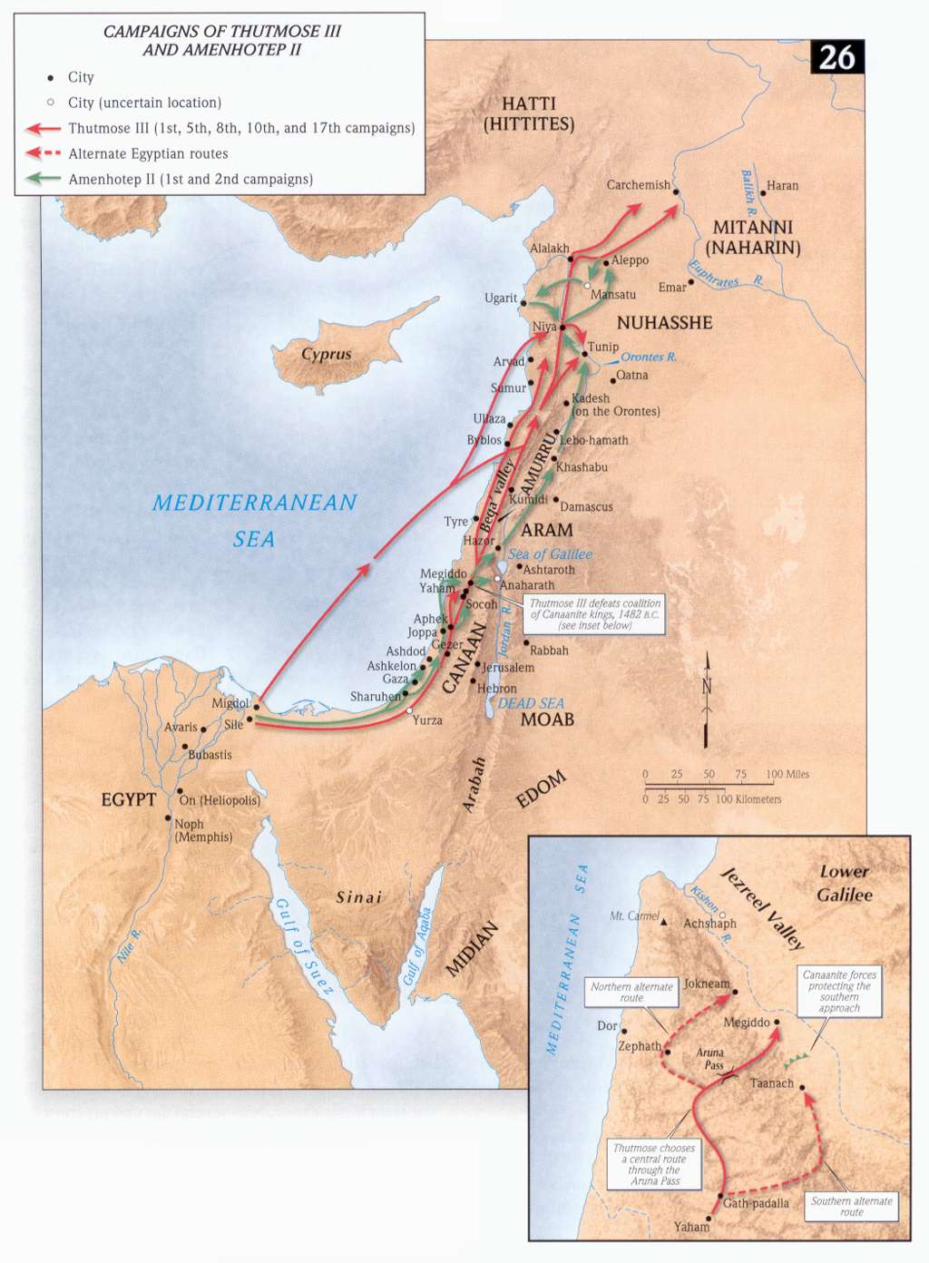
- Campaigns of Thutmose III and Amenhotep II
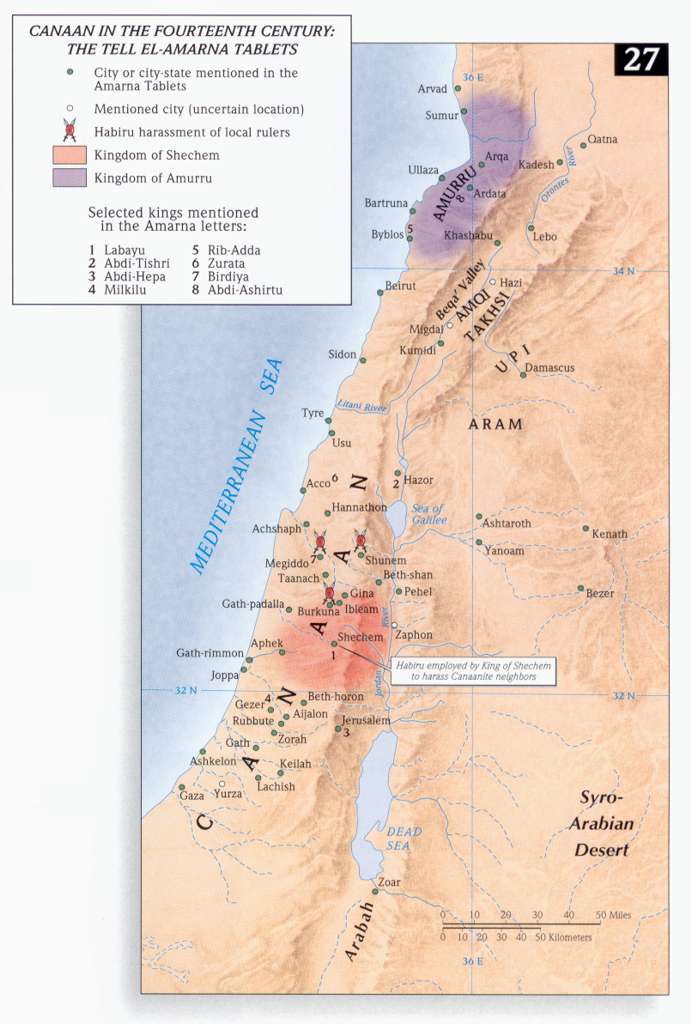
- Canaan in the 14th Century: The Tell el-Amarna Tablets
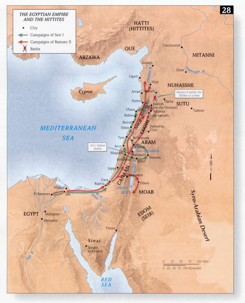
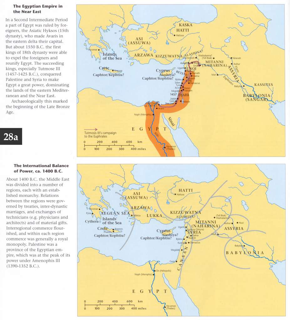
- The Egyptian Empire and the Hittites
- Egyptian Empire and Balance of Power, ca. 1400 BCE
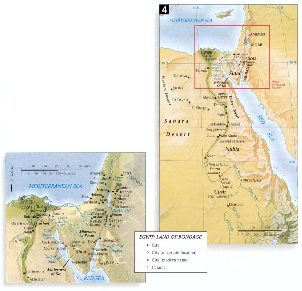
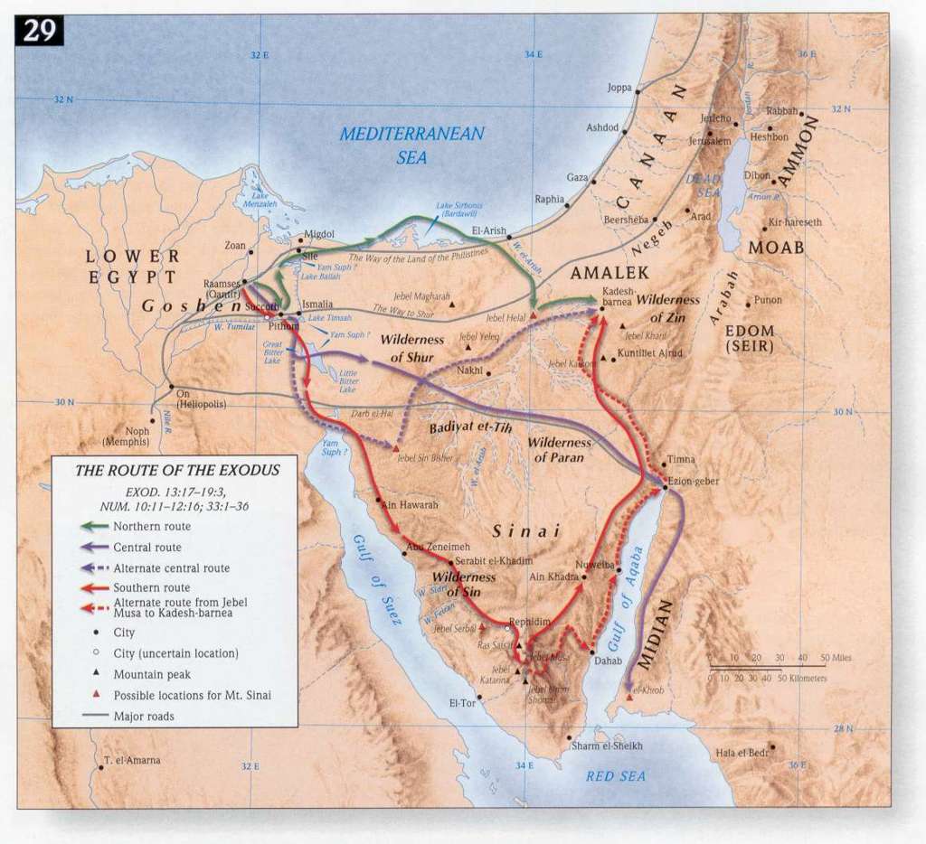
- The Route of the Exodus
- Nu 12:16 - Moses moves Wilderness of Paran (at Kadesh)
- Nu 13:2, 3, 21, 22, 23, 24, 25 - Spies Scout Canaan
- Nu 13:22, 28, 32, 33 (Dt 1:28, 29, 30) -The Land of Giants
- Nu 21:21, 22, 23, 33, 34, 35 (Josh 9:10) -Kingdoms of Og & Sihon
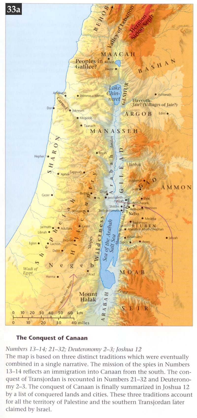
- Nu 14:1-14:45 The Conquest of Canaan
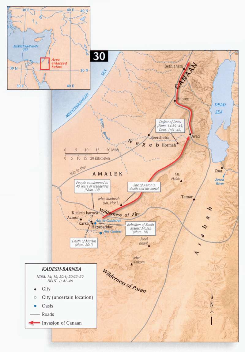
- Events during the Sojourn at Kadesh-Barnea
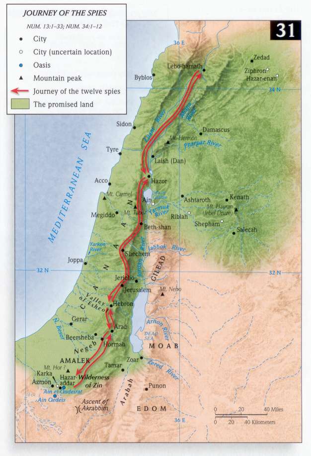
- Journey of the Spies
- The Journey from Kadesh-Barnea to the Plains of Moab
- Dt 2:1-3:39 The Conquest of Canaan
- Dt 32:49, 50, 34:1, 2, 3, 4 - Jericho - the Conquest
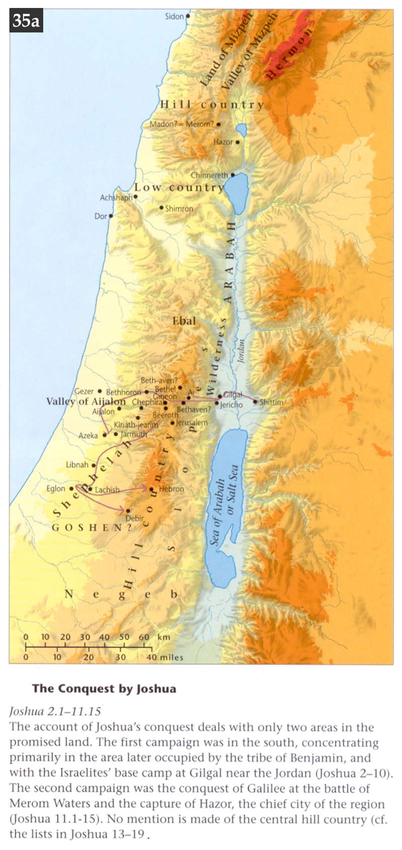
- Joshua 2:1-11:15 The Conquest by Joshua
- Joshua 2:1,2,3,4, 5, 6 - Jericho, Map of Joshua's Spies
- Joshua 4:19, 6:2, 3, 4, 5, 20, 21 -The Battle of Jericho
- Joshua 4:19, 20 - Joshua's Warpath
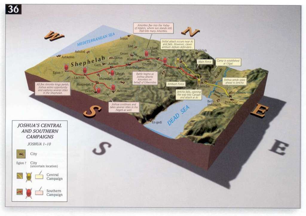
- Joshua 1-10:43 Joshua's Central and Southern Campaigns
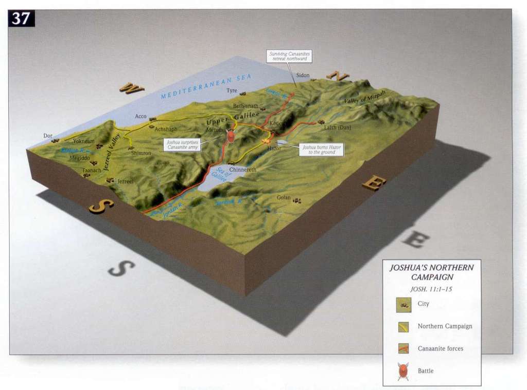
- Joshua 11:1-15 Joshua's Northern Campaign
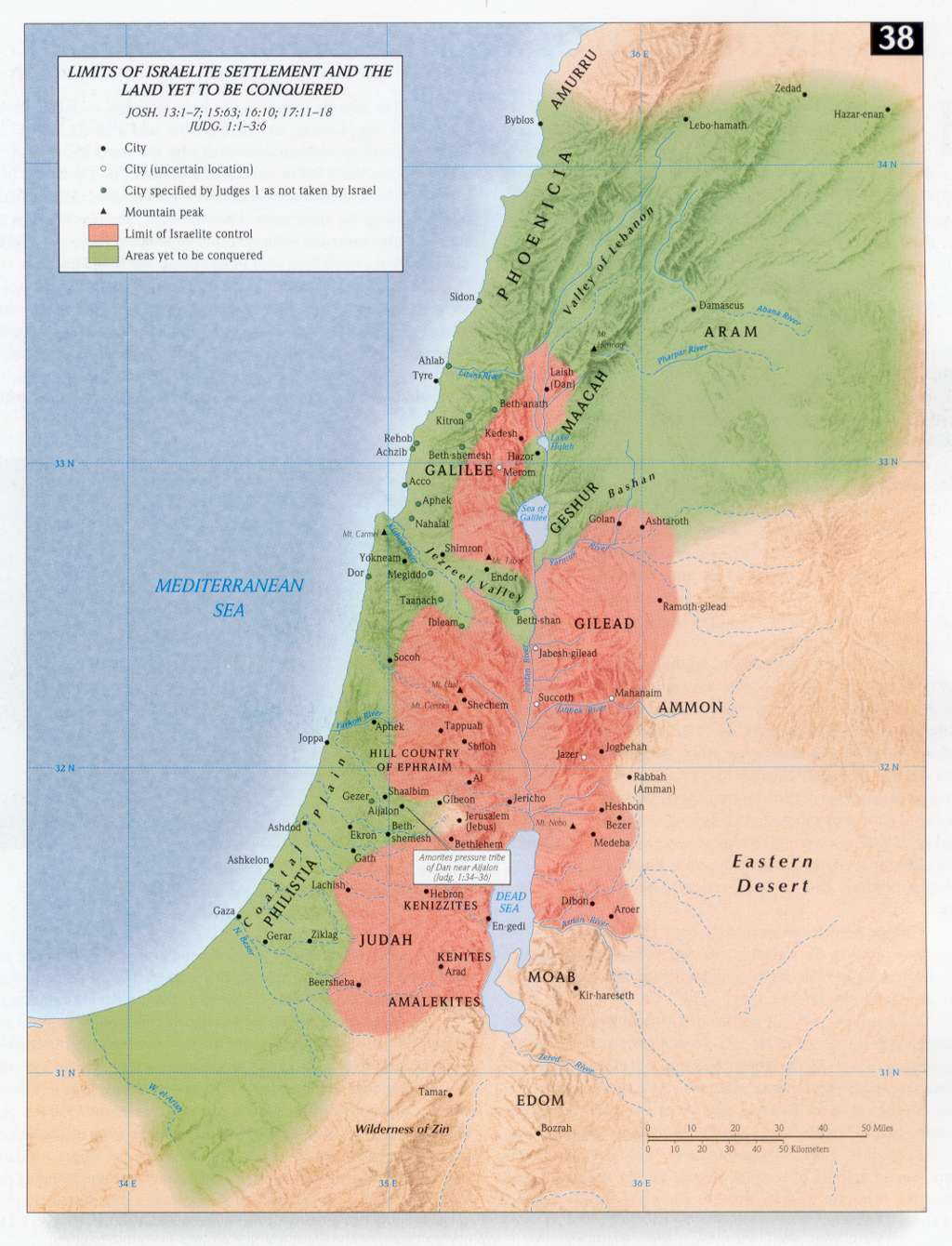
- Joshua 13:1-7, 15:63, 16:10, 17:11-18 The Limits of Israelite Settlement
- Joshua - Jericho, Battle of - Geography
- Joshua - Jericho, Battle of - Map
- Joshua 12:1-24 The Conquest of Canaan
- Joshua 13:8-19:49 The Tribal Allotments of Israel
- Joshua 13:1-19:51, Josh 15:20-62;18:21-28; 19:40-46 Division of the Land Among the Tribes
- Joshua 11:1, 11, 12, 13 -The Battle of Hazor
- Joshua 17:1-10, 11, 19:10, 17, 24, 32, - Northern Tribal Allotments
- Joshua 15:1, 16: 5, 6, 7, 8, 9, 18:7, 11, 19:1, 40 -Southern Tribal Allotments
- Joshua 15:13, 15 - Anakim - Map of Land
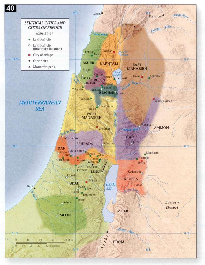
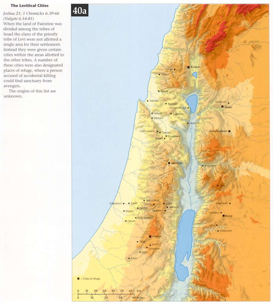
- Joshua 20:1-21:45 Levitical Cities and Cities of Refuge (1)
- Joshua 21:1-45, 1Chr 6:39-66 The Levitical Cities (2)
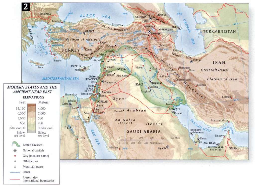
- Ancient Near East from 1200-100 BCE
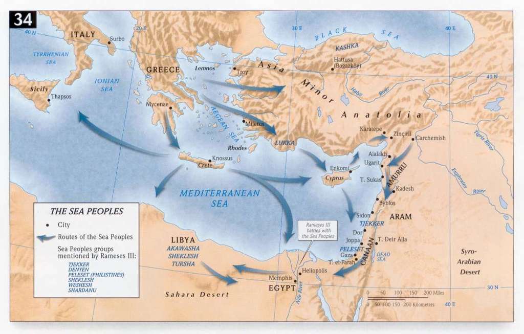
- The Sea Peoples
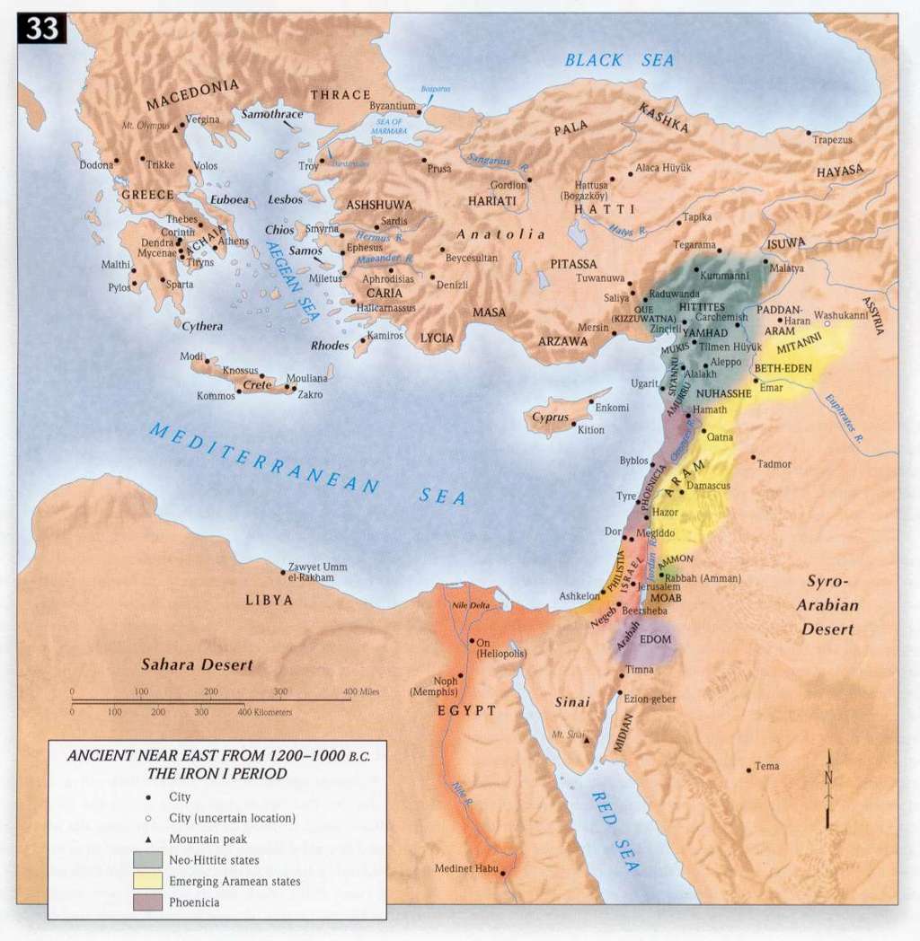
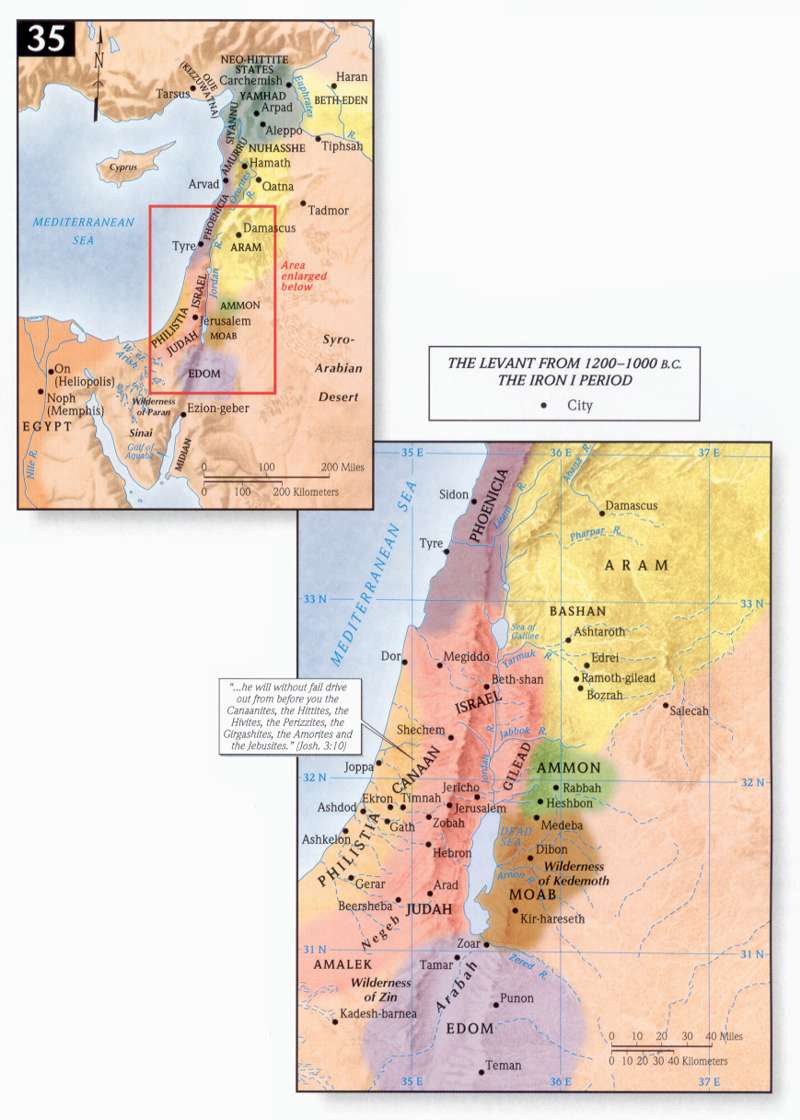
- The Levant from 1200-1000 BCE (What is Levant?)
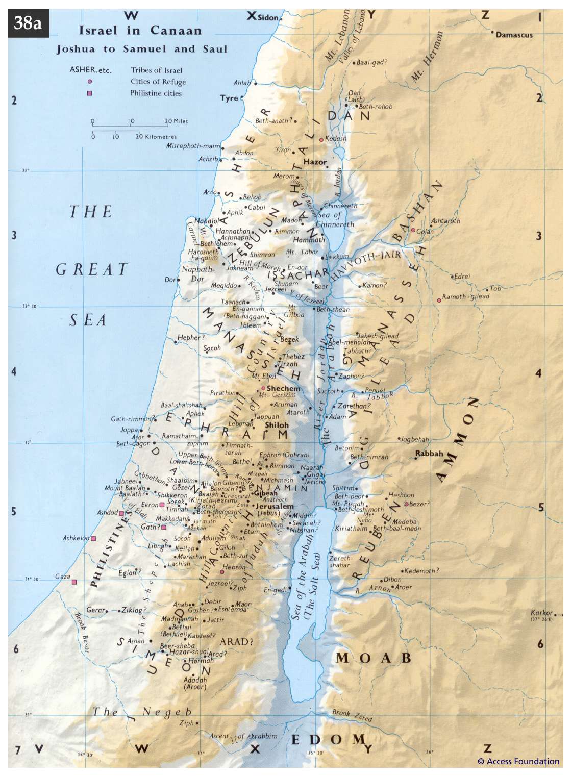
- Israel in Canaan from Joshua to Samuel to Saul
- Jdg 1:1-3:6 The Limits of Israelite Settlement
- Judges 3:15 -Moabite Oppression of Jericho
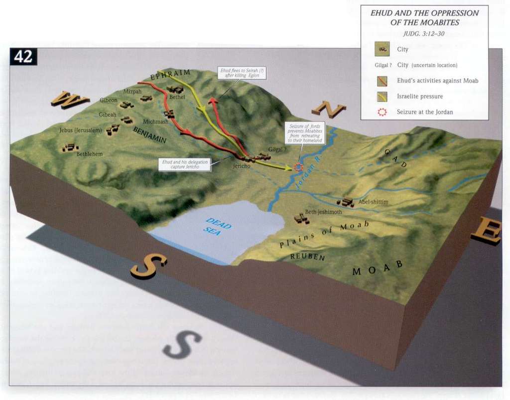
- Judges 3:20, 21, 22 - Ehud's Deliverance of Jericho
- Judges Map and Timeline - Steve Rudd
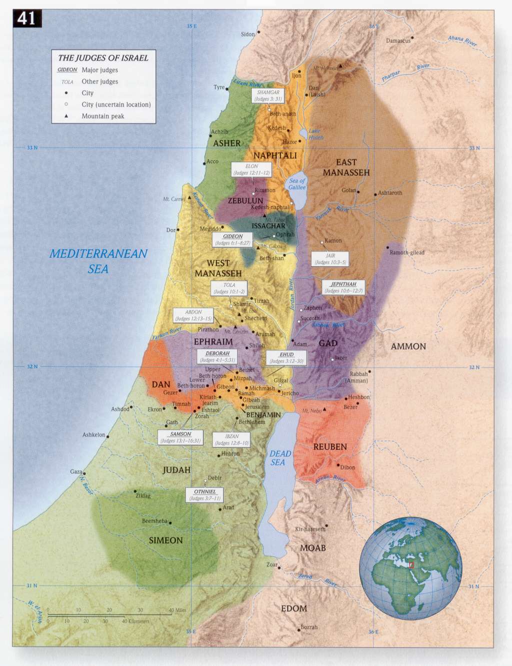
- The Judges of Israel
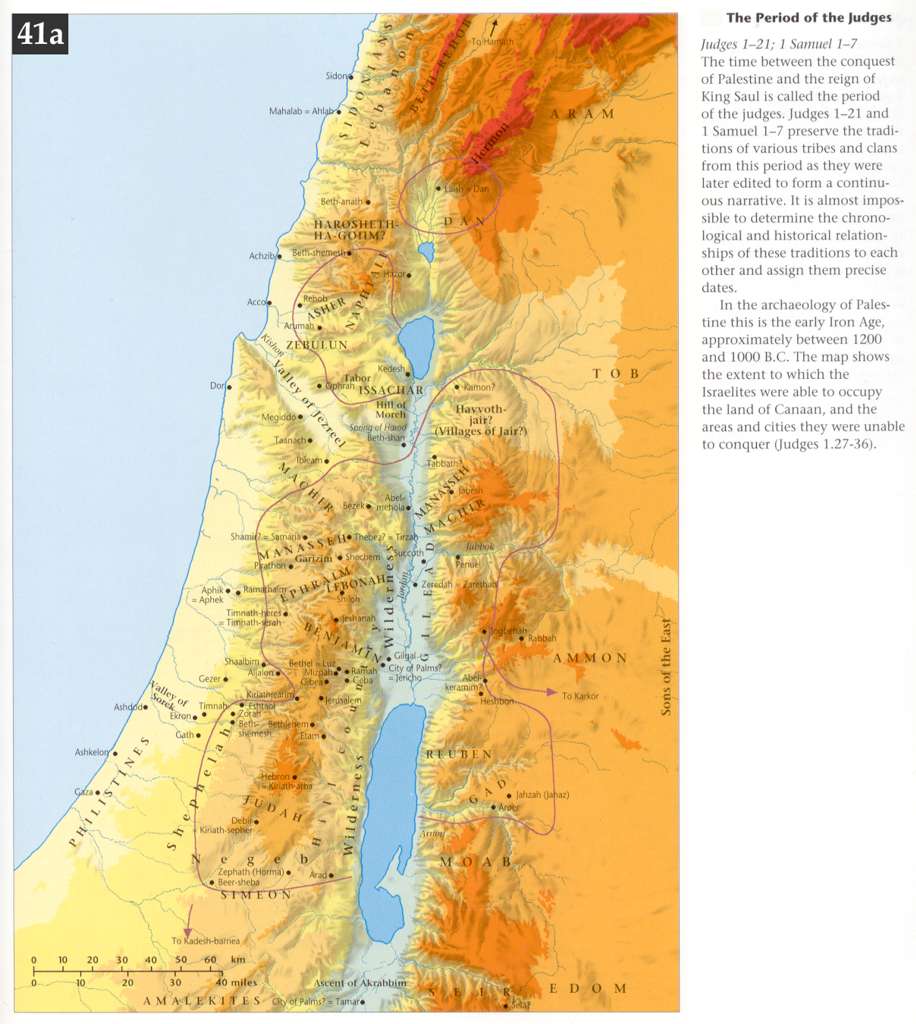
- The Period of the Judges
- Ehud and the Oppression of the Moabites
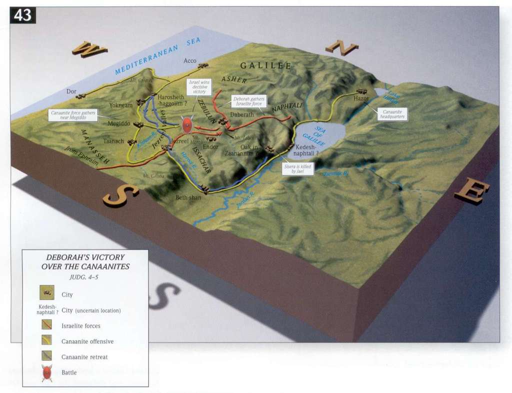
- Deborah's Victory over the Canaanites
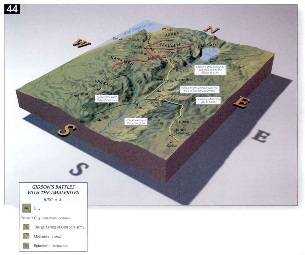
- Gideon's Battles with the Amalekites
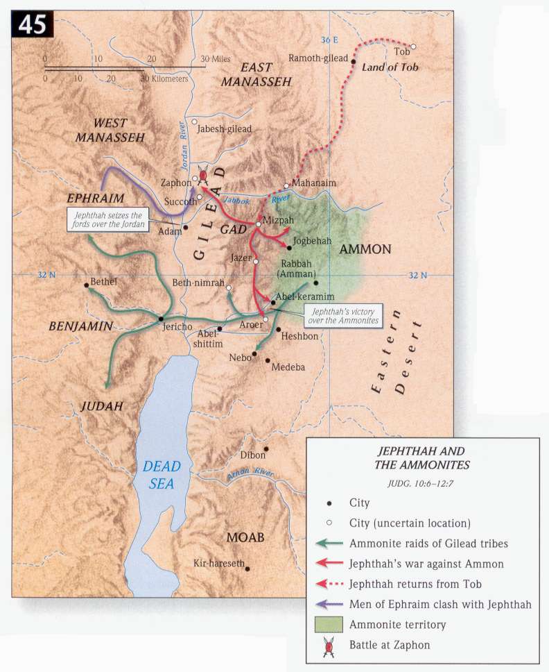
- Jephthah and the Ammonites
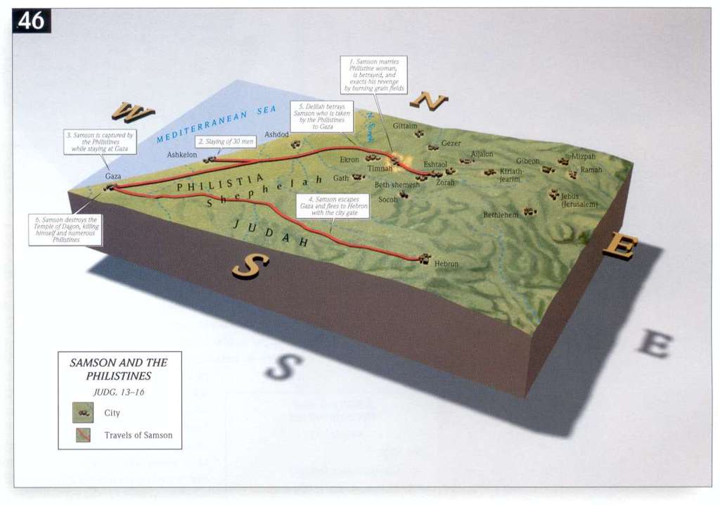
- Samson the the Philistines
- 1 Sa 17:1, 2, 3, 4, 16, 20, 21-24, 26, 32, 33-48, 49-58 -David & Goliath -Valley of Elah
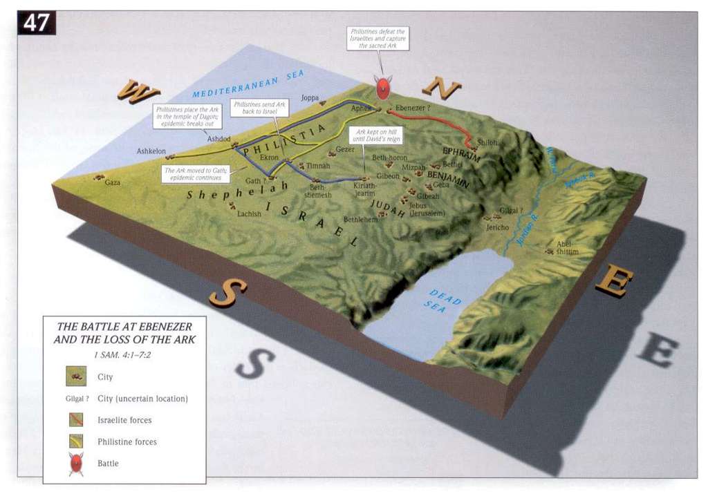
- 1 Samuel 4:1-7:2 The Battle at Ebenezer and the Loss of the Ark
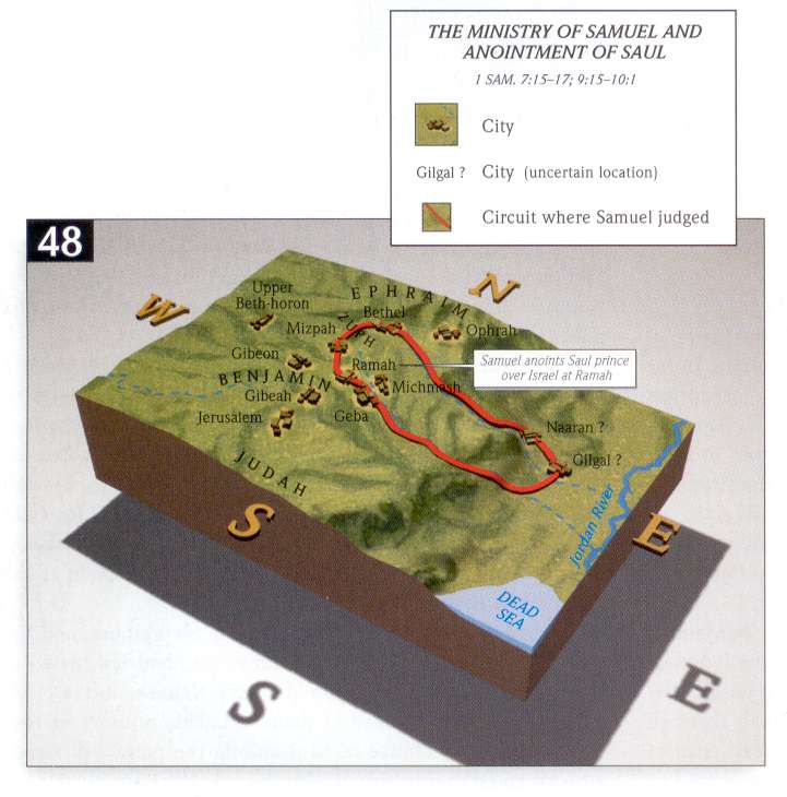
- 1 Samuel 11:1-14:48 The Ministry of Samuel and Anointment of Saul
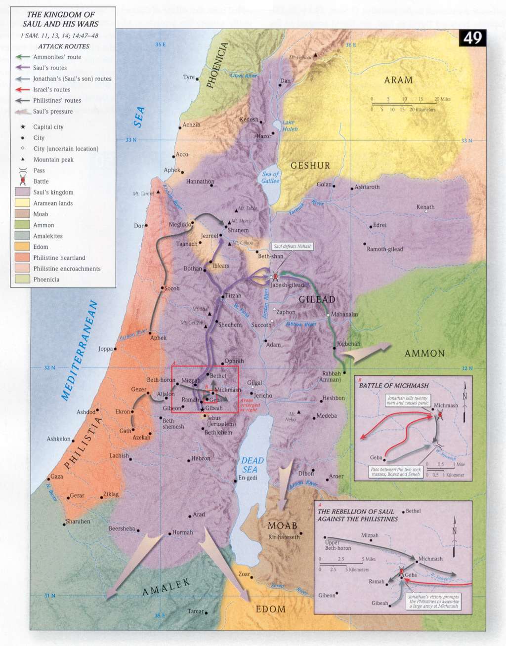
- 1 Samuel 11:1-14:48 The Kingdom of Saul and His Wars
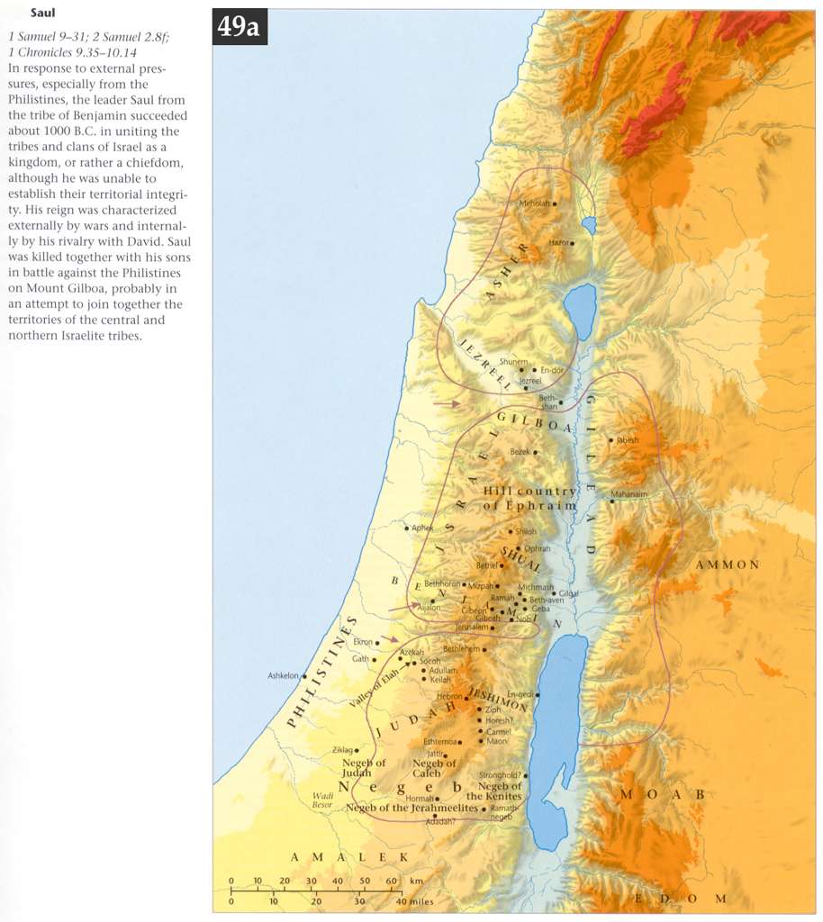
- 1 Samuel 9:1-31:1, 2 Samuel 2:8ff Saul, 1000 BCE
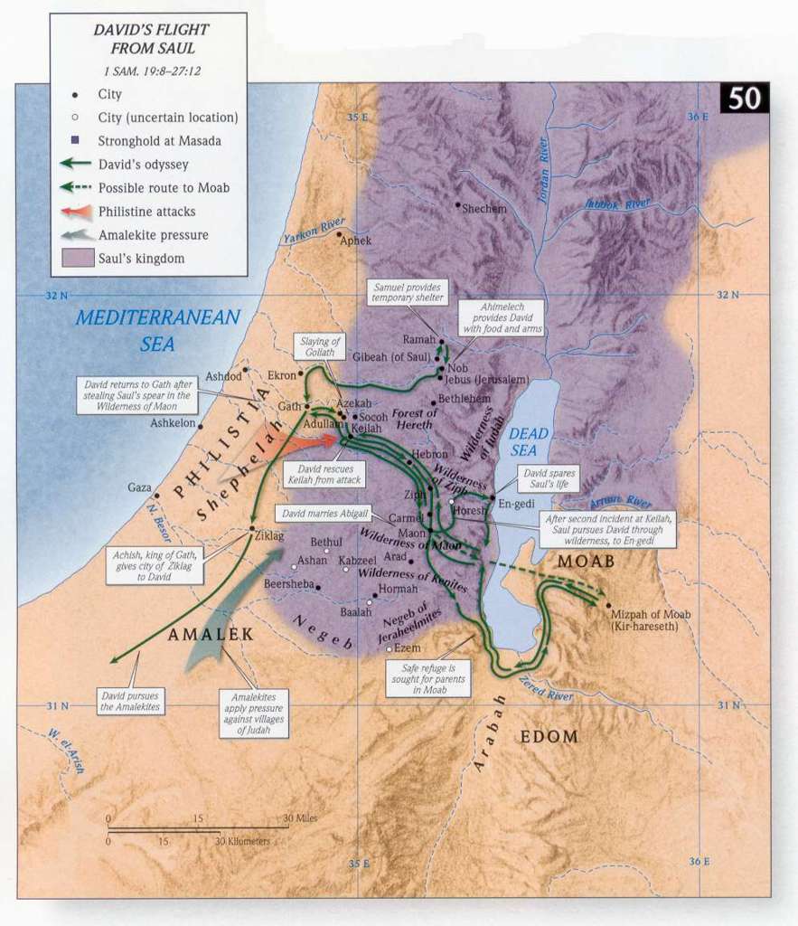
- 1 Samuel 19:8-27:12 David's Flight from Saul
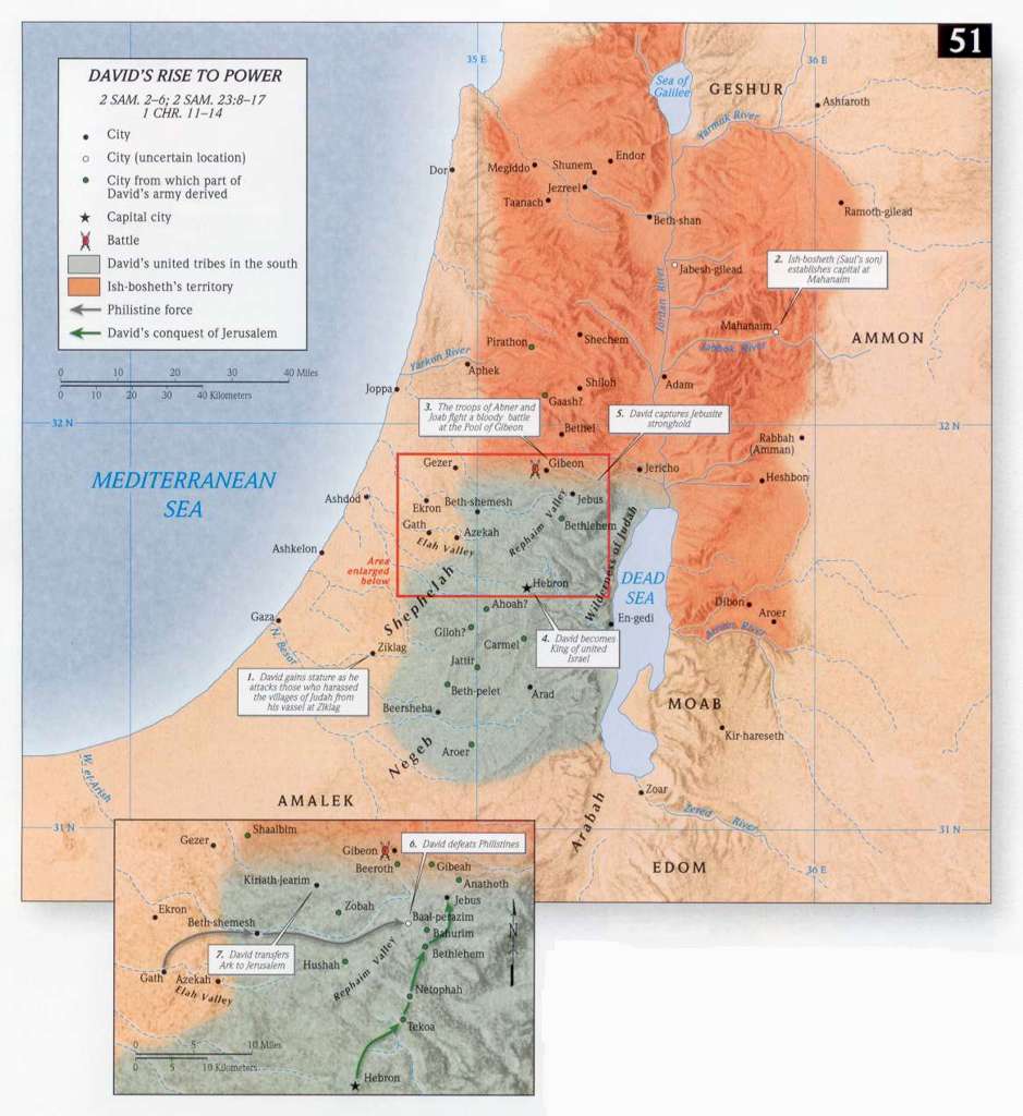
- 2 Samuel 2:1-6:1, 2 Samuel 23:8-17,1Chr 11:1-14:1 David's Rise to Power
- 2 Samuel 3:1-39 David in Conquest of Canaan
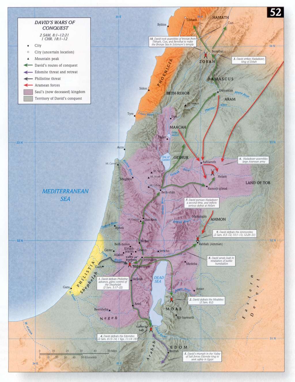
- 2 Samuel 8:1-12:21, 1Chr 18:1-12 David's Wars of Conquest
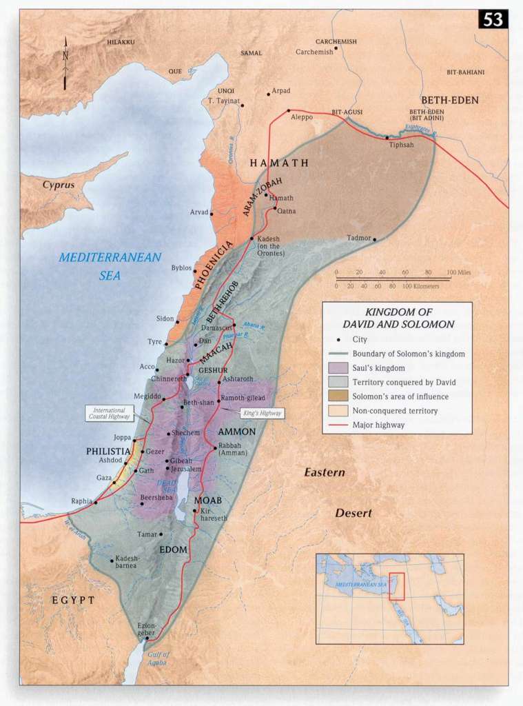
- Kingdom of David and Solomon
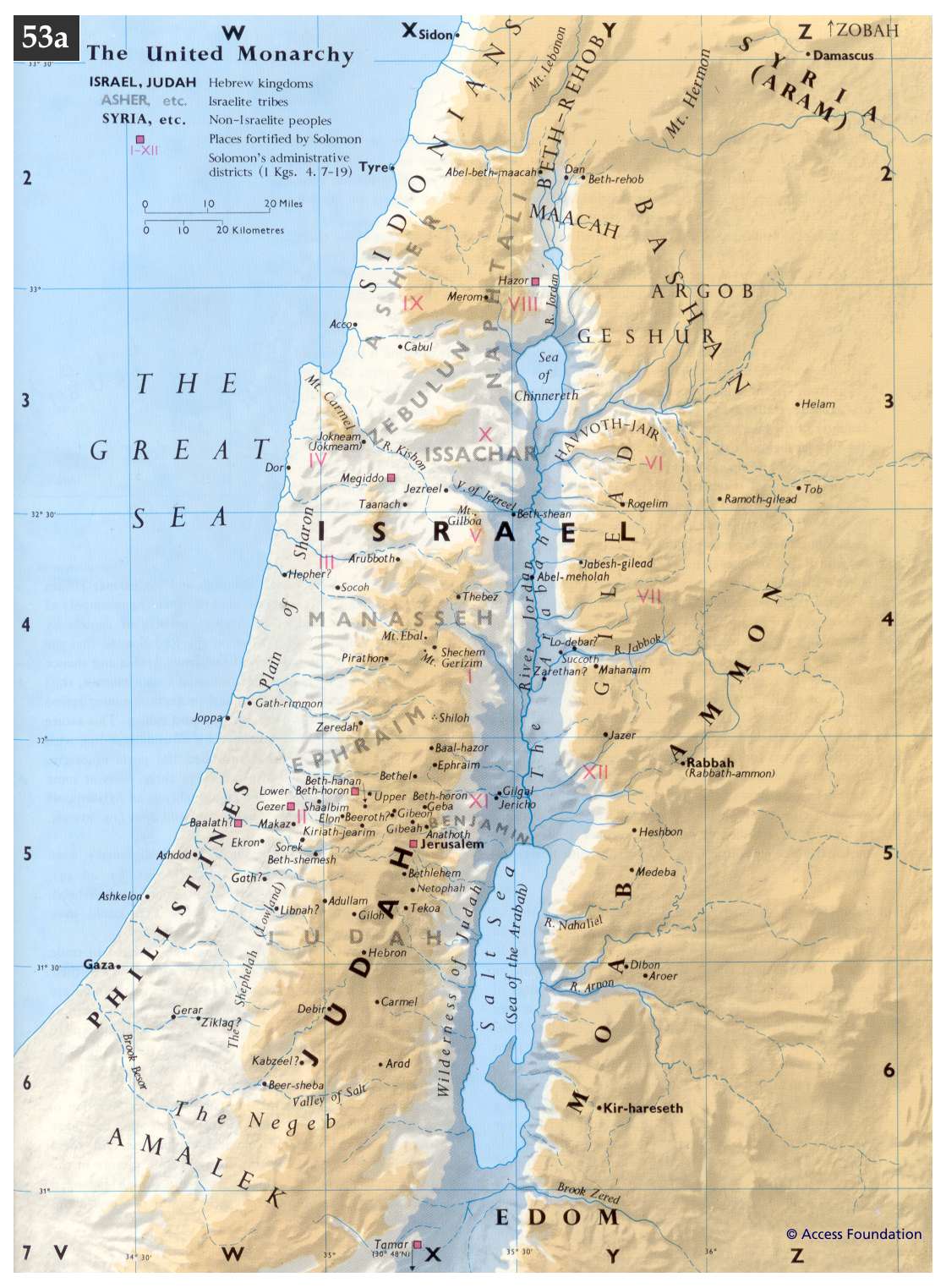
- The United Monarchy under Solomon (1)
- 1 Kings 1:1-12:2, 2Chr 1:1-9:1 The United Monarchy under Solomon (2)
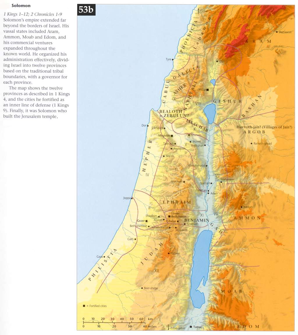
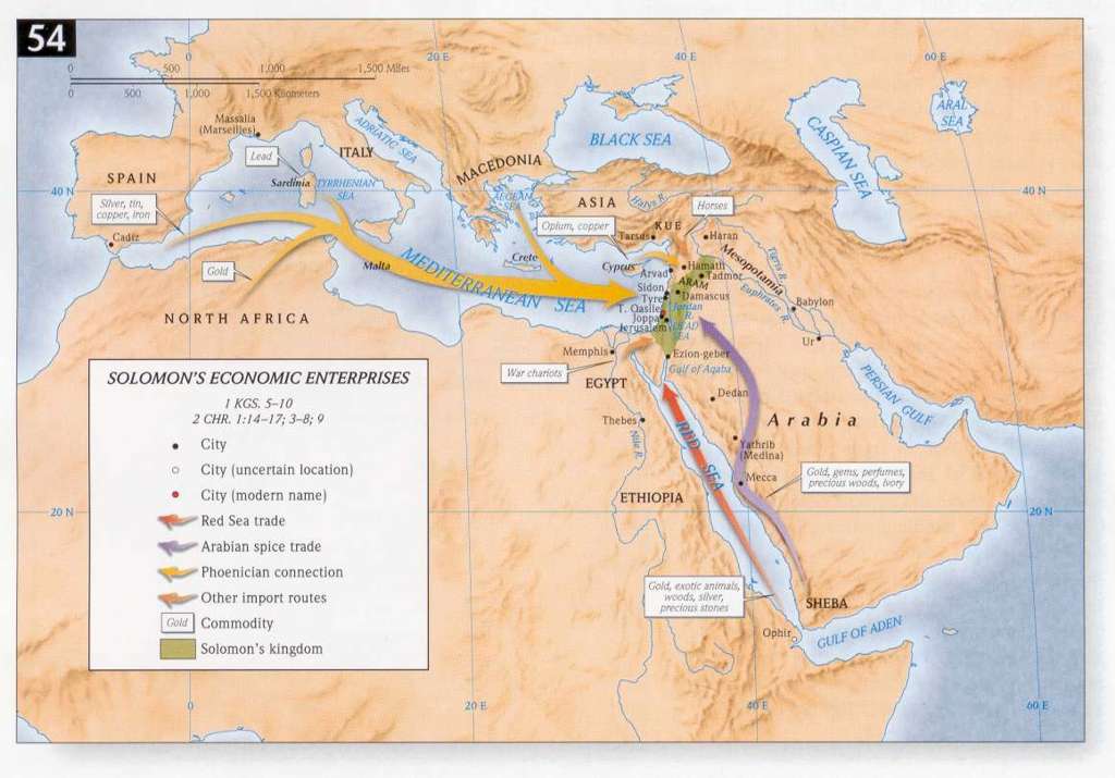
- 1 Kings 5:1-10:1, 2Chr 1:14-17, 3:1-8:1 Solomon's Economic Enterprises
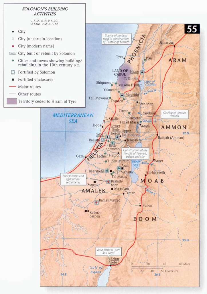
- 1 Kings 6:1-7:51, 9:1-22, 2Chr 2:1-4:1, 8:1-2 Solomon's Building Activities
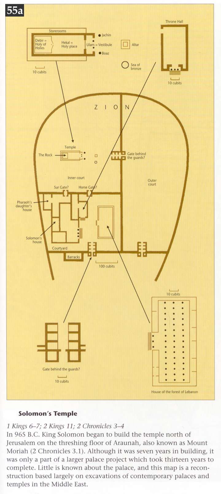
- 1 Kings 6:1-7:51, 2Ki 11:1-21, 2Chr 3:1-4:22 Solomon's Temple
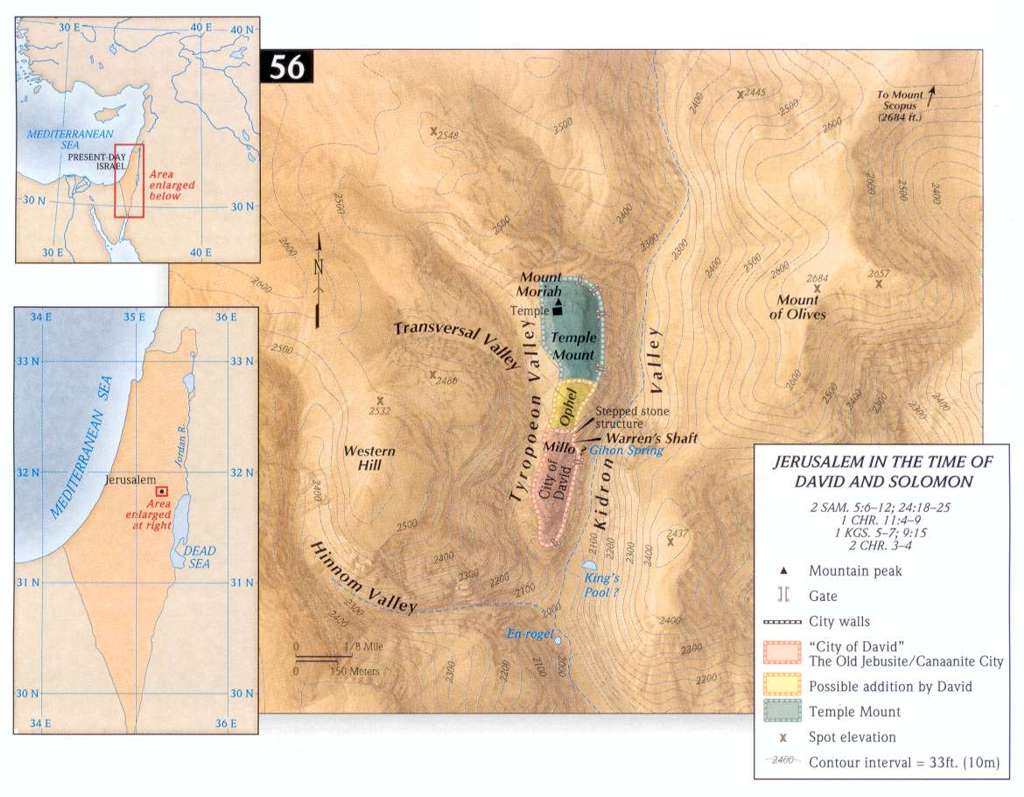
- 2 Samuel:5:6-12, 24:18-25, 1Chr 11:4-9, 1Ki 5:1-7:1, 2Chr 3:1-4:`Jerusalem of David and Solomon
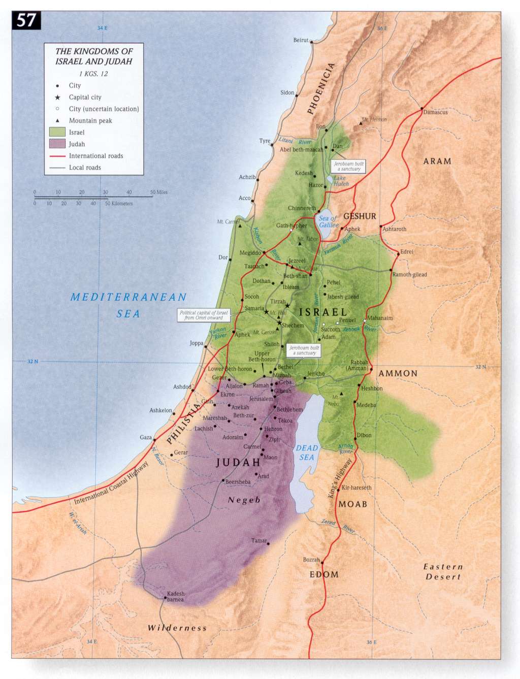
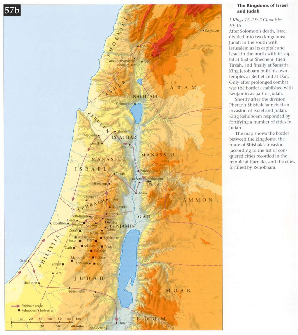
- The Kingdoms of Israel and Judah (1)
- The Kingdoms of Israel and Judah (2)
- The Kingdoms of Israel and Judah (3)
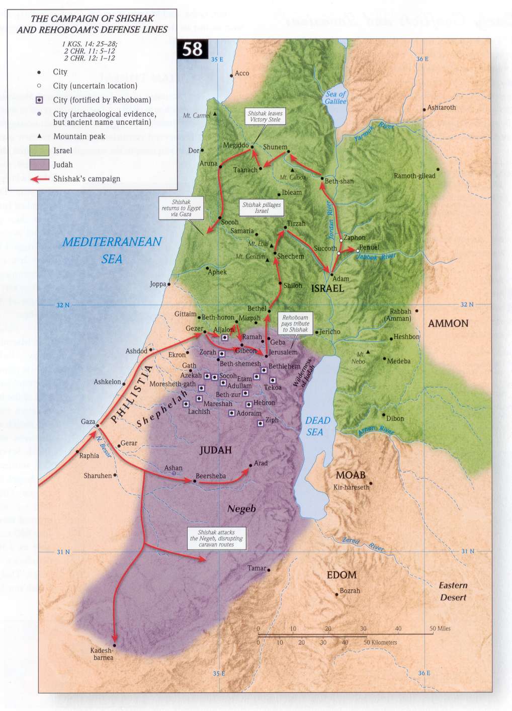
- 1Ki 14:25-28; 2Chr 11:5-12, 12:1-12 The Campaign of Shishak
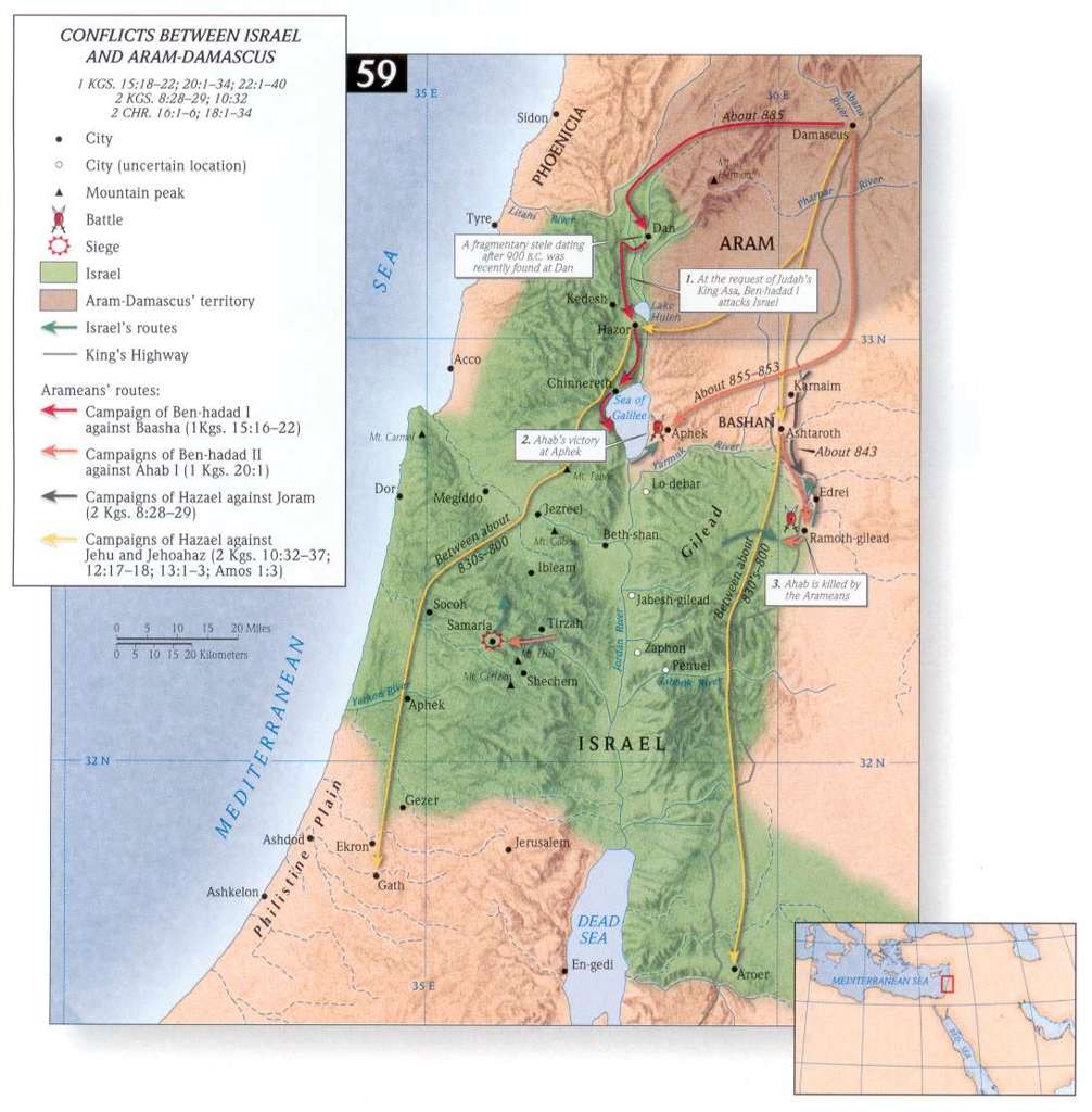
- 1Ki 15:18-22, 20:1-34; 22:1-40, 2Ki 8:28-29, 10:33. 2Chr 16:1-6, 18:1-34 Conflicts between Israel and Aram-Damascus
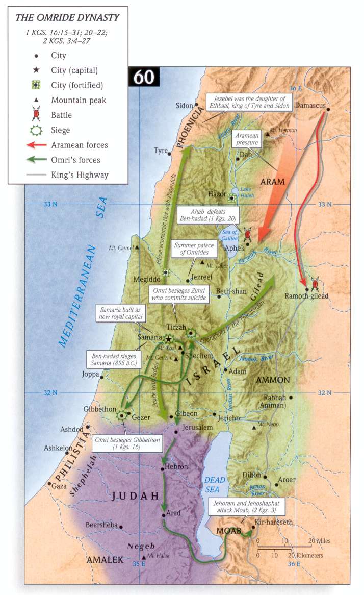
- 1 Kings 16:15-31; 20:1-22:1, 2Ki 3:4-27 The Omride Dynasty
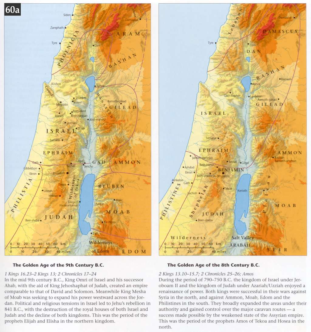
- The Golden Ages of the 9th & 8th centuries BCE
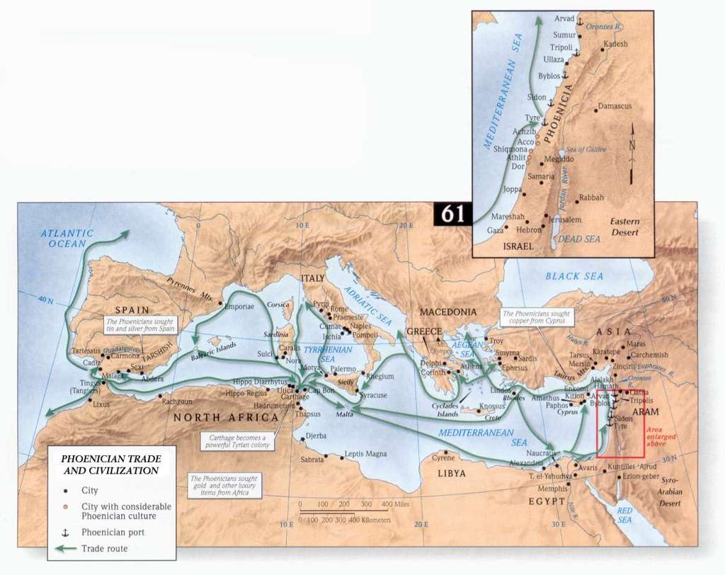
- Phoenician Trade and Civilization
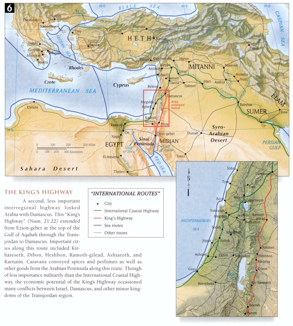
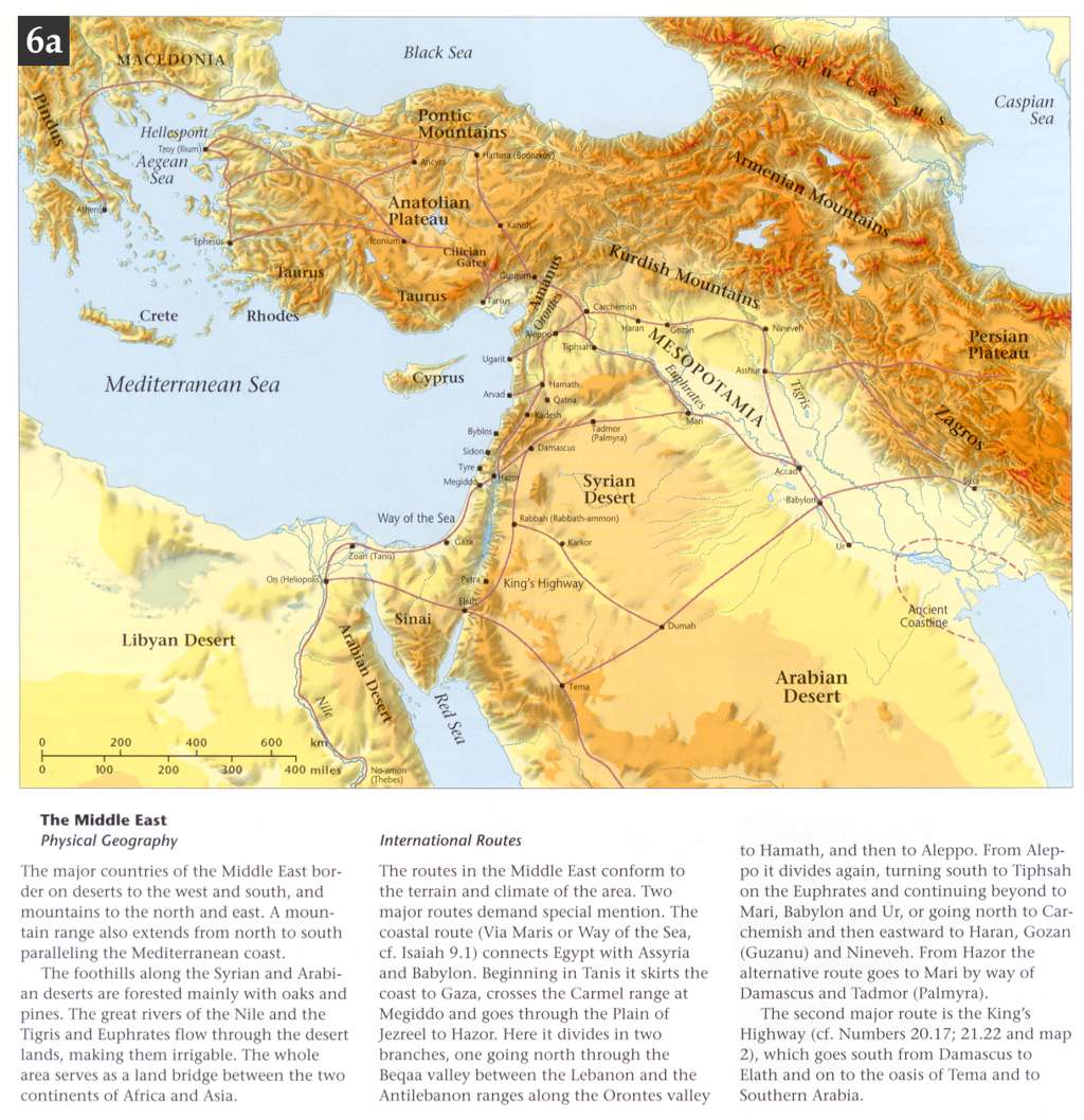
- Trade Routes throughout the Middle East
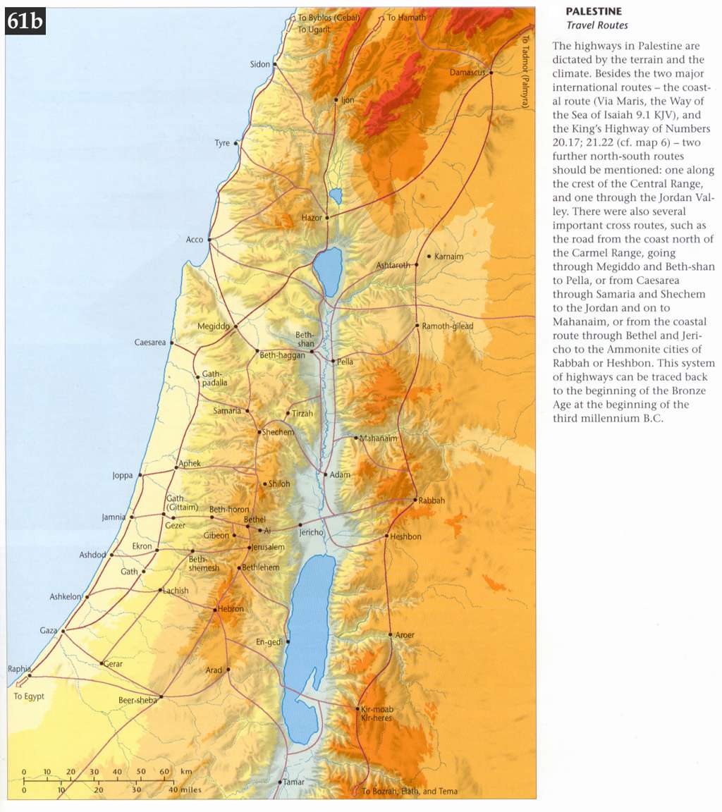
- Travel Routes throughout Palestine
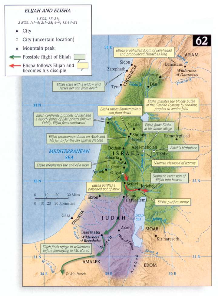
- Elijah and Elisha
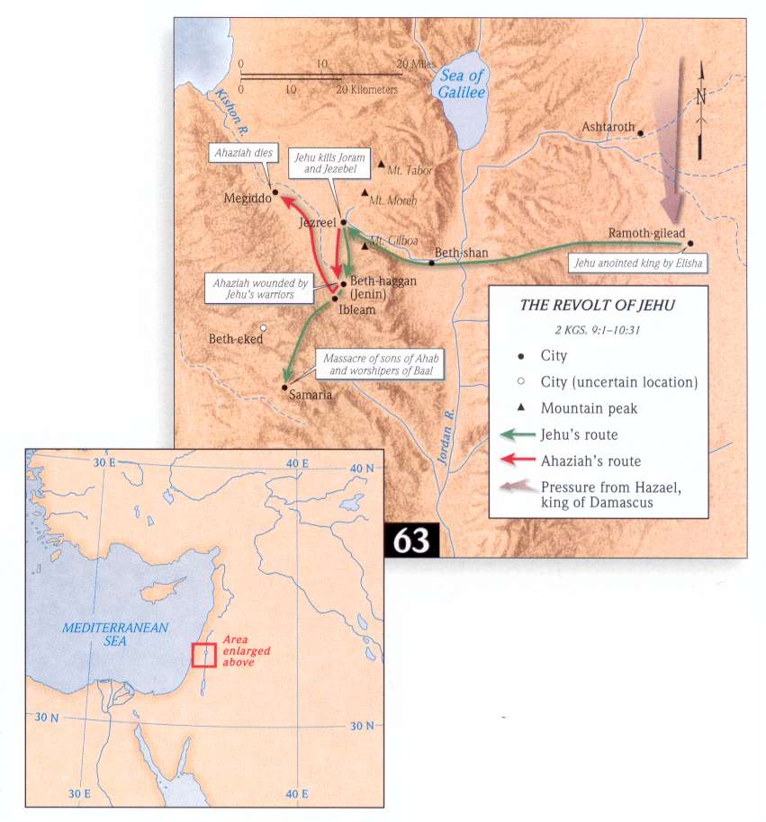
- The Revolt of Jehu
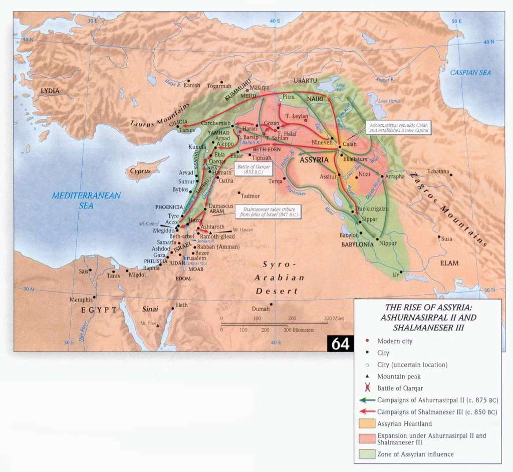
- The Rise of Assyria
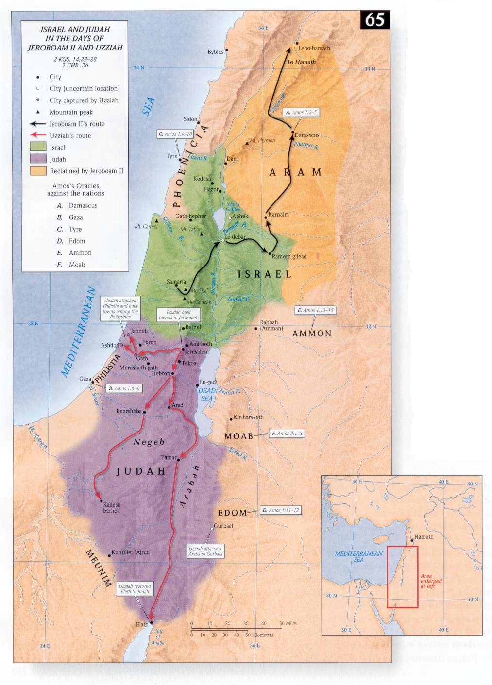
- Israel & Judah in the days of Jeroboam II and Uzziah
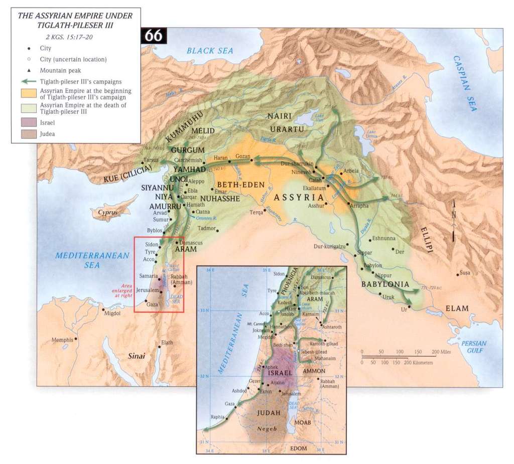
- The Assyrian Empire under Tiglath-Pileser III
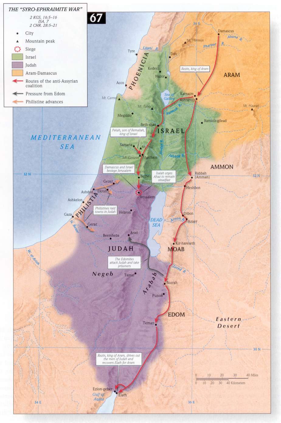
- The Syro-Ephraimite War
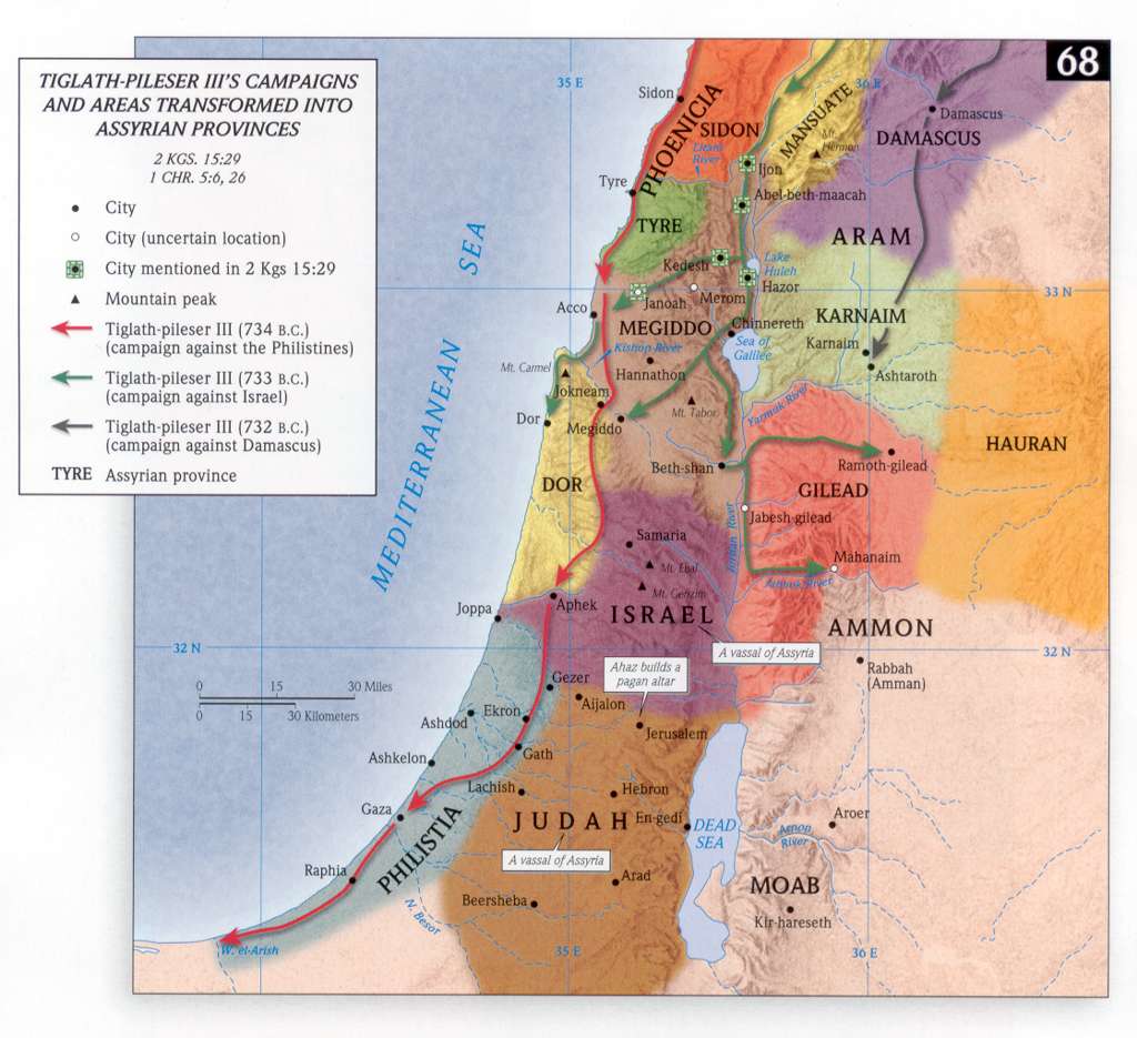
- Tiglath-Pileser III's Campaigns
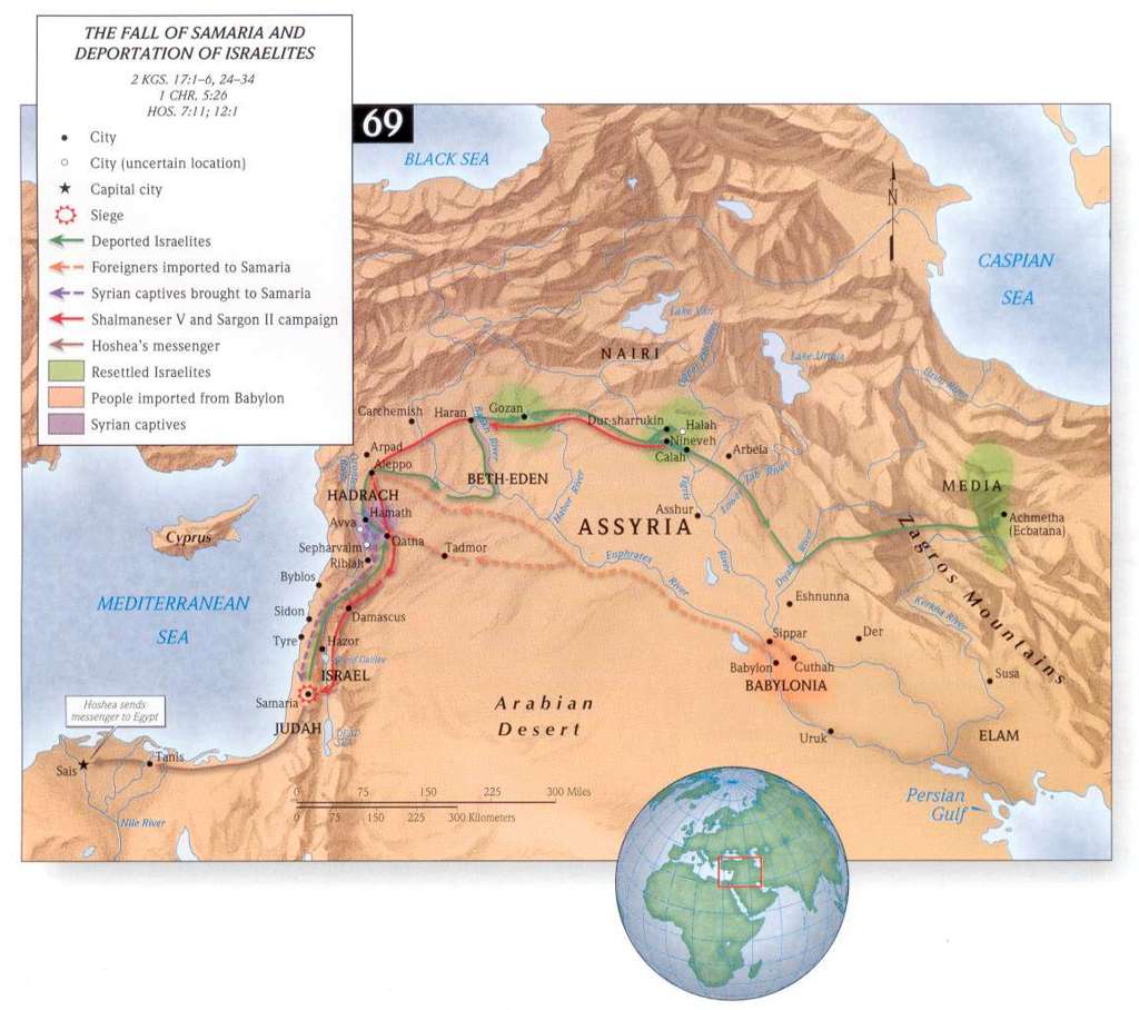
- Fall of Samaria and Deportation of Israelites
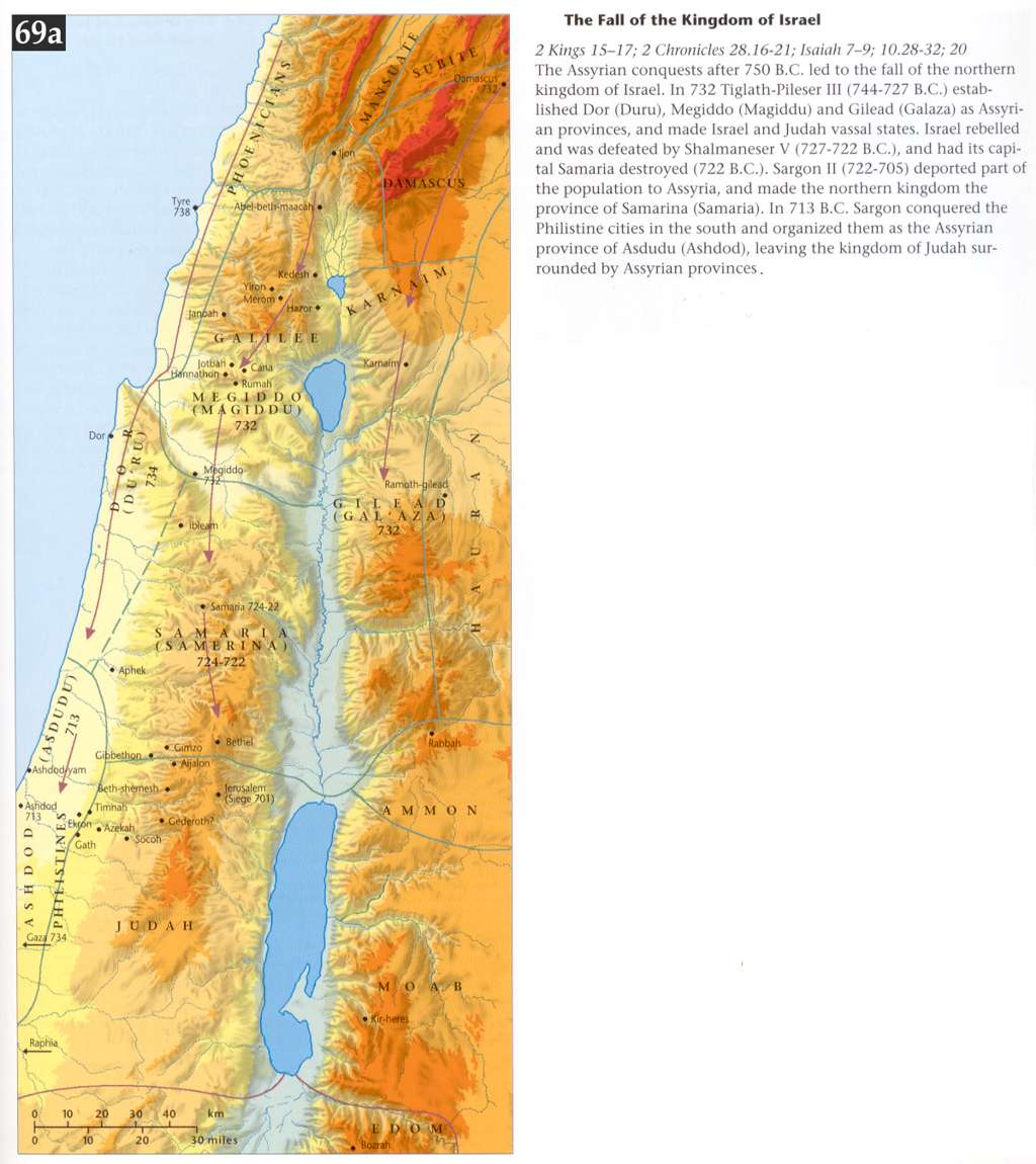
- The Fall of the Kingdom of Israel
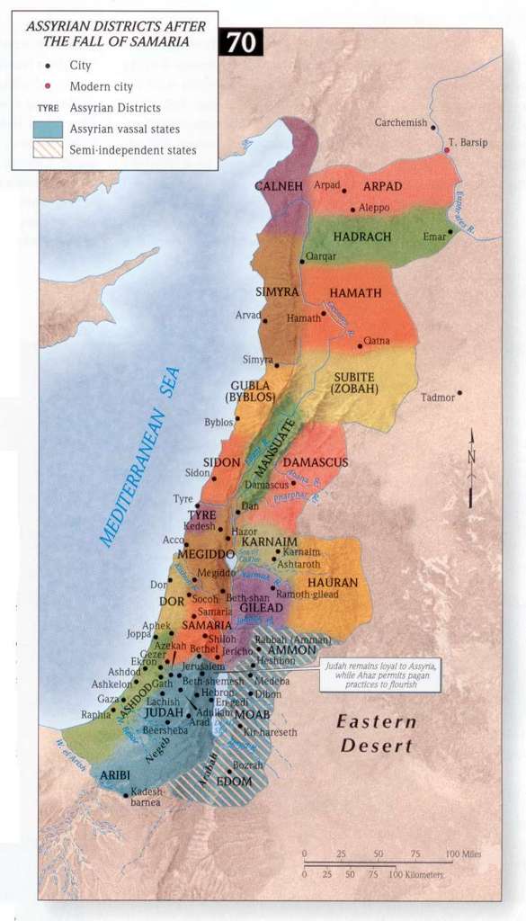
- Assyrian Districts after the Fall of Samaria
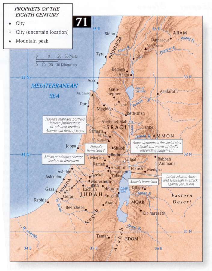
- Prophets of the 8th Century BCE
Judah Alone amid International Powers
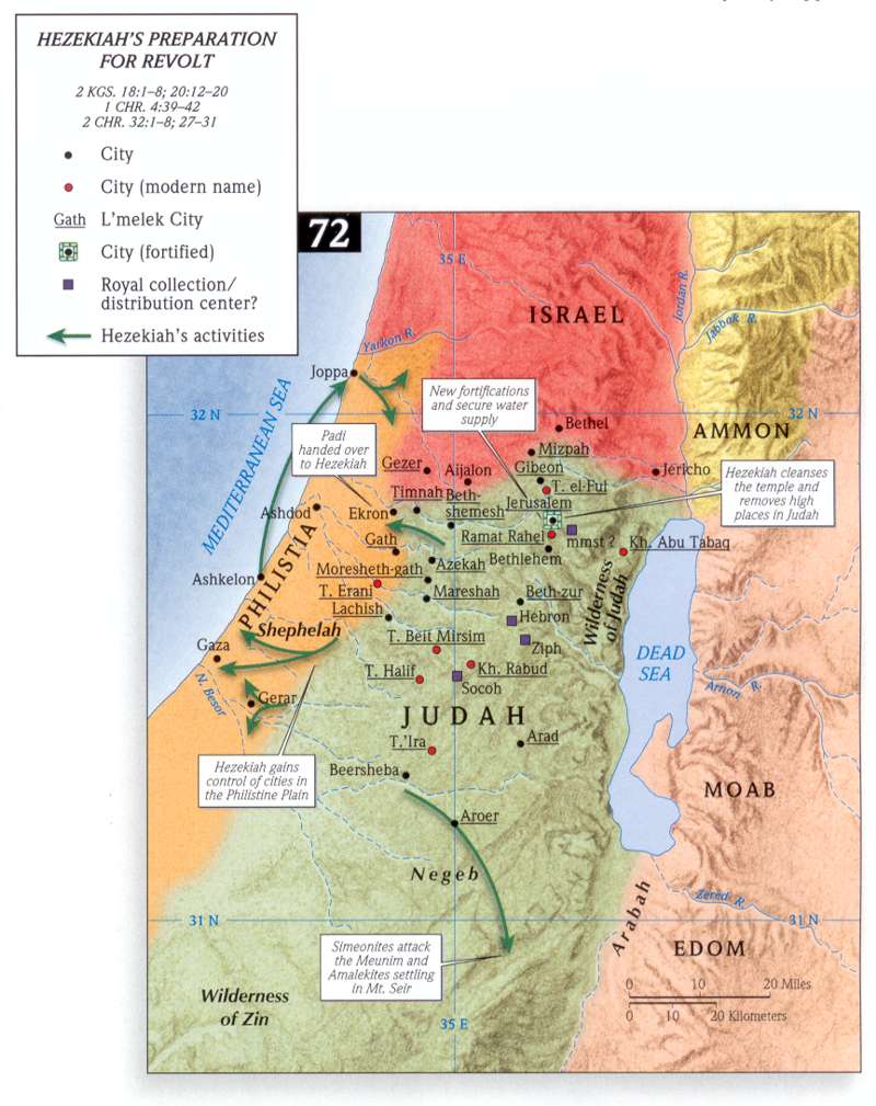
- Hezekiah's Preparation for Revolt
- Judah under King Hezekiah
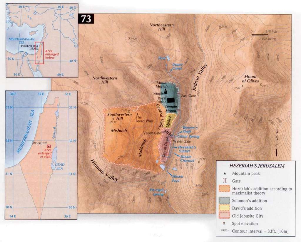
- Hezekiah's Jerusalem
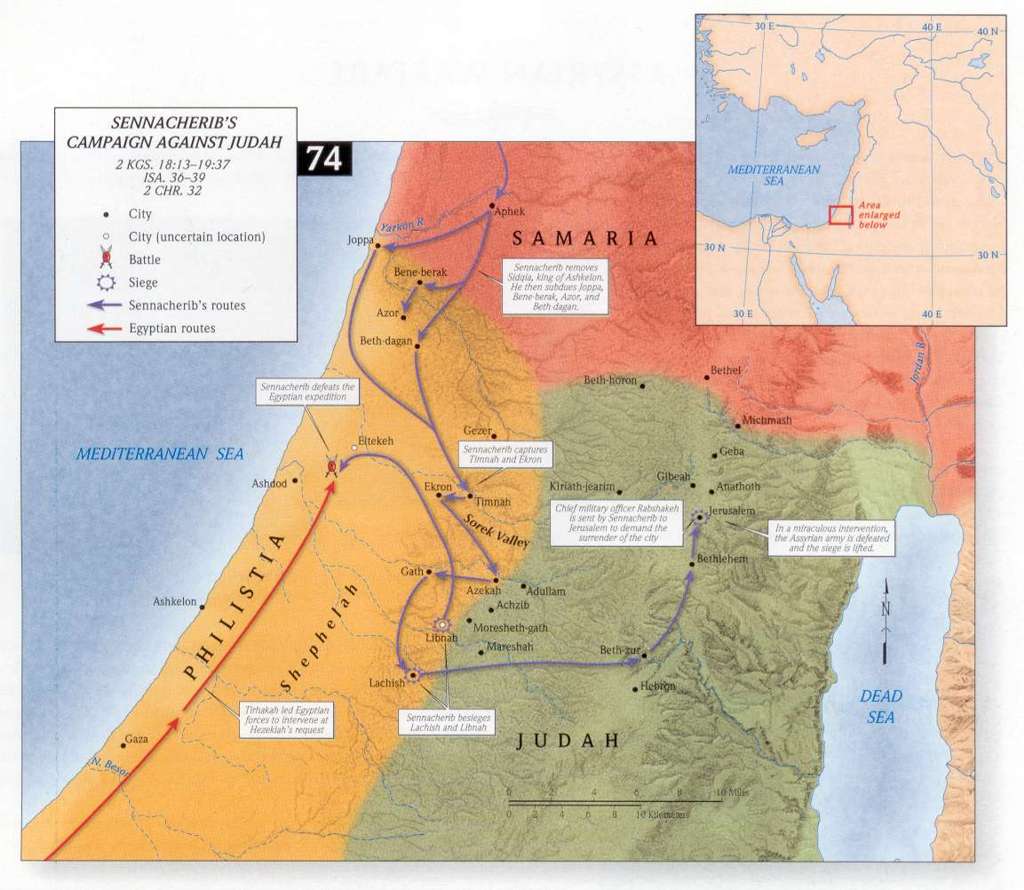
- Sennacherib's Campaign against Judah
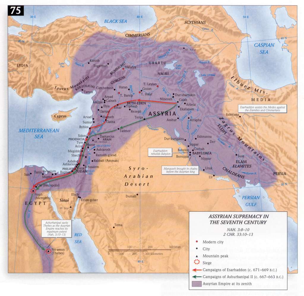
- Assyria in the 7th century BCE
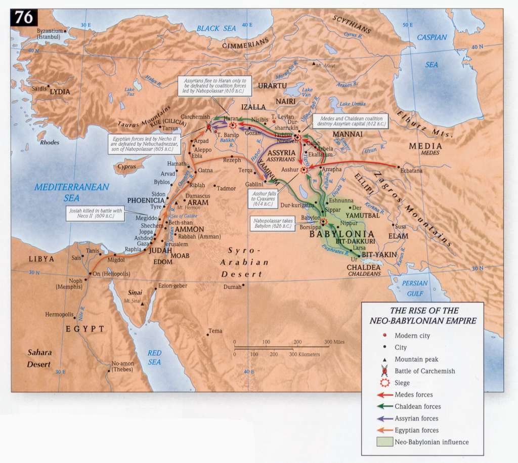
- The Rise of the Neo-Babylonian Empire
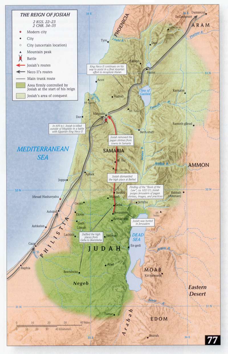
- The Reign of Josiah
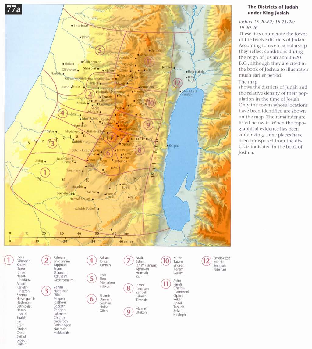
- The Districts of Judah under King Josiah
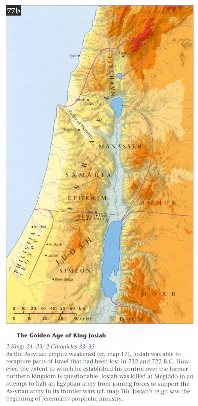
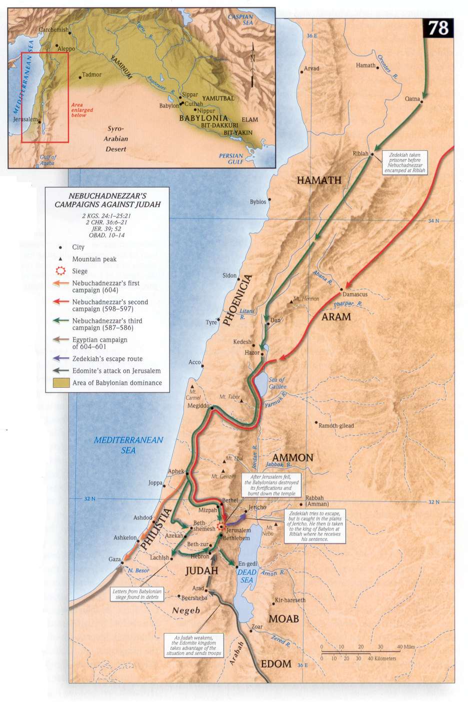
- The Golden Age of King Josiah; Nebuchadnezzar's Campaigns against Judah
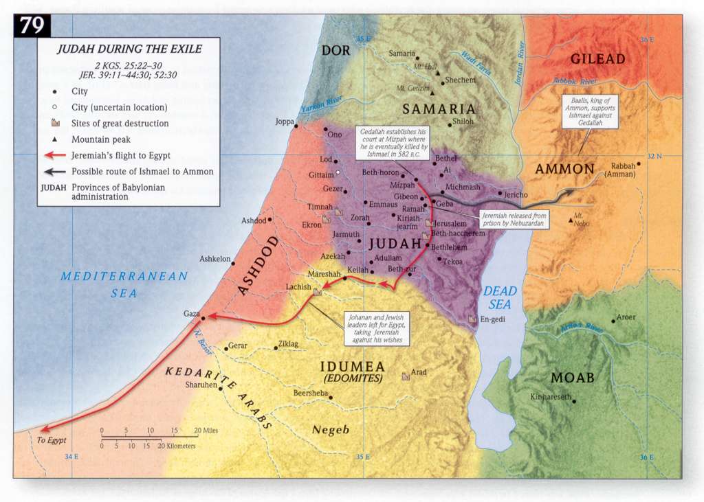
The Babylonian Exile
- Judah during the Exile
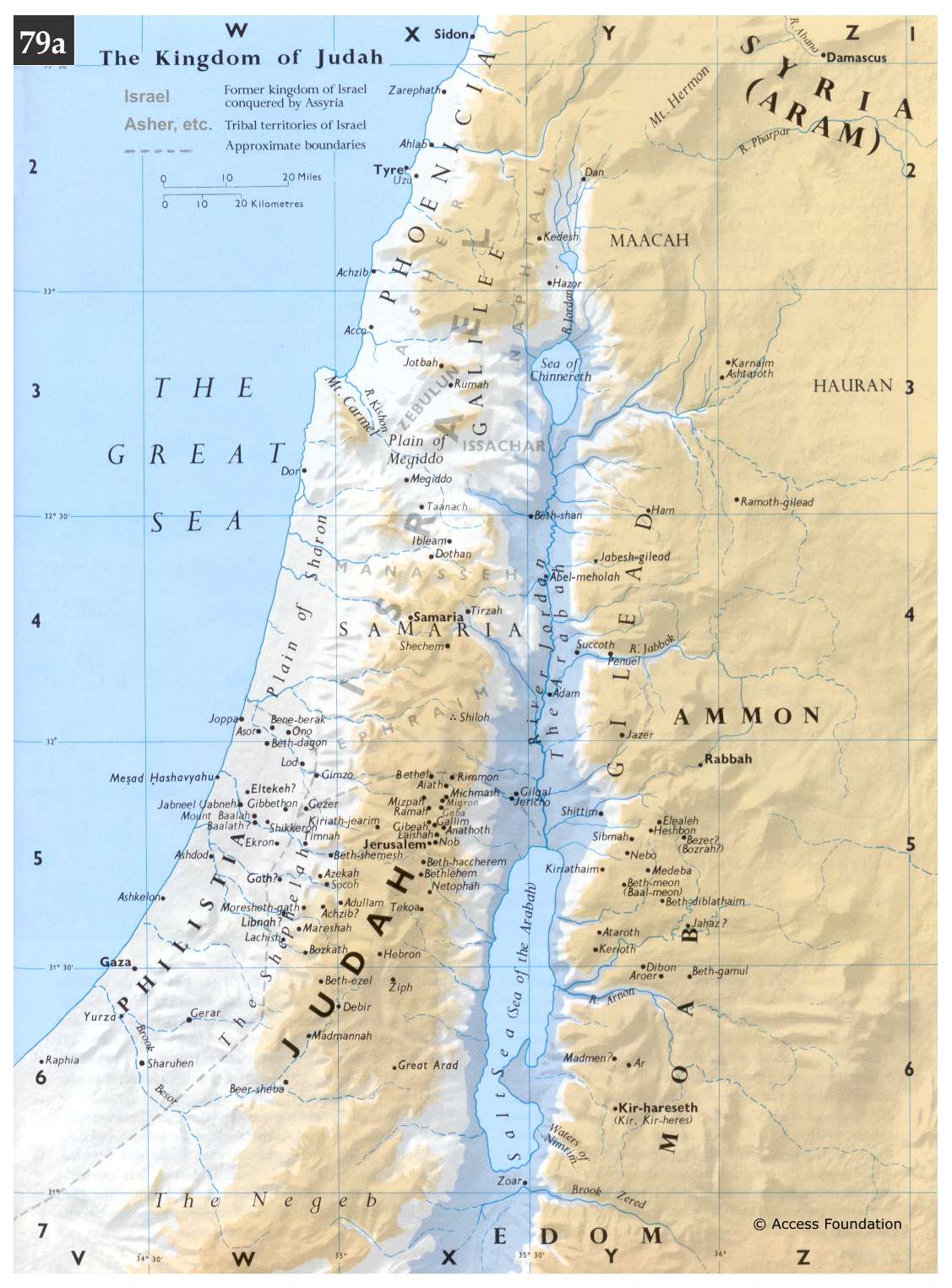
- The Kingdom of Judah
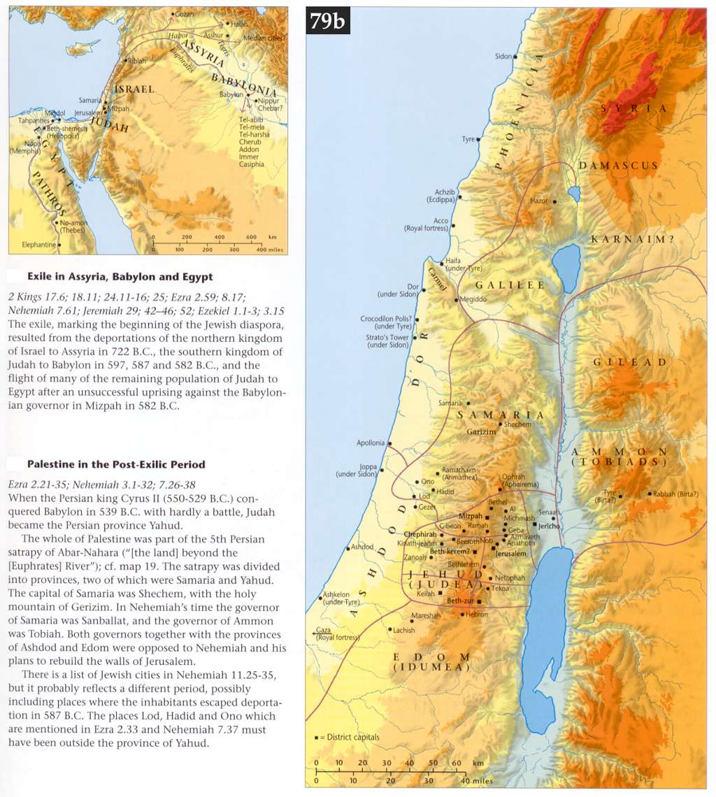
- Exile; Palestine in the Post-Exilic Period
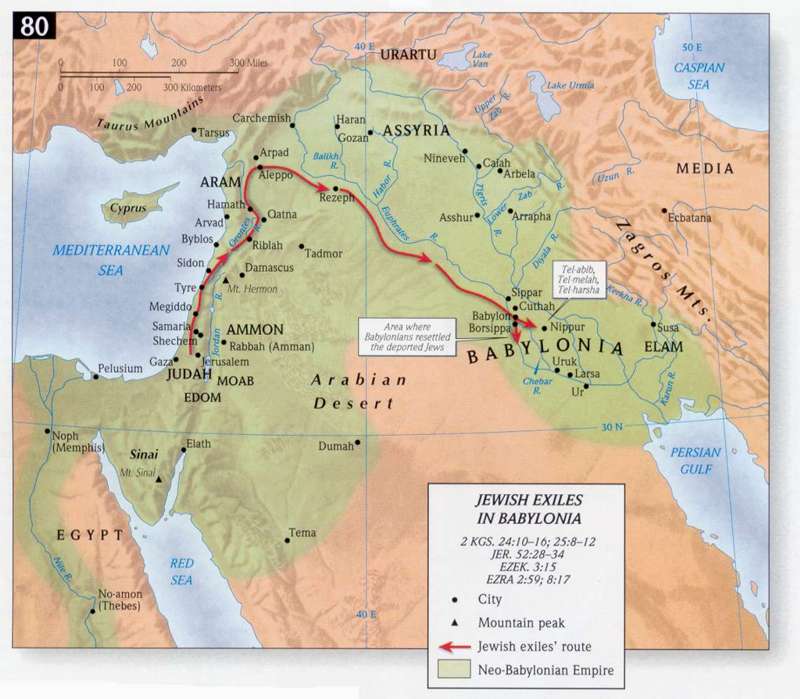
- Jewish Exiles in Babylon
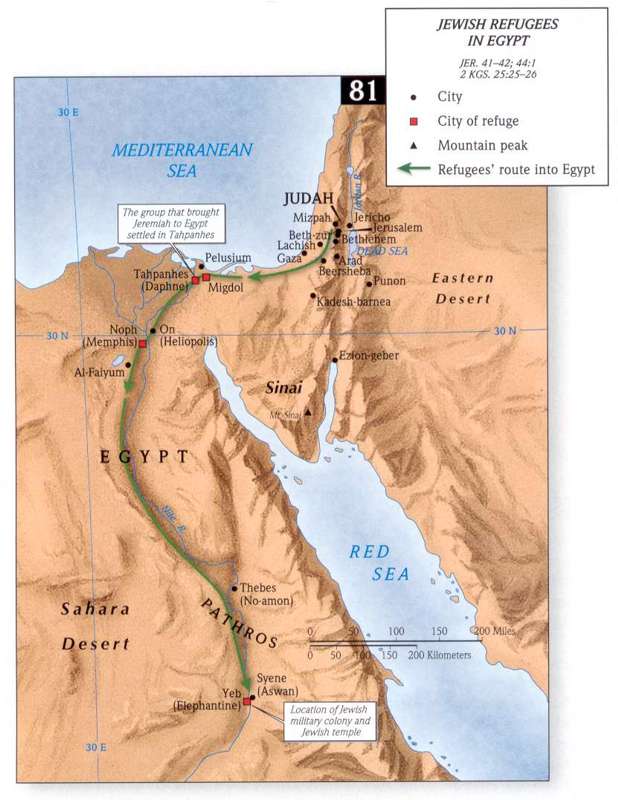
- Jewish Refugees in Egypt
The Persian Period
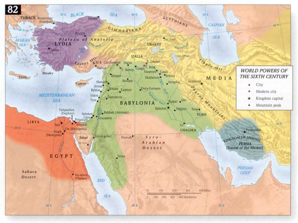
- World Powers of the 6th century BCE
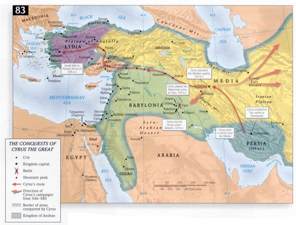
- The Conquests of Cyrus the Great
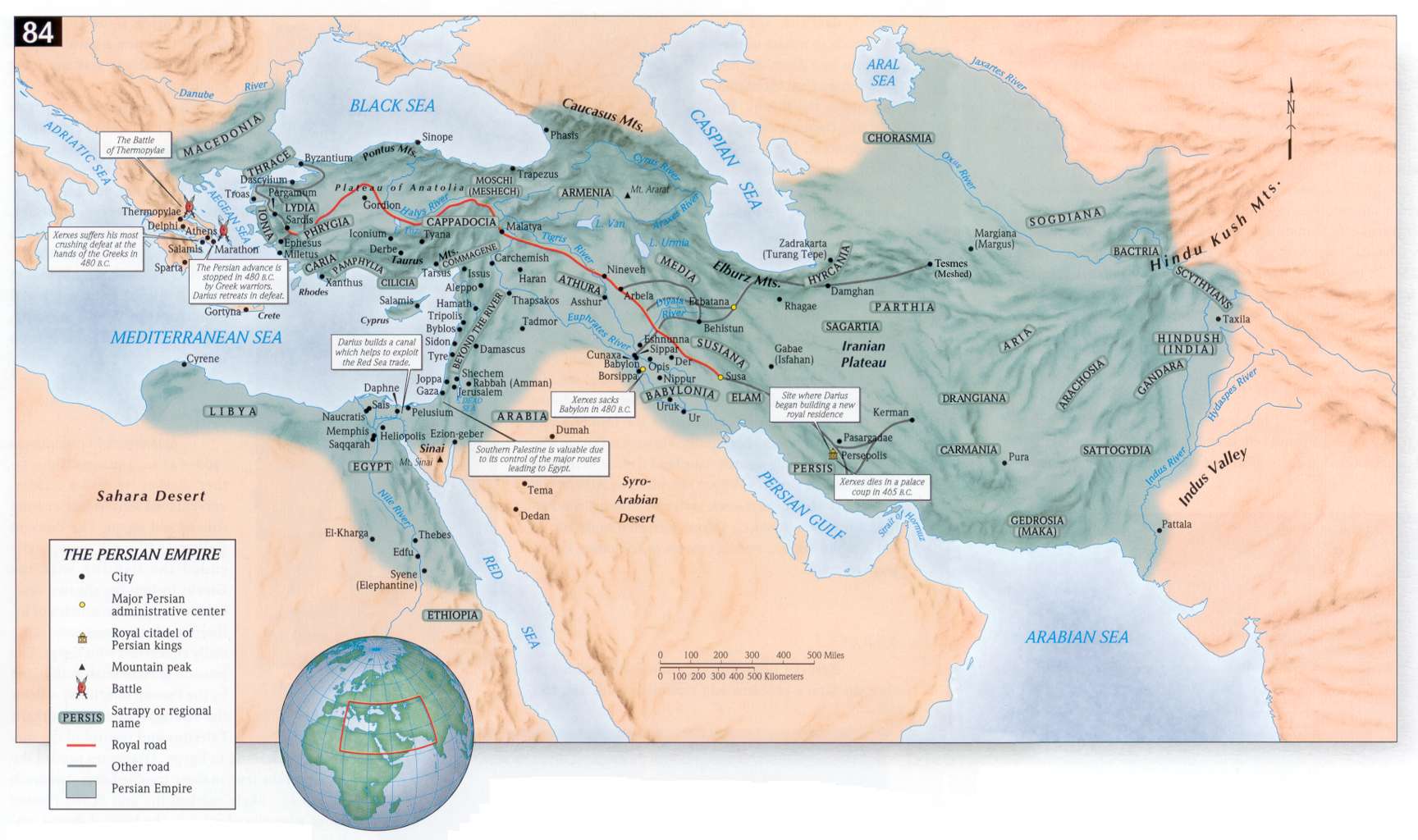
- The Persian Empire
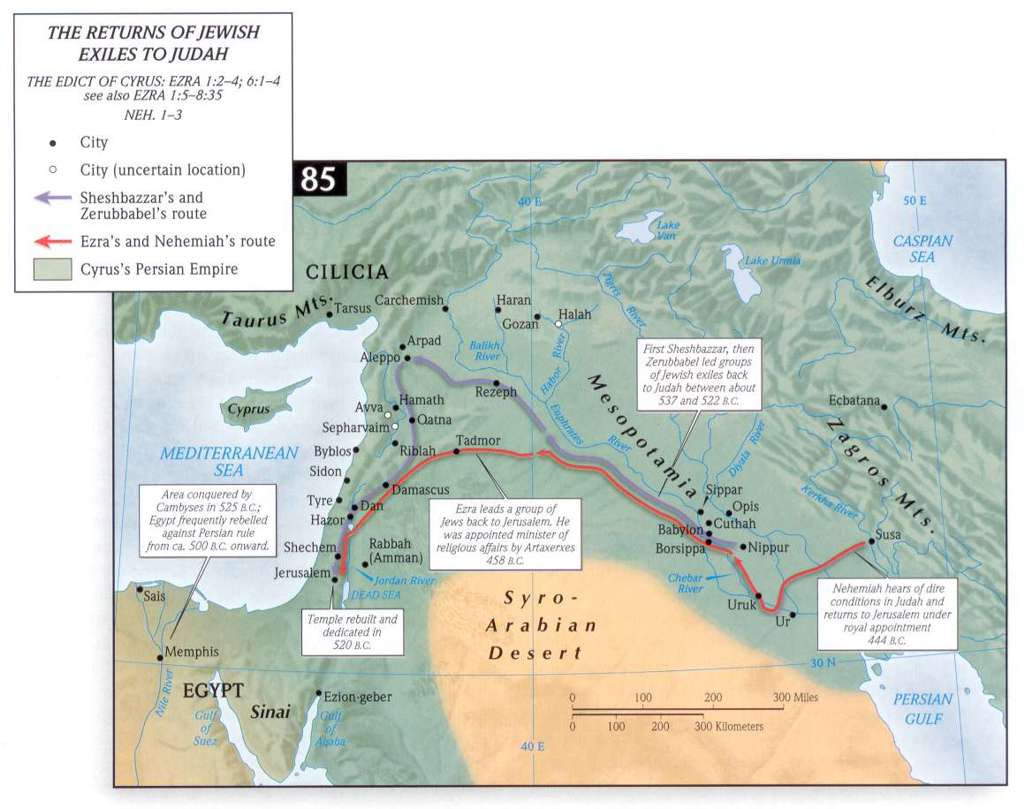
- The Return of the Jewish Exiles to Judah
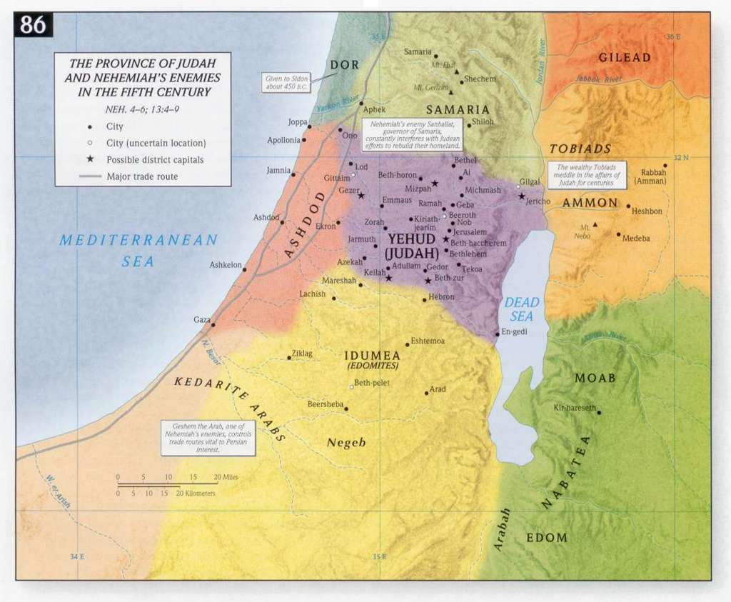
- Judah in the 5th century BCE
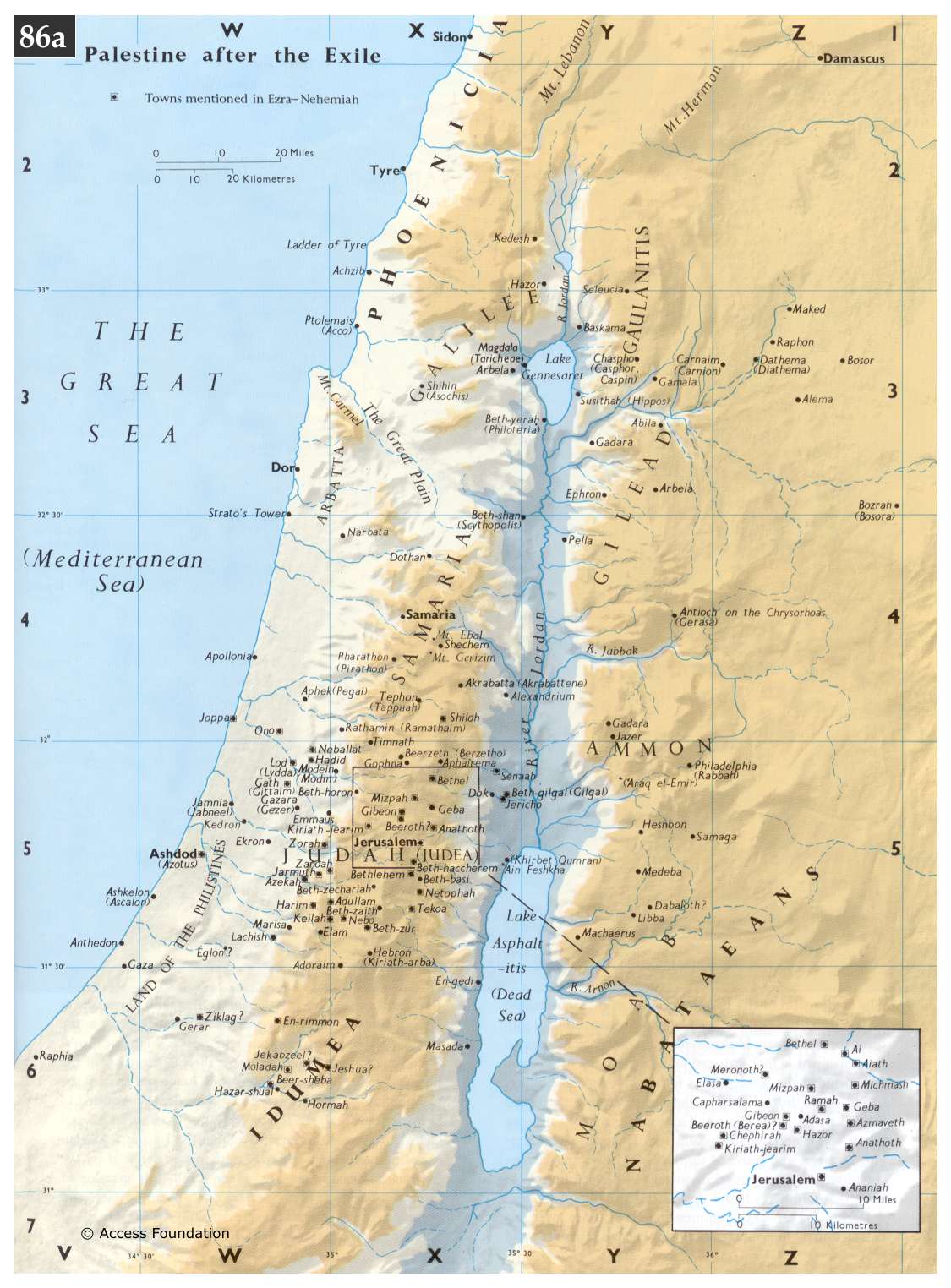
- Palestine after the Exile
The Hellenistic Period
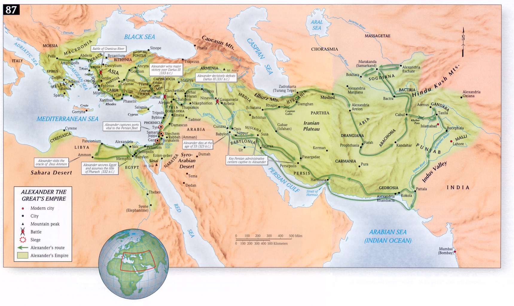
- Alexander the Great's Empire
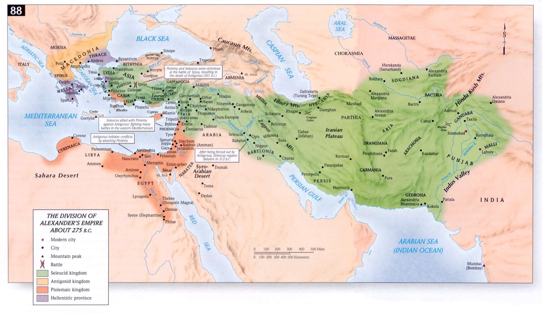
- The Division of Alexander's Empire ca. 275 BCE
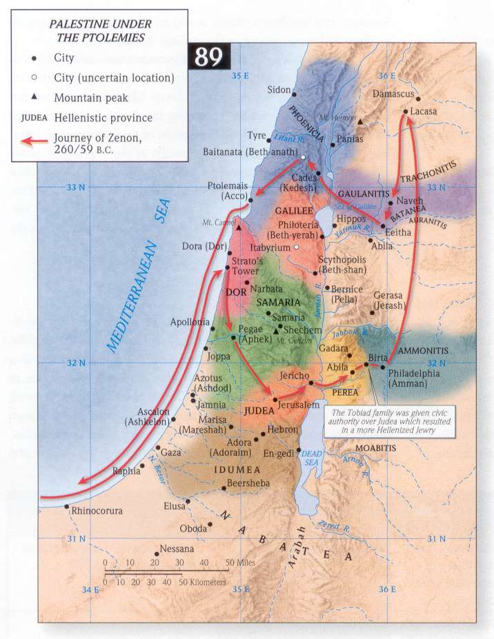
- Palestine under the Ptolemies
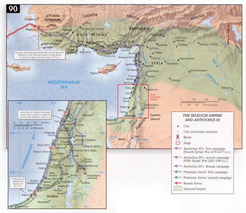
- The Seleucid Empire and Antiochus III
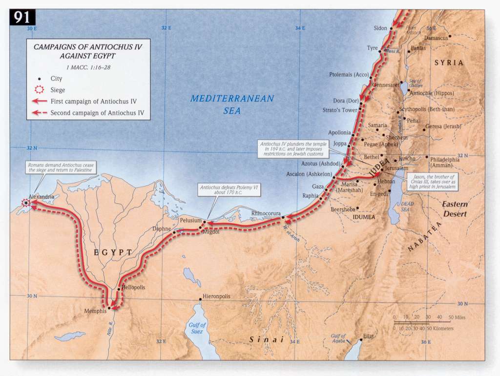
- Campaigns of Antiochus IV against Egypt
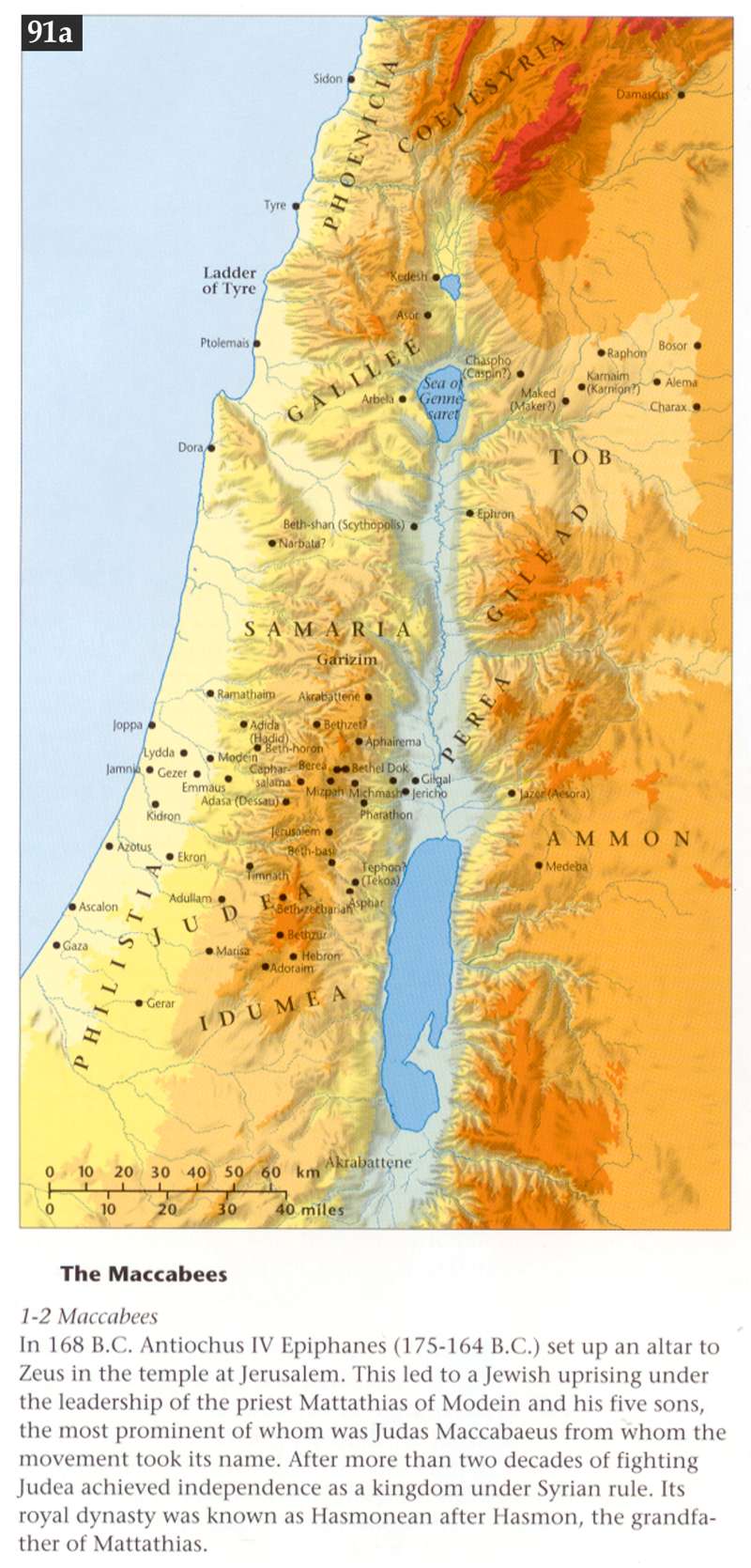
- The Maccabees in 168 BCE
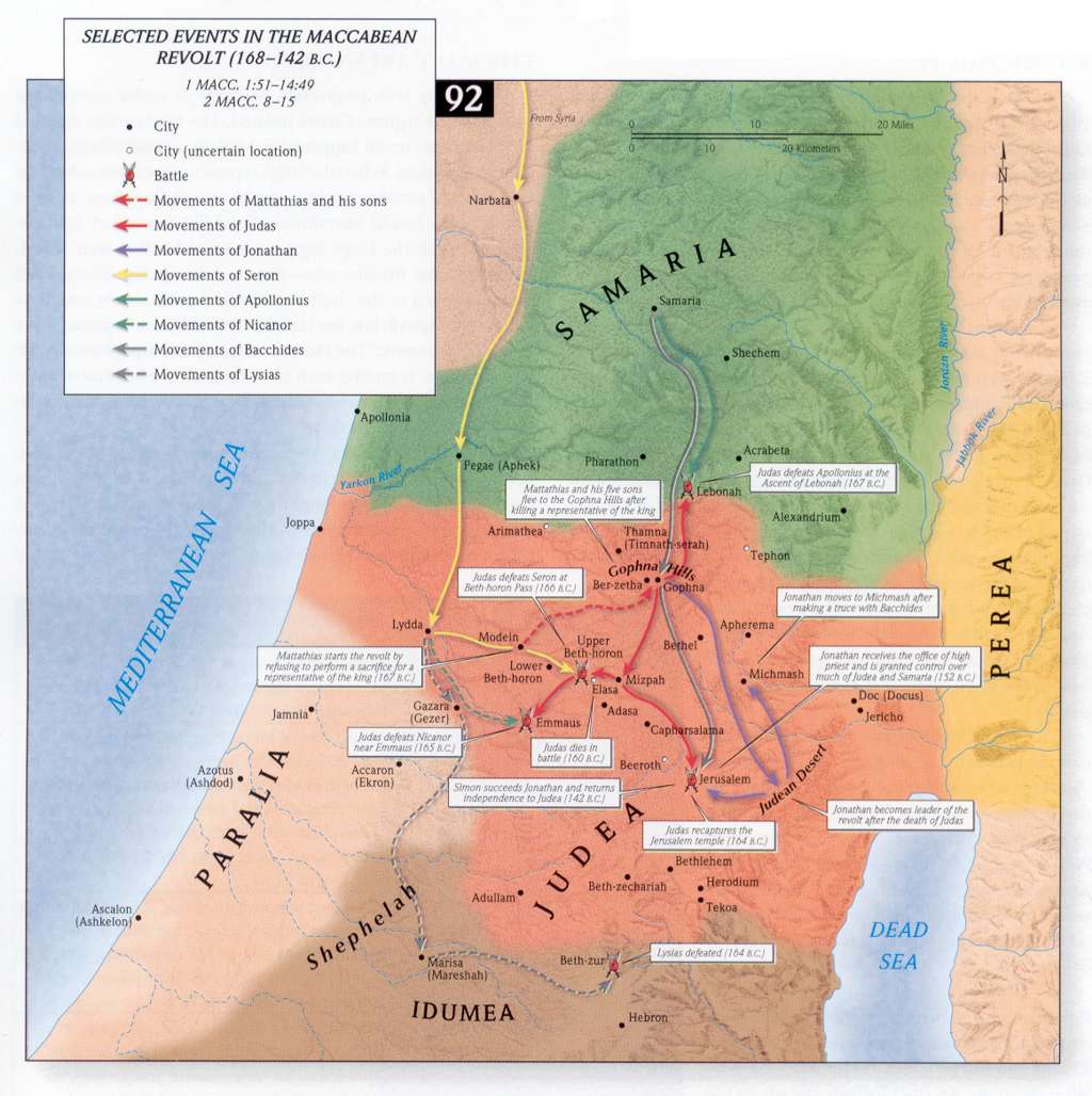
- Selected Events in the Maccabean Revolt
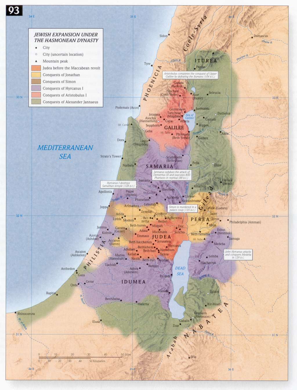
- Jewish Expansion under the Hasmonean Dynasty
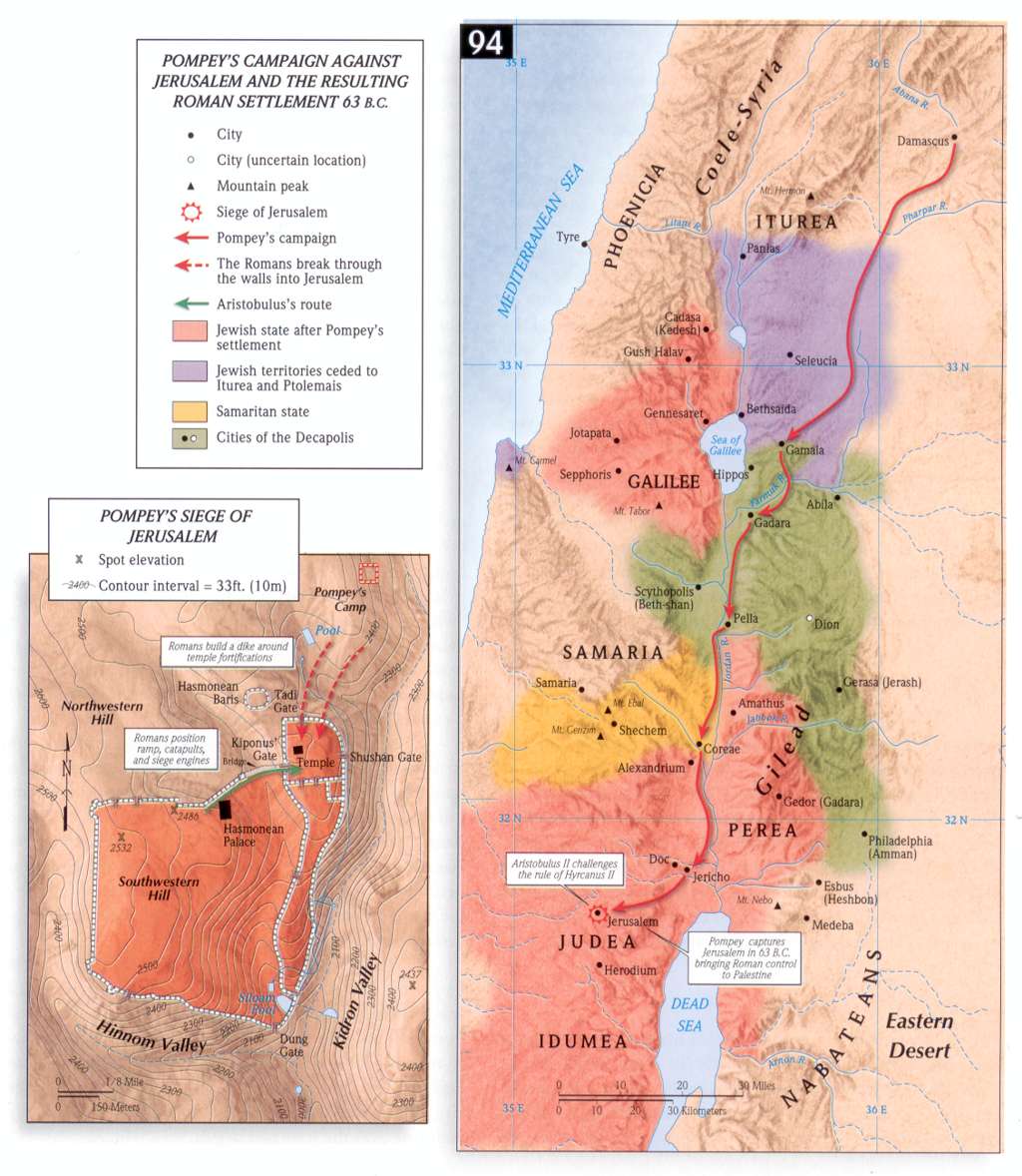
- Pompey's Campaign against Jerusalem
OTHER RELATED MAPS
- The Kingdom of Judah
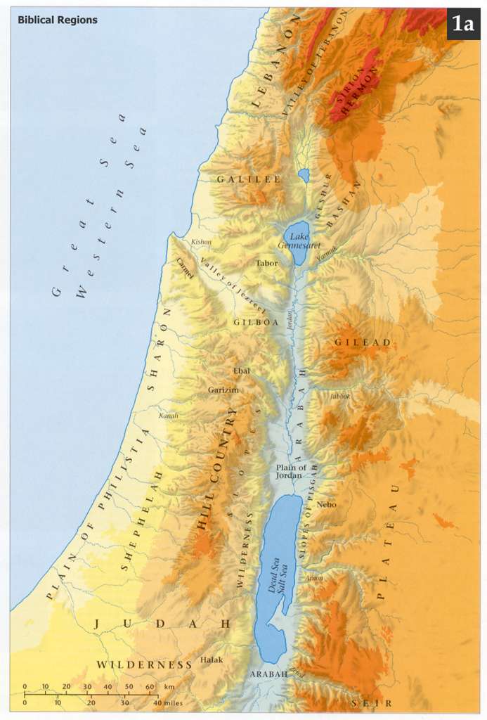
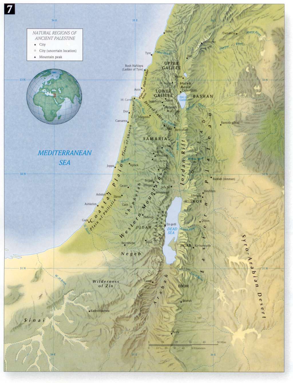
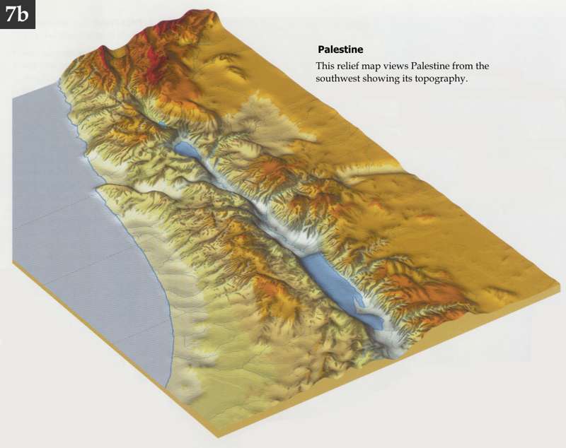
- Geographic Regions of Palestine
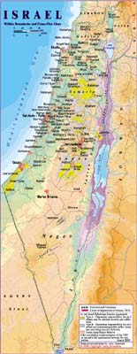
- The Holy Land in the Modern Day
- Maps - good quality maps
- Maps - high quality maps
- Map of Israel - Virtual mapl
- Acts
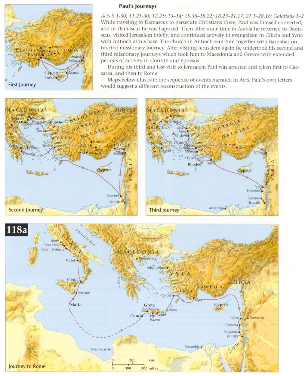
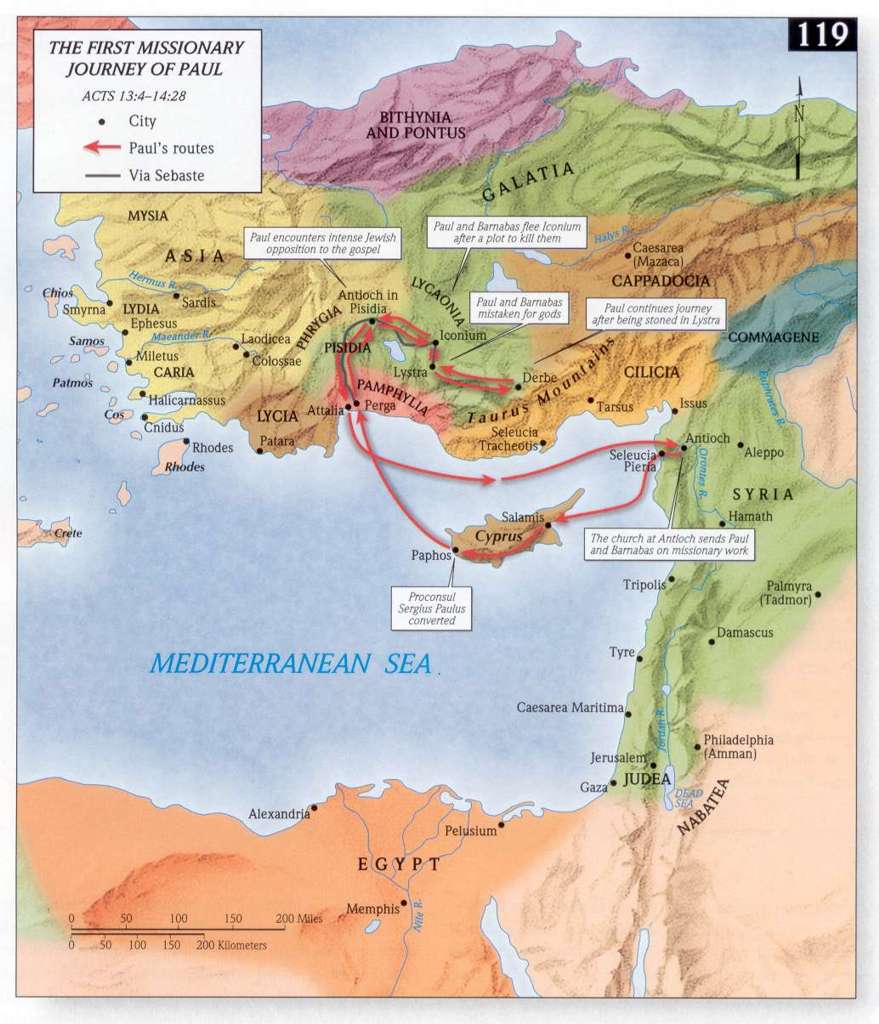
- Paul's First Missionary Journey
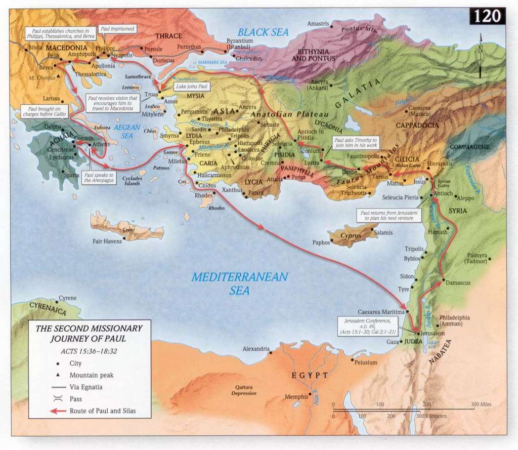
- Paul's Second Missionary Journey
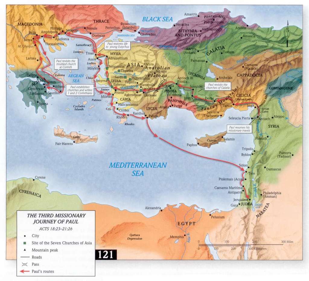
- Paul's Third Missionary Journey
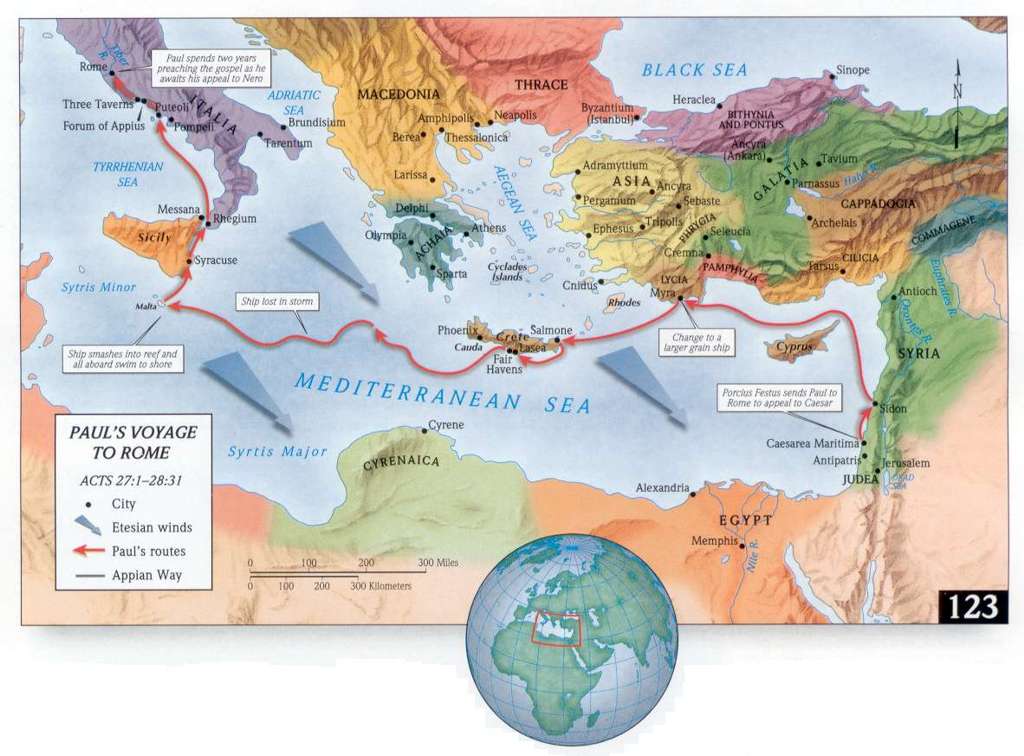
- Paul's Journey to Rome
- Romans
- 1 Corinthians
- 2 Corinthians
- Galatians
- Ephesians
- Colossians
- 1 & 2 Thessalonians
- 1 Timothy
- 2 Timothy
- Titus
- Philemon
- 1 Peter
- Revelation
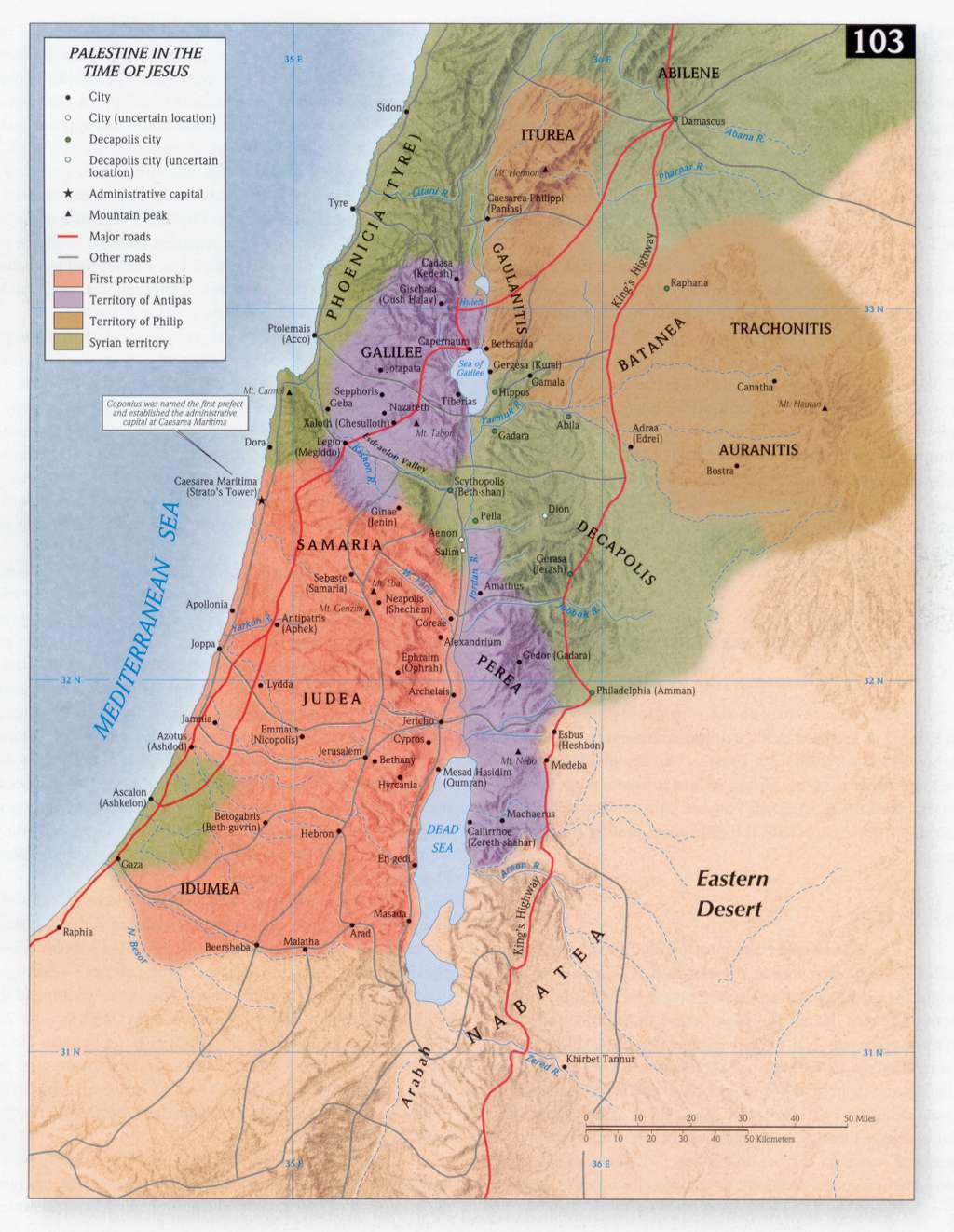
- Israel During the Time of Jesus
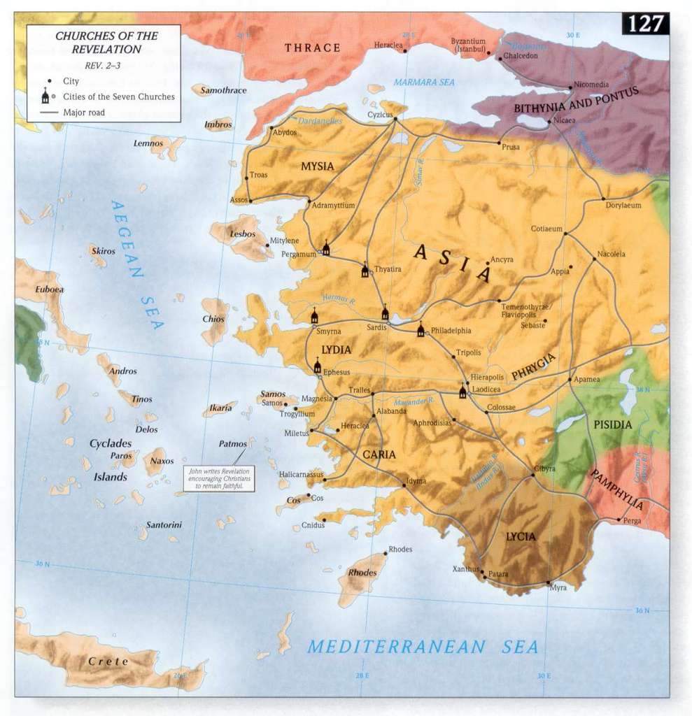
- The Seven Churches of Revelation
MAPS FROM ESV STUDY BIBLE
- Near East at the Time of Genesis
- Garden of Eden
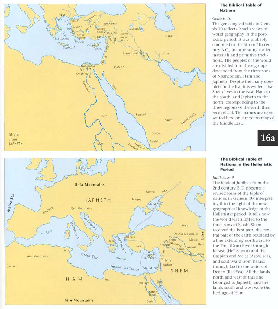
- Table of Nations
- Abram Travels to Canaan
- Jacob Returns to Canaan
- Egypt at the Time of Joseph
- Journey to Mount Sinai
- Setting of Leviticus
- Journeys in the Wilderness
- Journey to Canaan
- Boundaries of the Promised Land
- Setting of Deuteronomy
- Setting of Joshua
- Conquest of Canaan: Southern Campaign
- Conquest of Canaan: Northern Campaign
- Allotment of the Land
- Setting of Judges
- Judges of Israel
- Gideon Defeats Midianites
- Samson’s Exploits
- Setting of Ruth
- Setting of 1 Samuel
- Setting of 2 Samuel
- Battle at Elah
- David Flees from Saul
- Battle at Mount Gilboa
- David Captures Stronghold of Zion
- David and Absalom
- Extent of Solomon’s Kingdom
- Israel and Judah in 2 Kings
- Solomon’s Administrative Districts
- The Kingdom Divides
- Syria Captures Gilead
- Resurgence during Azariah, Jeroboam II
- Prophets of Israel and Judah
- Resurgence of Assyrian Influence
- Fall of Samaria, Deportation of Israelites
- Exile to Babylon
- Extent of David’s Kingdom
- Solomon’s International Ventures
- Syria and Israel Attack Judah
- Judah after the Fall of Israel
- Persian Empire at the Time of Ezra
- Persian Empire at the Time of Nehemiah
- Judea under Persian Rule
- Persian Empire at the Time of Esther
- Near East at the Time of Isaiah
- Israel and Judah at the Time of Jeremiah
- Babylonian Empire
- Babylon Attacks Judah
- Jeremiah Prophesies against Egypt
- Near East at the Time of Ezekiel
- Ezekiel’s Vision of Israel’s New Boundaries
- Setting of Daniel: Babylonian Empire
- Empires of Daniel’s Visions: Persians
- Empires of Daniel’s Visions: Greeks
- Empires of Daniel’s Visions: Ptolemies and Seleucids (Early)
- Empires of Daniel’s Visions: Ptolemies and Seleucids (Late)
- Maccabean Kingdom
- Near East at the Time of Hosea
- Setting of Joel
- Near East at the Time of Amos
- Setting of Obadiah
- Setting of Jonah
- Near East at the Time of Micah
- Near East at the Time of Nahum
- Near East at the Time of Habakkuk
- Near East at the Time of Zephaniah
- Jerusalem at the Time of Haggai
- Near East at the Time of Zechariah
- Setting of Malachi
- Setting of Matthew
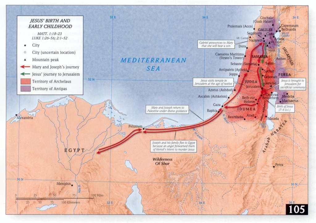
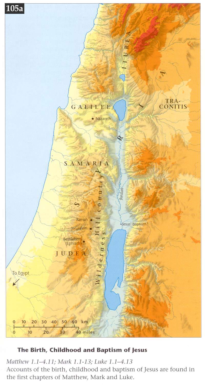
- Jesus’ Birth and Flight to Egypt
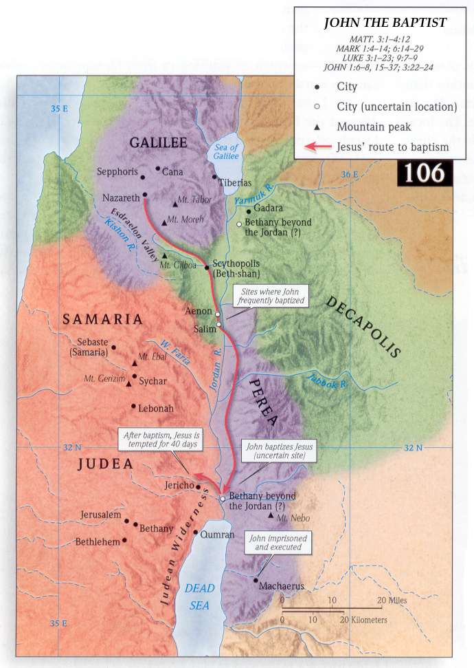
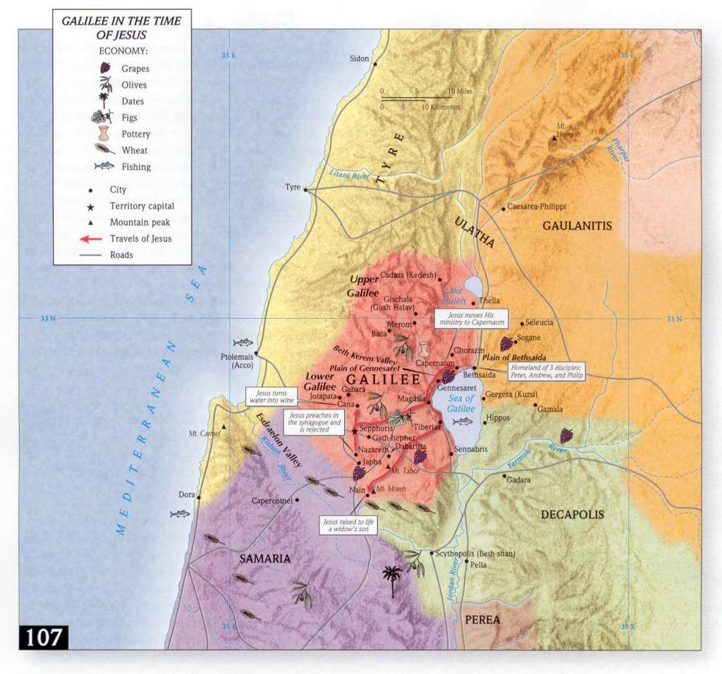
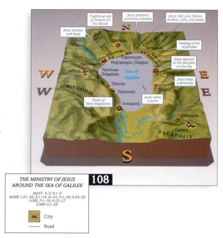
- Jesus’ Ministry in Galilee
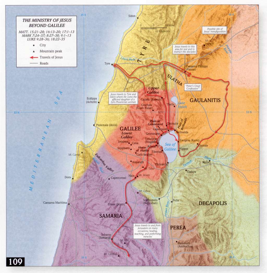
- Jesus’ Ministry beyond Israel
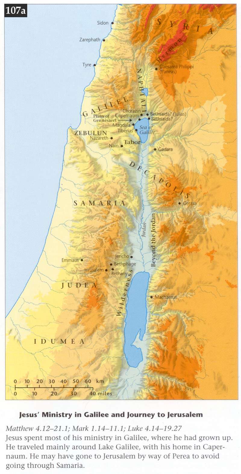
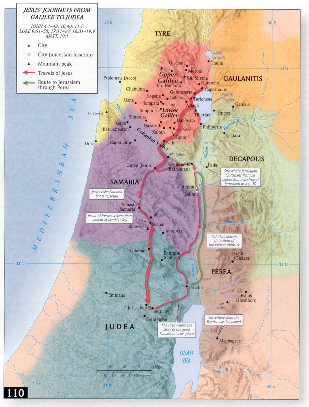
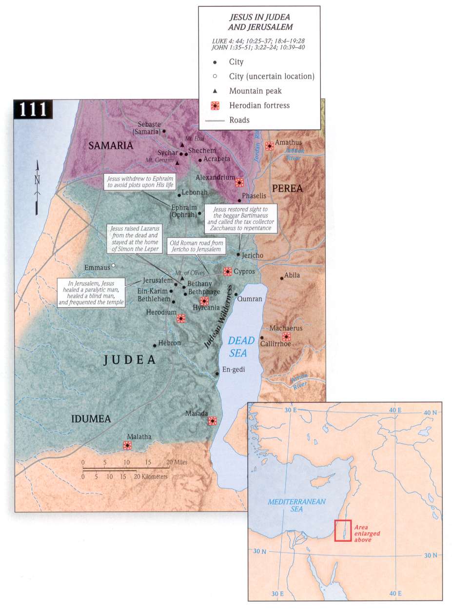
- Jesus’ Final Journey to Jerusalem
- Last Supper
- Jesus’ Arrest, Trial, and Crucifixion
- Setting of Mark
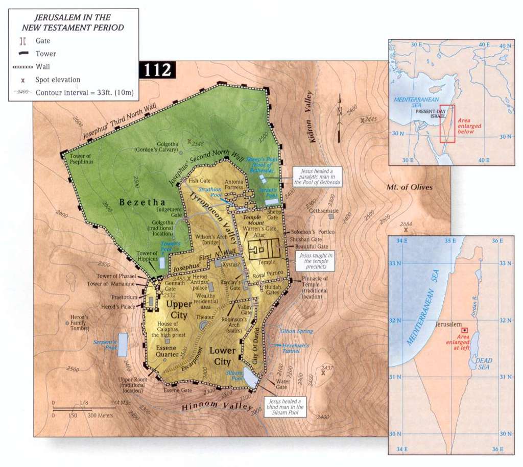
- Jerusalem at the Time of Jesus
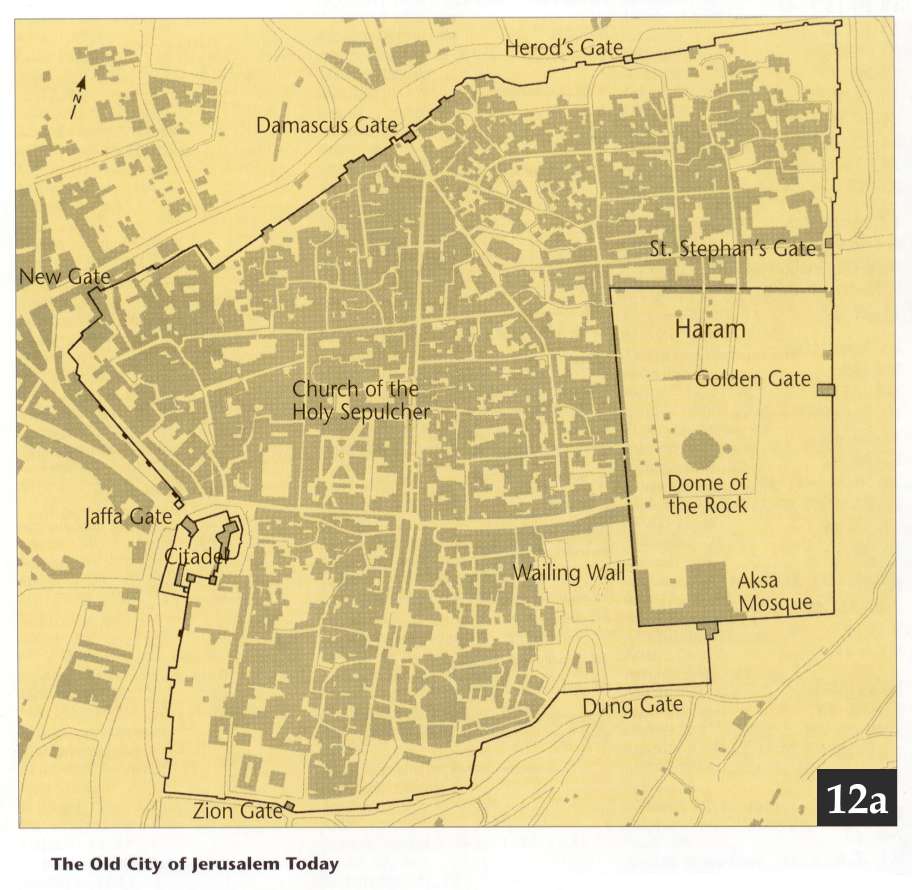
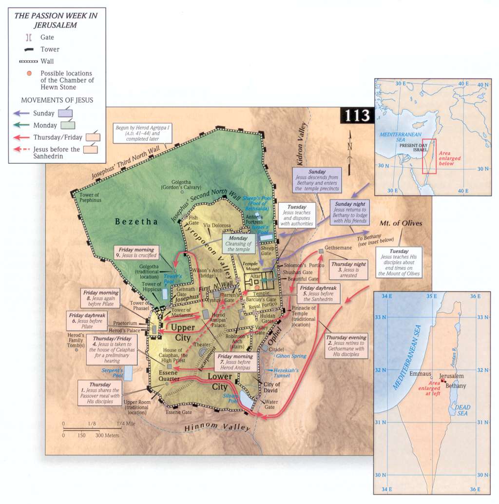
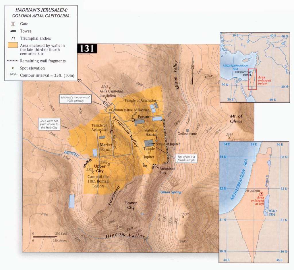
- Jerusalem in 33 AD - very detailed
- Setting of Luke
- Jesus Travels to Jerusalem
- Jesus’ Appearances after Resurrection
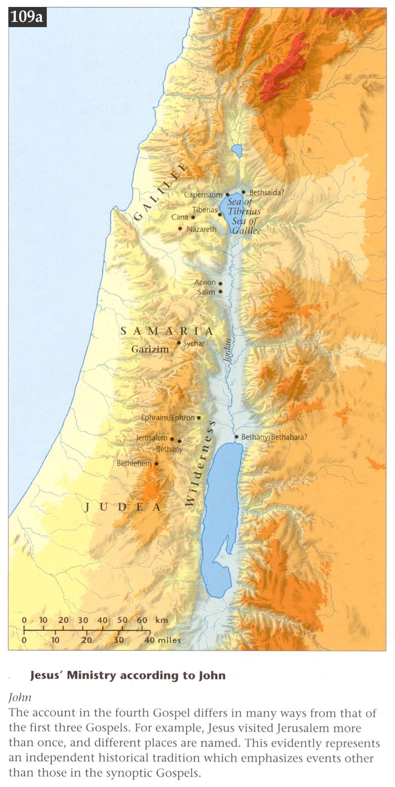
- Setting of John
- Setting of Acts
- Nations at Pentecost
- Paul’s First Missionary Journey
- Paul’s Second Missionary Journey
- Paul’s Third Missionary Journey
- Paul’s Journey to Rome
- Setting of Romans
- Setting of 1 Corinthians
- Setting of 2 Corinthians
- Setting of Galatians
- Setting of Ephesians
- Setting of Philippians
- Setting of Colossians
- Setting of 1 Thessalonians
- Setting of 1 Timothy
- Setting of 2 Timothy
- Setting of Titus
- Setting of James
- Setting of 1 Peter
- Setting of 1 John
- Setting of Revelation
ILLUSTRATIONS FROM ESV STUDY BIBLE - excellent
- The City of Ur
- The Table for the Bread of the Presence
- The High Priest’s Holy Garments
- The Altar of Incense
- The Golden Lampstand
- The Bronze Altar
- The Ark of the Covenant
- The Tabernacle Tent
- The Tabernacle and Court
- Tabernacle, Court Architectural Plan
- The City of Jericho
- Jerusalem in the Time of David
- Jerusalem in the Time of Solomon
- Solomon’s Temple
- Temple Architectural Plan
- Jerusalem in the Time of Hezekiah
- Zerubbabel’s Temple
- Jerusalem in the Time of Nehemiah
- Ezekiel’s Temple Vision
- The City of Babylon
- The City of Nineveh
- Jerusalem in the Time of Jesus
- The Temple Mount in the Time of Jesus
- Temple Mount Architectural Plan
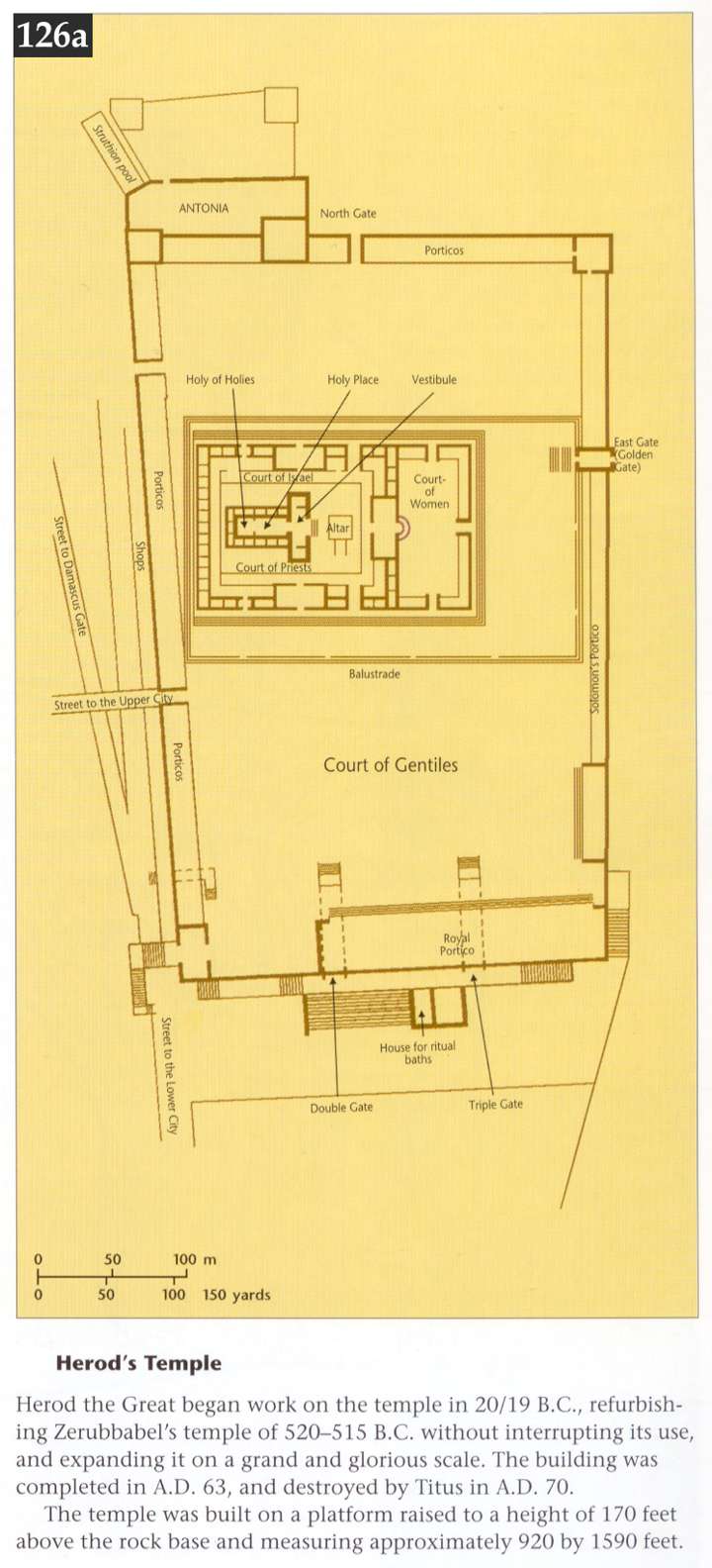
- Herod’s Temple in the Time of Jesus
- Temple Architectural Plan
- The Synagogue and Jewish Worship
- Synagogue Architectural Plan
- Temple Complex in the Time of Jesus
- Temple Complex Architectural Plan
- Golgotha and the Temple Mount
- Rome in the Time of Paul
- Corinth in the Time of Paul
- Ephesus in the Time of Paul
- Philippi in the Time of Paul
CHARTS AND DIAGRAMS FROM ESV
- Genealogies of Genesis
- Genealogies: Age at Fatherhood and Death
- Chronology of Noah’s Time in Ark
- Generations of Genesis
- Four Kinds of Abraham’s Offspring
- Covenantal Call and Dialogue
- Battle between Yahweh and Rulers of Egypt
- Sacrifices
- Holy Feasts
- Israel in Camp
- Positions and Duties of Levites
- Parallels: Exodus and Numbers
- Ancient Treaty Structure
- Joshua 1:1–9 as a “Table of Contents”
- Historical Books Timeline
- Seven Stone Memorials in the Land
- Covenant Renewal Ceremony at Shechem
- Judges
- Common Cycle for Each Judge
- Samson’s Ten Feats of Strength and Heroism
- Family of Ruth
- Journey of Ark of Covenant in 1–2 Samuel
- Fall of Saul and Rise of David in 1 Samuel
- Events of 1–2 Samuel Referenced in Psalms
- Rise and Failure of David in 1–2 Samuel
- Solomon’s Tainted Glory in 1 Kings
- Divided Kingdom
- Evaluating Kings of Israel and Judah
- Basic Chronology of 1–2 Chronicles
- Comparison of 1–2 Chronicles, 2 Samuel, 1–2 Kings
- Chronology of Ezra
- Adversaries Hinder Work
- Kings of Persia in Ezra–Nehemiah
- Chronology of Nehemiah
- Chronology in Esther
- Structure of Psalms
- Psalms Based on Incidents in David’s Life
- Use of Psalm 22 in Matthew
- Terms in Psalms
- Creation in Psalms
- Terms in Psalm 119 for Covenant Revelation
- Essential Features of a Good Life (Proverbs 19)
- Simplified Overview of Isaiah
- Kings of Judah in Time of Isaiah
- Datable Events in Book of Isaiah
- Oracles against Nations in Prophets
- Writing Prophets during Kings of Israel and Judah
- Parallels: Jeremiah and Lamentations
- Traditional View of Daniel’s Visions
- The 70 Weeks of Daniel
- Day of the Lord in Prophets
- Afflictions of Assyria against Israel
- Zechariah’s Visions
- Zechariah Quoted in NT on Jesus’ Ministry
- Malachi’s Sixfold Wake-up Call
- Lord of Hosts: Frequency/Use in OT
- Twelve Apostles
- Parables of Jesus
- Harmony of Events of Holy Week
- Five Controversies from Mark 2:1–3:
- Three Major Passion Predictions in Mark
- Parallels: Jesus, Peter, and Paul in Luke–Acts
- Predictions/Proofs of Jesus’ Death/Resurrection
- First Week of Jesus’ Ministry
- Jesus Is God: Theos Applied to Jesus
- Seven Signs Pointing to Jesus as Messiah
- Physical Items Used by Jesus to Teach Spiritual Truths
- Witnesses to Jesus
- “I Am” Statements of Jesus
- Work of the Trinity
- High Priestly Prayer
- Major Sermons in Acts
- Major Events in the Life of Paul
- Itinerary of Paul’s First Journey
- God’s Sovereignty in Salvation in Acts
- Itinerary of Paul’s Second Journey
- Itinerary of Paul’s Third Journey
- Paul Collects Offering for Judea
- OT Testimony that All Are under Sin
- Trinity in Romans
- Spiritual Gifts in Paul’s Letters
- The Epistles
- Imitating Paul as Paul Imitates Christ
- Church Leaders, Examples to Imitate
- Divorce and Remarriage
- Earthly Bodies and Resurrection Bodies
- Believer’s Apparent Defeat, Actual Victory
- Sufficiency of God in 2 Corinthians
- Weakness and Power in 1–2 Corinthians
- Spectrum of Beliefs about Christians and Law
- Trinitarian Expressions in Ephesians
- Christ and the Church
- Principles of Marriage
- Joy and Rejoicing in Philippians
- “In Christ”: Central Theme in Colossians
- Second Coming in 1 Thessalonians
- Authentication of Paul’s Letters
- False Teaching and Teachers
- Qualifications for Elders
- Qualifications for Deacons
- God and Christ as “Our Savior” in Titus
- Levitical High Priests, Jesus the High Priest
- Redemptive History in Book of Hebrews
- Psalm 110 in Hebrews
- Echoes of Sermon on the Mount in James
- Leviticus 19 in James
- Regeneration in the New Testament
- Deity of Jesus Christ in 2 Peter
- Theological Themes of 1 John
- Equivalent Expressions for “Last Days”
- Jude’s Application of Prophecies/Events
- Letters to Seven Churches
- Promises to Overcomers
- Doxologies to God and the Lamb
- Seven Trumpets
- Four Series of Seven Messages or Visions
- Seven Benedictions
- Seven Bowls of Wrath
- “Bookends” of Biblical Theology
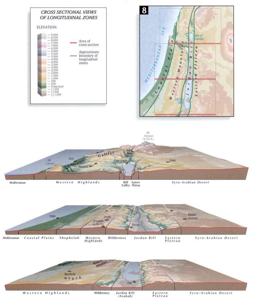
- Topography of Palestine
- World of the Patriarchs
- Exodus from Egypt
- Twelve Tribes of Israel
- Conquest of Canaan
- Kingdoms of Israel
- Deportations and Returns Under Assyria and Babylon
- Assyrian and Babylonian Empires
- Palestine Between Old and New Testaments
- Old Testament Jerusalem
- Roman Division of Palestine
- Ministry of Jesus
- Bethany, Jerusalem, Emmaus, Mount of Olives, and Bethlehem
- Paul's Missionary Journeys
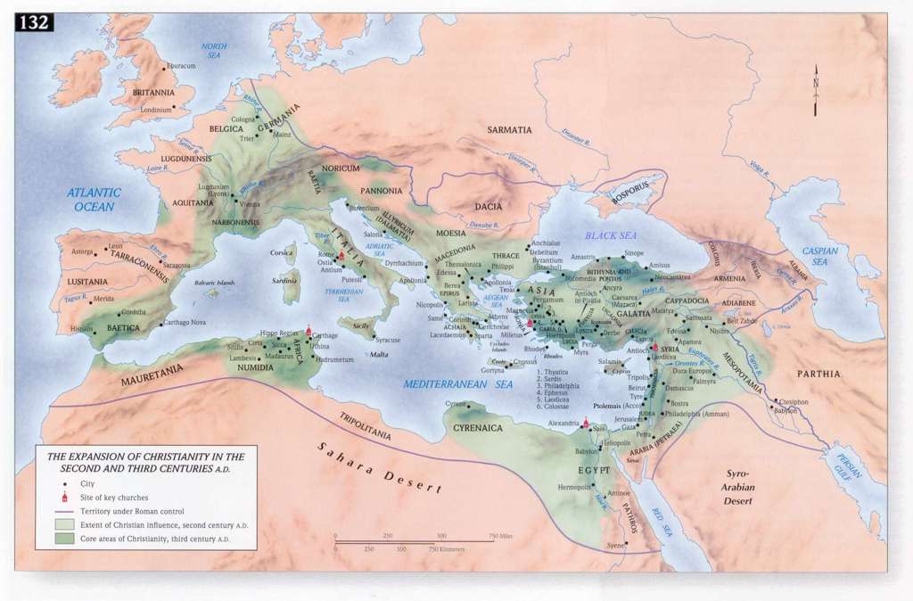
- Roman Empire and the Spread of Christianity
- Israel and the Middle East Today
MAPS AT NET BIBLE (Bible.org)
This is an interesting tool which links the Biblical place names with the corresponding Scriptural references. In the 3 categories below you can hold the mouse pointer over the Place Name to see Bible passages that mention that name and if you want more information click the actual place name which links to an compilation of Bible dictionary articles all on one page! Very handy. Below are the 3 subdivisions.
(1) OLD TESTAMENT
- The World of The Patriarchs - eg hold pointer over Gaza for Bible ref, click for more
- The Travels of The Patriarchs in Canaan
- The Exodus
- The Tribes of Israel
- Israel During The Divided Monarchy
- The Assyrian and Babylonian Empires
(2) NEW TESTAMENT
- Israel During the Time of Jesus
- Paul's First Missionary Journey
- Paul's Second Missionary Journey
- Paul's Third Missionary Journey
- Paul's Journey to Rome
- The Seven Churches of Revelation
(3) ISRAEL (Satellite Maps)
- Galilee and The North
- Galilee and The North -2
- Galilee and The North - 3
- The Hill Country of Samaria
- The Hill Country of Samaria
- The Hill Country of Samaria
- The Hill Country of Judah
- The Hill Country of Judah
- Coastal Plain and Shephelah
- Hill Country and Wilderness
- The Negev and The South
- The Negev and The South
Well Done Maps from Swindoll Study Bible
- Topography of Palestine
- World of the Patriarchs
- Exodus from Egypt
- Twelve Tribes of Israel
- Conquest of Canaan
- Kingdoms of Israel
- Deportations and Returns Under Assyria and Babylon
- Assyrian and Babylonian Empires
- Palestine Between Old and New Testaments
- Old Testament Jerusalem
- Roman Division of Palestine
- Ministry of Jesus
- Bethany, Jerusalem, Emmaus, Mount of Olives, and Bethlehem
- Paul's Missionary Journeys
- Roman Empire and the Spread of Christianity
- Israel and the Middle East Today
Bible Mapper is a fully interactive, highly accurate Bible mapping system that helps you quickly and easily create customized maps of the Holy Lands or study a particular period and aspect of Bible history. Interesting tool! Many of the maps in the next site are made using "Biblemapper" See Bible Mapper Gallery
Bible Maps for every OT and NT location
These color maps are attractive and include two interesting features: (1) Scripture references in which the place name is found (some entries have all the Scriptures, others only representative entries) and (2) Bible Dictionary article (International Standard Bible Encyclopedia) describing the specific name. Very nice tool!
Bible Maps, Charts, Timelines
- Charts of all 66 Books - generally well done (but be a Berean!- eg, I disagree with their Revelation chart) (See onsite study of Revelation charted out - Rev 4-22
- Timelines of the entire Bible! - click timeline to enlarge
- Bible Maps - beautiful maps but I am not sure of the copyright info
- Israel's History 1917-2001 with maps at bottom
- NT Timeline by Dr Bob Utley
- OT Timeline by Dr Bob Utley
- Map of Royal Grant of Land to Abraham
Bible "Timelines" (Tables) from The Dated Events of the Old Testament
- This is an older (1907) but interesting work by Willis Judson Beecher that consists of a tabular collection of secular and parallel Biblical dates with scholarly notes on the dates.
- Abraham to Joshua
- Joshua to Solomon
- Division of the Kingdom to close of OT History
- From the close of OT History to the Time of the Birth of Jesus
Bible Maps - Wikimedia
- Maps are of varying quality and legends in various languages - you have to search around but you may find what you are looking for.
- Bible Maps - History of Israel
- Bible Maps - More Maps of Israel
- Subcategories (please be discerning)
Maps on E-sword
Click E-sword is one of the best free Bible study software available. Multiple reference resources can be downloaded free of charge, easily installed. Online video tutorials. Many of my students have downloaded this program and all have given positive reviews. If you don't have a computer Bible program, consider this program.
Timeline - Primarily Historical Events
Click the link above - the page that opens has a timeline at the top of the page. This timeline deals primarily with historical events related to Christianity beginning in AD 1-300 (a few events in the 6000-1BC tab). Click the tab of the date range you are interested in and then click on specific people or events. Interesting especially for us history aficionados. From Christian History Institute.
Some other new additions to the Timelines, Sources of pictures and/or Maps...
- Timeline of the Bible - nice dating of the Kings of the Northern Kingdoms and the Southern Kingdom
- Bible Diagrams - 2000 Year Biblical Timeline - very interesting - combines a timeline with diagrammatic representation of select Biblical events.
- Chronology of the History of Israel
- Clickable Map of Ancient Israel - check this one out. Very nice concept. Click geographic location to open new info page.
- The Bible in Pictures - 250 pages of Illustrated lessons (220 Other Bible Images by Gustave Dore)
- Geography of the Bible - links to various maps
- Case's Bible Atlas to Illustrate the Old and New Testaments - Google book online or as a PDF download. These are old style maps but do include extensive comments.
- Click and watch the rise and fall of kingdoms of the World in 90 seconds...very interesting!
The Glory Story - The Bible in Pictures from Genesis to Revelation
Genesis to Revelation in still pictures & text, to tell the Bible story! Down load, print, publish, power-point project the pictures!
These pictures are originals and from my brief review (comparing the actual picture to what the Scripture states) appear to accurately picture the people, places and events in God's Holy Word.
RECOMMENDATION: This would be an excellent tool to supplement your Sunday School class. Another powerful use of these pictures would be in presentation of the gospel cross culturally (short term or long term mission trips, to hidden peoples who do not yet have the Scriptures in their language or for that matter lack an actual written language!)
OLD TESTAMENT
- The Biblical World
- Old Testament Palestine
- Map of Alexander's Conquests
- Map of Alexander's Conquests
- Map of the Seleucid Empire, ca 198 BC
- The Twelve Tribes
- Abraham's Journey
- Battle of Michmash — Elijah's Travels
- United Kingdom: 12 Tribes of Israel
- Israel Under Solomon
- Divided Kingdom: 931BC
- The Divided Kingdoms of Israel and Judah
NEW TESTAMENT
- New Testament Palestine
- Matthew, Chapters 1-7 Summary of Events
- Paul's First Missionary Journey
- Paul's Second Missionary Journey
- Paul's Third Missionary Journey
- Paul's Journey to Rome
GEOGRAPHY
MODERN ISRAEL
Rose Publishing Maps
- New Testament Time Line
- Old Testament Time Line (Part 1 of 2)
- Old Testament Time Line (Part 2 of 2)
- Ancient Middle East
- Book of Joshua: Themes and Map
- New Testament Holy Land
- Paul's First Missionary Journey
- Paul's Second Missionary Journey
- Paul's Third Missionary Journey
- Paul's Journey to Rome
Paul's Journey (Unbound Bible) To walk through each of Paul's missionary journeys city by city click the following links for the map beneath which are the cities
- 1st Journey - begins at the Church at Antioch (in Syria)
- 2nd Journey
- 3rd Journey Geography of the Bible
- Clickable Map of Ancient Israel click locations for information
- Maps From Around The Web - many maps but of variable quality
Many of the maps in the list are black and white and/or of variable quality
- Map of Royal Grant of Land to Abraham
- Map of the Physical Features of Palestine
- Map of the Ancient Territory of Palestine
- Map of Palestine Benjamin
- Map of Jerusalem
- Map of the Ancient Near East
- Map of Lower Galilee
- Map of Upper Galilee
- Map of the Northern Negev
- Map of Palestine Bodies of Water
- Map of Samaria
- Map of Asia
- Map of the Coastal Plain (Northern)
- Map of the Coastal Plain (Southern)
- Map of Palestine Natural Divisions
- Map of Palestine Judea
- Map of Palestine Samuels Circuit
- Map of Philistine Cities and Expansion
- Map of the Philistine Valley of Sorek
- Map of the Sinai Peninsula
- Map of Canaan - Twelve Tribe Portions
- Map of Achaia
- Map of Adriatic Sea
- Map of Pharaonic Egypt
- Map of The Amalekites Territory
- Map of The Ammonites Territory
- Map of Amorite Settlements
- Map of the Territory of Asher
- Map of Ancient Nubia
- Mount Ararat Comparison
- Map of Ancient Aram
- Map of the Campaigns of Alexander the Great
- Map of Alexander's Conquests
- Map of Asia in Roman Times
- Map of the Wanderings of the Patriarchs
- Map of Assyrian Expansion
- Map of Canaanite Nations
- Map of the Nations Defeated by King David
- Map of the Decapolis and its Cities
- Map of the Edomite Territory
- Map of Egypt in Bible Times
- Map of the Route of the Exodus of the Israelites from Egypt
- Map of Galilee and Northern Palestine
- Map of Judea and Southern Palestine
- Map of the Kingdom of David and Solomon
- 1949 Map of Israel with boundaries
- Map of Jerusalem in New Testament Times and Cross Section
- Map of the Profile of the Jordan
- Map of Palestine During Joshua's Time
- Map of the Period of the Judges and Places
- Map of the 7 Churches of Revelation (Asia Minor)
- Map of Samaria and Central Palestine
- Map of the Roman Empire In the Time of Jesus
- Map of Phoenicia in Biblical Times
- Map of the Territory of the Philistines
- Map of Paul's Missionary Journeys
- Map of Palestine in New Testament Times
- Map of the Ancient Near East
- Satellite Map of the Near East
- Map of Judah and Israel During the Period of the Kings
Color Maps from Bible History Online
- Map of the Ancient Fertile Crescent (2500 B.C.)
- Map of Israel and her Neighbors (2000 B.C.)
- Map of the Egyptian Empire (1450 B.C.)
- Map of the Assyrian Empire (650 B.C.)
- Map of the Babylonian Empire (550 B.C.)
- Map of the Donations of Alexandria (34 B.C.)
- Map of Paul's First Missionary Journey (48 A.D.)
- Map of Paul's Second Missionary Journey (51 A.D.)
- Map of the New Testament World
- Map of New Testament Asia
- Map of New Testament Greece
- Map of New Testament Italy
- Map of Ancient Mesopotamia
- Map of Ancient Trade Routes From Mesopotamia
- Map of Alexander the Great - Decisive Battles (336-323 B.C.)
- Map of Alexander's Conquests
Old Testament Maps These maps are on preceptaustin.org and can be used freely
- Abraham's Journey
- Battle of Michmash
- Elijah's Travels
- United Kingdom
- 12 Tribes of Israel
- Divided Kingdom 931BC
Maps from Biblestudy.org.
- Resolution not good in some of these maps
Old Testament
- Historic Israel
- Palestine in the Time of Judges
- Geography of the Books of Samuel
- Map of Old Testament Events
Between the Old and New Testament
New Testament
- The Roman Empire
- Seven Churches of Revelation
- Paul's First Missionary Journey
- Paul's Second Missionary Journey
- Paul's Third Missionary Journey
- Paul Goes to Rome
- Euphrates River and Middle East
- Historic Maps from the time of Jesus
New Testament Cities
- Bethlehem
- Nazareth
- New Testament Jerusalem
- Walled City of Jerusalem
- Cities and City States (eg Decapolis, etc)
- Jerusalem Today
- West Bank
New Testament Countries
- Israel in the First Century
- Israel Today
- Topographical Map of Israel- focusing on seas, lakes and rivers
- Topographical Map of Israel- focusing on Major Mountains
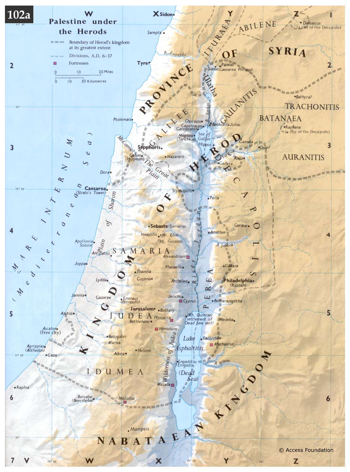
- The Division of Herod's Kingdom
- The Roman Empire - 1st Century BC
- Probable route that Jesus took after the Last Supper
- Middle East
- Galilee
Temple in the New Testament
- Temple of Herod Nice Schematic
Miscellaneous Maps of Paul's Journeys
- Booklet on Acts - timeline of Acts = p.5, p 22, Maps = p. 24-25 - PDF
- Maps of Paul's Missionary Journeys - 21 maps with explanations
- Paul's First Missionary Journey
- Paul's Second Missionary Journey
- Paul's Third Missionary Journey
- Paul's Journey to Rome
- Clickable Map of the Roman Empire
- Timeline of the Apostle Paul
- Another site for Timeline Chart of Paul's Life
- Paul's 1st Journey // 2nd Journey // 3rd Journey - nice, simple to the point maps
- Second Journey; Third Journey; Journey to Rome
- Journeys of Paul - First Missionary Journey
- Journeys of Paul - Second Missionary Journey
- Journeys of Paul - Third Missionary Journey
- Journeys of Paul - Journey to Rome
Satellite Image Maps: On preceptaustin.org courtesy of ISV Foundation - Note you may need to resize these for optimal resolution (double click map and in right lower corner click the icon).
- Old Testament
- Old Testament Israel
- The Biblical World
- New Testament
- New Testament Israel
- Paul's First Missionary Journey
- Paul's Second Missionary Journey
- Paul's Third Missionary Journey
- Paul's Journey to Rome
- Matthew 1-7: Jesus Birth & Ministry Leading up to Sermon on the Mount
Empires
Old Testament
- Sites in Exodus' Wilderness Wanderings
- The Twelve Tribes in the Promised Land
- Select Cities Mentioned in Old Testament
- Israel's Enemies
- Northern Cities/Mountains in Israel in OT
- Southern Cities/Mountains in Israel in OT
New Testament
The Tabernacle in the Old and Temple in the Old and New Testament
Jerusalem
- From time of City of David's City to time of Hezekiah
- Jerusalem after Israel Returns from Exile at time of Nehemiah
- Nehemiah 2:13-15 - Refuse [Dung] Gate, Fountain Gate, Valley Gate
- Nehemiah 3:1-32 - Sheep Gate, Fish Gate, Old Gate, Water Gate, Horse Gate
- Jerusalem at the Time of Jesus
Israel in the New Testament Times
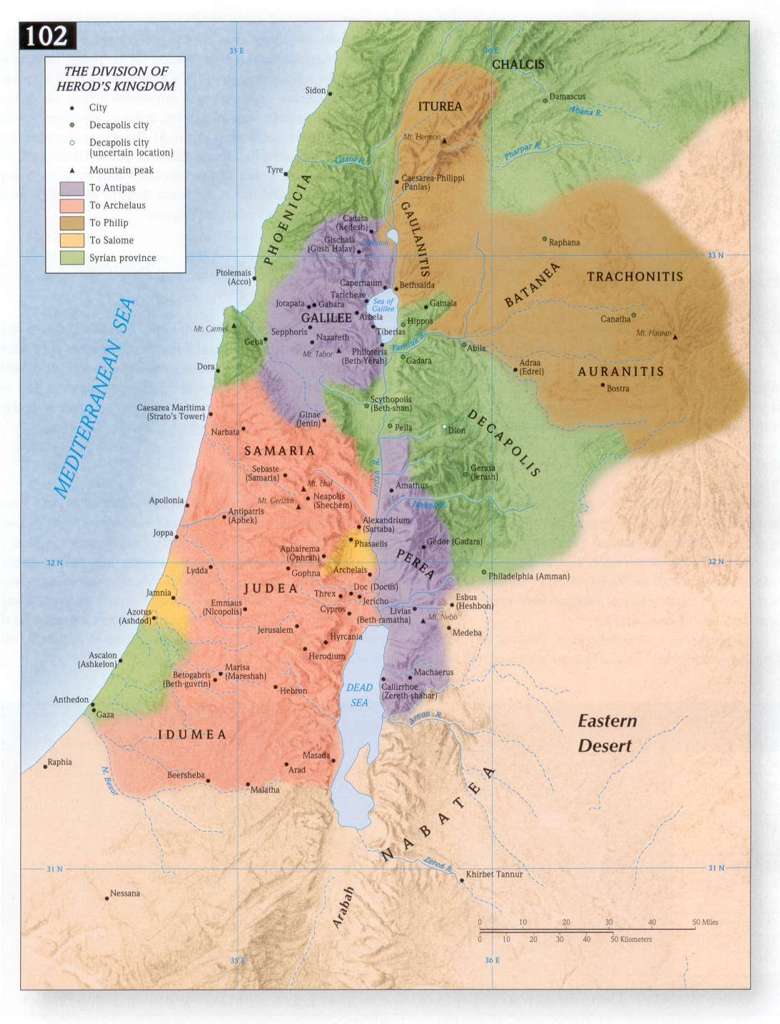
- Herod's Kingdom Divided Among His Sons - Archelaus (Judea, Idumea, Samaria), Decapolis, Ituraea and Trachonitis, Herod Antipas (Galilee, Perea)
- Pictorial Tour Ruins of the 7 Churches of Revelation 1-3 Click See also Paul's Journeys created by the same webmaster
General Maps
Genesis through Deuteronomy (Pentateuch) Maps
- Garden of Eden
- Noah's Ark 1
- Noah's Ark 2
- Noah's Ark Mt. Ararat
- Tower of Babel
- Abraham's Journey
- Abraham's Journey to Egypt
- Abraham in Canaan
- Wandering's of Jacob
- Joseph's Journey to Egypt
- Joseph's Family to Goshen
- Route of the Exodus
- Exodus Major Events Map
- Twelve Tribes of Israel
- Nations of Canaan
Tabernacle/Temple
- Tabernacle Schematics 1
- Tabernacle Schematics 2
- Tabernacle Schematics 3
- Solomon's Temple
- Herod's Temple
Late Old Testament
- Solomon's Israel
- Divided Kingdom of Israel
- Assyrian Empire
- Babylonian Empire
- Persian Empire
- Alexander the Great
- Roman Empire
New Testament
Paul's Journeys
- Paul - 1st Missionary Journey
- Paul - 2nd Missionary Journey
- Paul - 3rd Missionary Journey
- Paul to Caesarea
- Paul - Journey to Rome
- Paul's Letters to Churches
- Corinth/Athens
Late New Testament/Modern
- 7 Churches of Revelation
- Modern Israel Bible Images and more...
- Click for additional links to hundreds of images from both Old & New Testaments
- Holy Land Photos
- Thousands of pictures including statues, ruins, some maps
- Cyprus - Paphos
Greece -
- Aegina ;Amphipolis
- Athens - Acropolis [Erechtheion; Parthenon; Southern Slope - Odeion of Herodes Atticus, Structures , Theater of Dionysus ; Acropolis Museum ] Agora, General
- Berea
- Cenchreae
- Corinth [The Site, Artifacts, Acrocorinth , Diolkos Corinthian Canal]
- Crete - Fair Havens ; Gortyna ; Knossos
- Delphi - Stadium; Theater; Charioteer; Artifacts; Temple of Apollo; Lower Area Site
- Isthmia - Site; Artifacts
- Mycenae - Beehive Tombs; Setting; Citadel
- Neapolis (Kavala)
- Olympia - The Site; Stadium; Temple of Zeus; Museum/Artifacts; Museum Pottery
- Patmos - View of Island Harbor/Skala; Acropolis (Kastelli)
- Philippi - West Philippi; East Philippi; Baptismal Site
- Thessalonica (Thessaloniki) - City; Forum/Agora; Via Egnatia
Israel
- Arad - Iron Age Citadel; Early Bronze Age City (ca. 2800 B.C.)
- Ashqelon/Ashkelon; Bouleuterion/Forum Views of Site Gate & Glacis
- Beersheba (Beer Sheva)
- Bethlehem
- Bethsaida/et-Tell (Sea of Galilee)
- Caesarea Maritima - Ampitheater; Promontory Palace; Circus/Hippodrome Theater; Harbor Aqueduct, High Level; Aqueduct, Low Level; Crusader City; Artifacts; Temple of Augustus
- Caesarea Philippi
- Cana of Galilee
- Capernaum
- Dan
- Dead Sea - Masada Western Palace Northern Palace Synagogue Roman Ramp and Camps
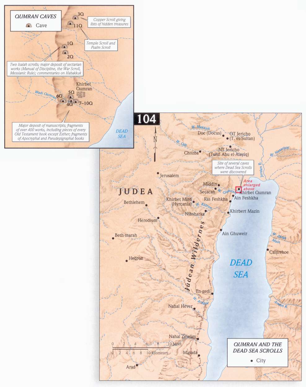
- Qumran
- En Gedi -- En Gedi- Joshua 15:62 - photo list in left column!
- et-Tell (Ai?)
- et-Tell (Galilee; Bethsaida)
- Galilee (Jesus) Boat
- Gezer
- Golan/Bashan Views
- Hazor
- Hebron
- Herodium
- Herodium — Herod's Tomb
- Hill Country of Judah - Views
- Old Testament Jericho
- Jerusalem
- Citadel at Jaffa Gate; Citadel Museum; City of David; Garden Tomb & Gordon's Calvary; Gates & Walls; Gethsemane; Yad Vashem; Israel Museum; Mount of Olives; Mount Zion ; Broad/Avigad's Wall; Rockefeller Museum; Southern Wall; Excavations; Temple Mount Platform/Haram; Golden Gate & East; El Aqsa & South ; West; Antonia & North; Dome of the Rock & Central Views; Haram
- Tombs - Hinnom Valley; OT Tombs; Silwan OT Tombs; Tombs OT (First Temple); Tumuli ; Garden Tomb; Kidron Valley Tombs; Family Tomb of Herod; Jason's Tomb; Tomb of Grapes; Via Dolorosa
- Water Systems - Pool of Siloam (NT), Gihon Spring, Middle Bronze Age Channel, Hezekiah's Tunnel Diagonal Tunnel, Pool Tower; Warren's Shaft
- Western Wall Rabbinic Tunnels Excavations
- Jordan River - Lower Jordan River
- Korazin (Chorazin) - Village ; Synagogue
- Masada - Western Palace ;Northern Palace ;Synagogue ;Roman Ramp and Camps
- Megiddo - Bronze Age Remains ;Israelite Remains
- Mount of Beatitudes
- Nazareth
- Negev Highlands - Haluqim ;Middle Bronze I Settlements
- Qumran
- Ramat Rachel
- Rehoboth
- Sea of Galilee Views
- Sepphoris - Roman Villa ;The Site
- Wilderness of Judah Views
- Megiddo - Joshua 12:21- photo list in left column!
- Jezreel, Jezreel Valley - (Google) Joshua 15:56
- Italy - Rome - Nike Exhibit ;Arch of Titus
- Turkey - Alexandria Troas; Assos; Cilician Gates; Colossae; Derbe
- Ephesus - The Site ;Ephesus Artifacts
- Euphrates River
- Euromos - Temple of Zeus
- Haran
- Hierapolis; Iconium (Konya); Laodicea; Lystra; Miletus (Balat)
- Pergamum - Acropolis ; Asclepion ;Artifacts
- Perge - The Site ;Artifacts & Inscriptions
- Philadelphia
- Pisidian Antioch - The Site; Artifacts
- Sardis
- Smyrna - The Site ; Artifacts ;
- Tarsus - Tarsus (Roman Temple)
- Thyatira
- The Desert of Sinai
- Joshua Old Testament maps
- Old Testament Nations
- Solomon's Temple
- The Tribes of Israel
- Old Testament Lands
- The Tabernacle
- Twelve tribes in Canaan Joshua to Saul 1400-1100BC
- Map of the 7 Nations of Canaan
- Historical Maps of the Middle East - Perry-Casta-eda Library Map Collection
- Ephesus pictures
- Maps and images from U of Florida
- Ebible Teacher maps
- New Testament World
- Bible History Online - Maps and Geography
- George Adam Smith's The Historical Geography of the Holy Land
- Historic Views of the Holy Land Click for older maps, drawings and photographs that reveal features of the Holy Land which are no longer visible.
- Woodcuts by Gustave Dore
- Click for works by Gustave Dore (Referred to as an "Artist of the People" by Vincent van Gogh. 212 of his beautiful engraved illustrations depicting many Old and New Testament. Not copyrighted. Make impressive black and white overhead transparencies for teaching.
- Alternative resource: Bible Illustrations, by G. Dore - Main Page
- Click for collection of hundreds of Black and White pictures associated with various OT and NT passages
Google Search - Another source I have found helpful searching for images is the Google Image Search. E.g., type "Abraham Genesis" (Note - do not include quotation marks) which retrieves over 100 images. As of 4/18/05 the number of image hits matching Abraham Genesis has increased to 708 (and this is using the preference Moderate Safe Search is on.). The images retrieved include classics by Rembrandt, Michelangelo, etc.
Remember - do not include quotation marks - any phrase in quotation marks produces a search for that exact phrase whereas words without quotation marks will search for a combination that includes all the words on one page. E.g., if you type "Galilee map" in Google and keep the quotation marks, you will retrieve 103 hits on Google Image search. Now type the same two word but this time remove the quotation marks and you retrieve 36,800 hits! (Both with Moderate SafeSearch on - searching without a filter is not recommended!)
In addition to the Google "Image" search engine you can also occasionally find other maps and pictures by using the regular Google search. For example, type in "Ephesus" into Google and retrieve over 241,000 hits (as of 7/22/03), this number increasing to 686,000 as of 4/18/05 and 3,060,000 (9/17/07)! The number one hit remains Ephesus, Turkey: Panoramic pictures of Ephesus - click it for a well done Virtual Tour of Ephesus which is the best preserved archeological site of the 7 churches of the Revelation. But be a Berean (Acts 17:11-note) examine everything carefully; hold fast to that which is good; abstain from every form of evil (1Th 5:21, 22-notes) (Notice that all three verbs are not suggestions but commands calling for this to be our habitual attitude and action = present imperative)
Bible Places.com
See samples of some of 6000 pictures available (for purchase). Note that at the bottom of the page of each of the links to places in the table below there are multiple additional links related to that place (potentially very helpful). If you use pictures in preaching or teaching, consider this set. Power Point files included.
|
Bible Places.com |
||
Samaria
Jerusalem |
Judah/Dead Sea
Negev |
Jordan Turkey
Greece |
NOTE: Purchase Holman Bible Atlas either digital book or Hardcover. Maps copyright © 1998 B&H Publishing Group, used by permission, all rights reserved.